No one moves fast in the Caribbean, it’s too hot. Barranquilla and the surrounding area rarely gets below 30⁰C (80s℉). This was our first lesson, as it took almost an hour to pick up our rental car. There were no problems, just an endless stream of information written on paper, xeroxed, typed into a computer, printed, signed and fingerprinted. We managed to get around Barranquilla on its ring road before rush hour took serious hold and made it to our new place in Tubará.
The next day we took a long walk on the beach, did some beachcombing and headed for the store with a shopping list for the rest of our stay. With vague directions, we drove toward Cartagena and toured a bit of the region, ending up at a small grocery store in Juan de Acosta. Remarkably, we found everything on our list.
One of the local landmarks is The Sombrero, a restaurant, store, roadside stop.
We stopped at a woodworking stand where the owner showed us a wood sink basin he was carving. It yielded bright yellow sawdust. The wood is called Golden something for the color.
We saw a few birds and are still waiting for more of the local fauna to step out.
The beaches are highly varied. There are barely any waves on Playa Cano Dulce, the closest to our house. One arm of a long bay, Ensenada de Trebol, shields the beach. When we went out to the sea side of the Ensenada we found an astonishing beach full of driftwood. There are huge logs and twisted shapes of all kinds.
The next day we visited Playa Mendoza, where we found sand dollars.
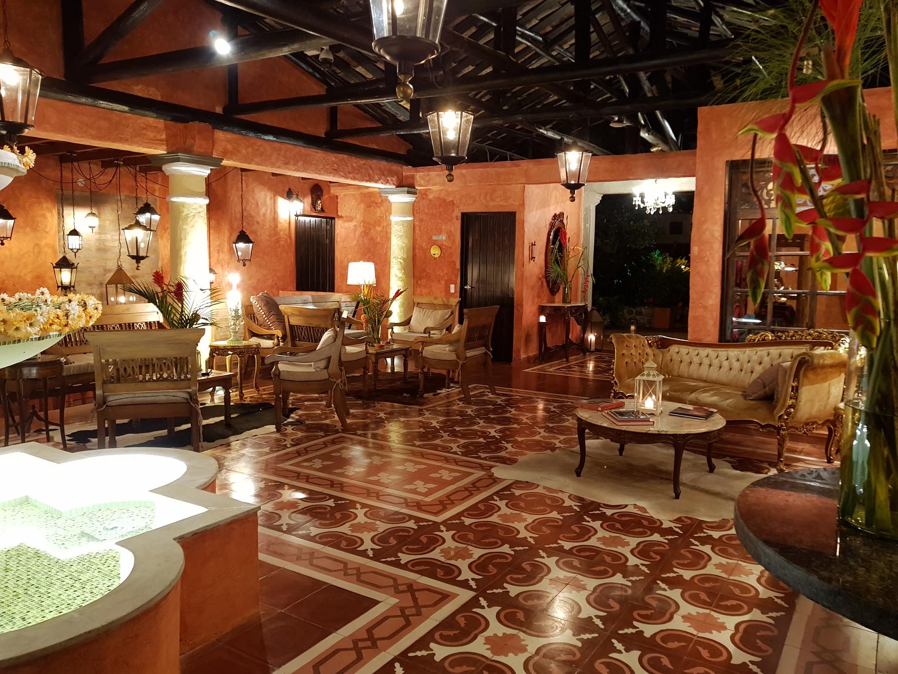
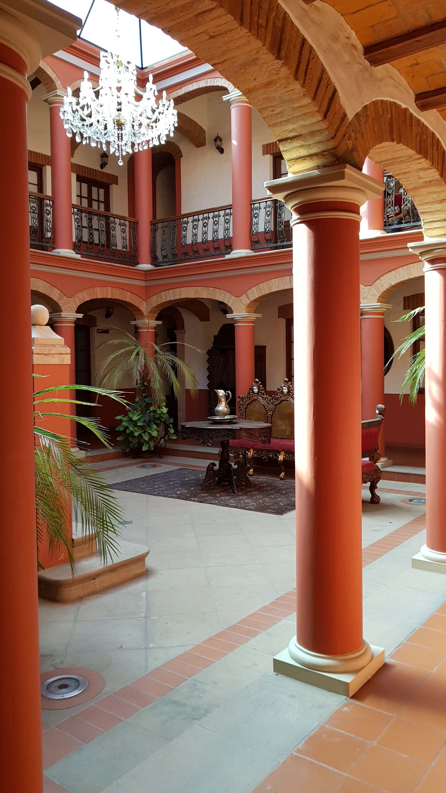
What would it be like to live in this region? Getting used to the heat is the biggest hurdle. It makes most sense to go out in the morning and evening and stay home in the shade in the middle of the day. You wouldn’t need to worry about getting to the office and into the air-conditioning at work because no one commutes to Barranquilla from here. Our house this week is a “casa campestre,” part of a development of vacation homes. On Saturday and Sunday we can hear the voices of people on the beach. At night there is music. Weekdays we are alone apart from the caretakers. We had to summon someone to open the gate to the beach on Monday morning.
The people who live in this area full time are those who staff the beachside businesses, teach kite-surfing or build new villas for the weekenders, as development extends ever further along the coast between Baranquilla and Cartagena.
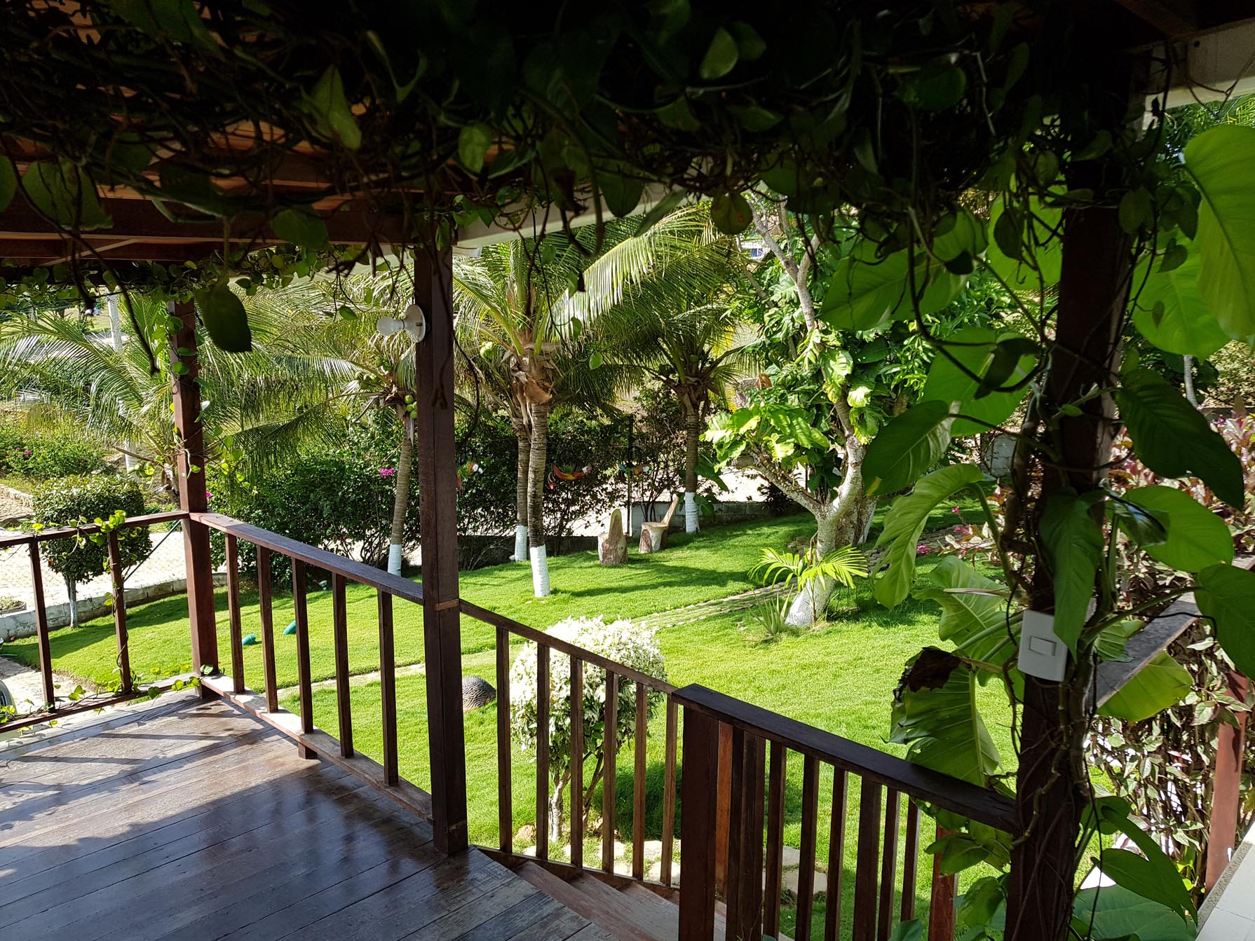
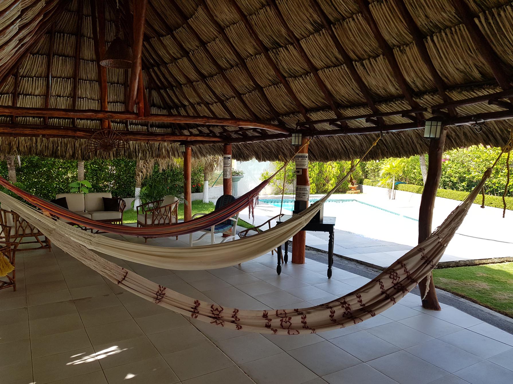
The pace of life suits us fine, as we visit beaches in the morning and late afternoon. We are at home for a dip in the pool, lunch and rest in the shade while it is hot.
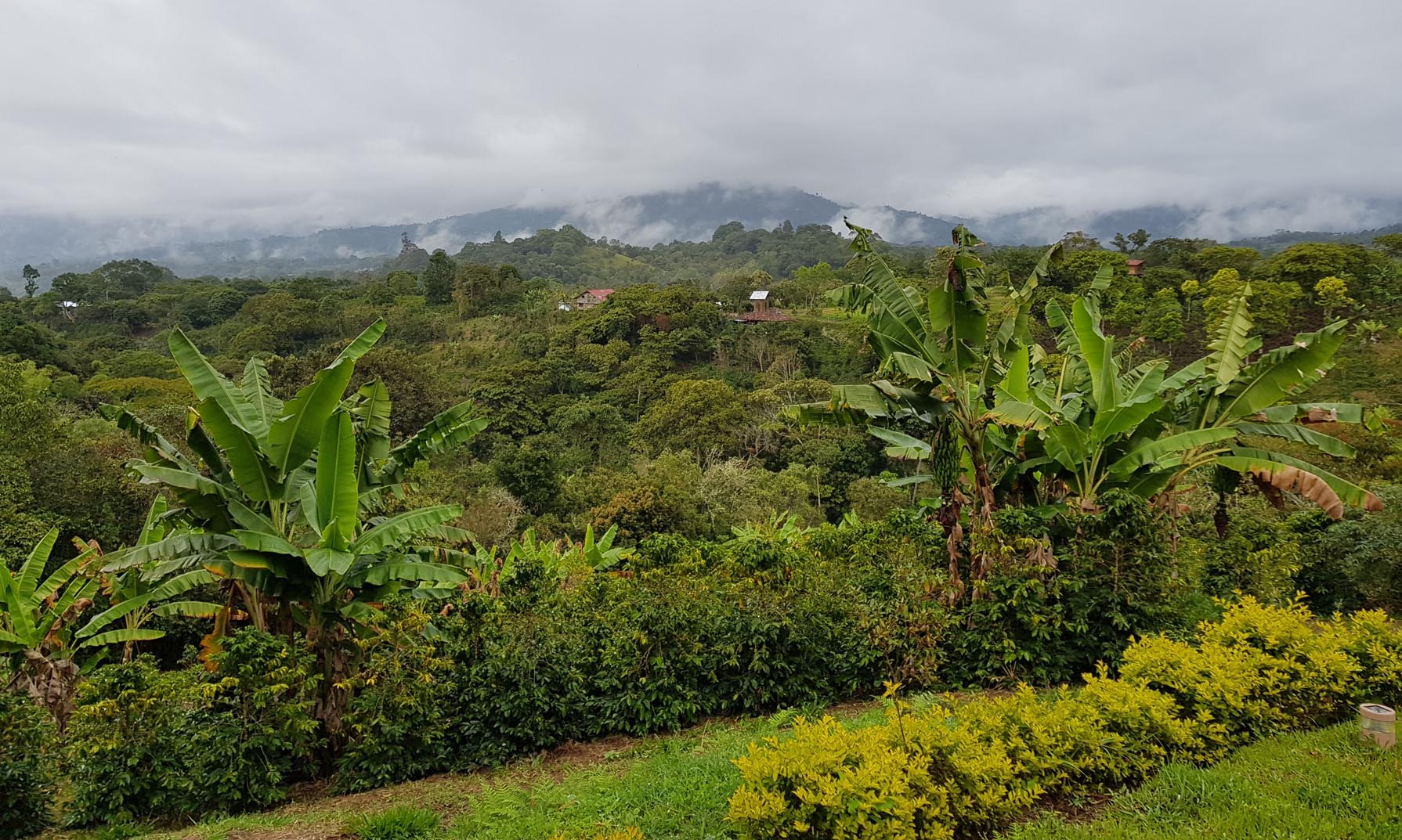
We drive through the Colombian countryside alongside the Magdalena River in a tiny cab. When we met Hugo and his taxi at 9 am we were glad we decided to leave our big suitcases at the hotel in Neiva and travel with our carry-ons for our two-day trip to San Agustin. Other than the occasional swerve when we go over a bump or hit a pothole we are doing well, seeing rural sights as we make our way toward the archaeological sites of the San Agustin region. We were doubly happy that we hired Hugo to drive when his car was struck by a branch about a half hour out of Neiva. He stopped and negotiated with the trimmers from the electric company and we continued on our way.
Crops of all kinds are out the car windows. Colombia grows fruit, vegetables, ornamental plants and cut flowers. In addition to pineapple, banana, watermelon and papaya at breakfast, we tried juice of lulo (ugh) and cholupa (yum). Passing through Campoalegre we saw cacao beans drying on the sidewalk. There are lots of combination businesses, like photocopies and coffee, or parking and coffee.
Here’s a reason to eat less beef and drink more coffee.
Cattle pastureShade grown coffee
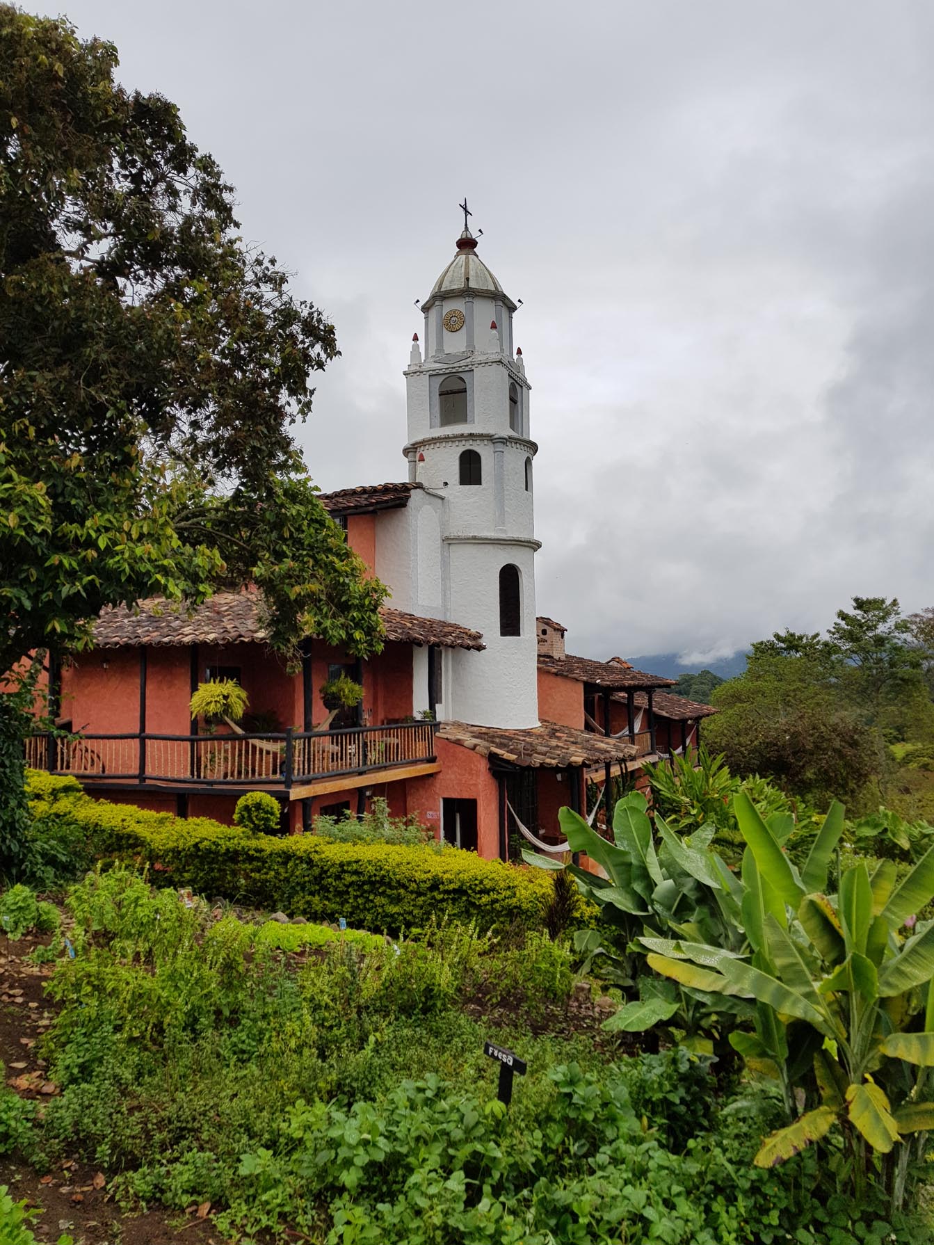
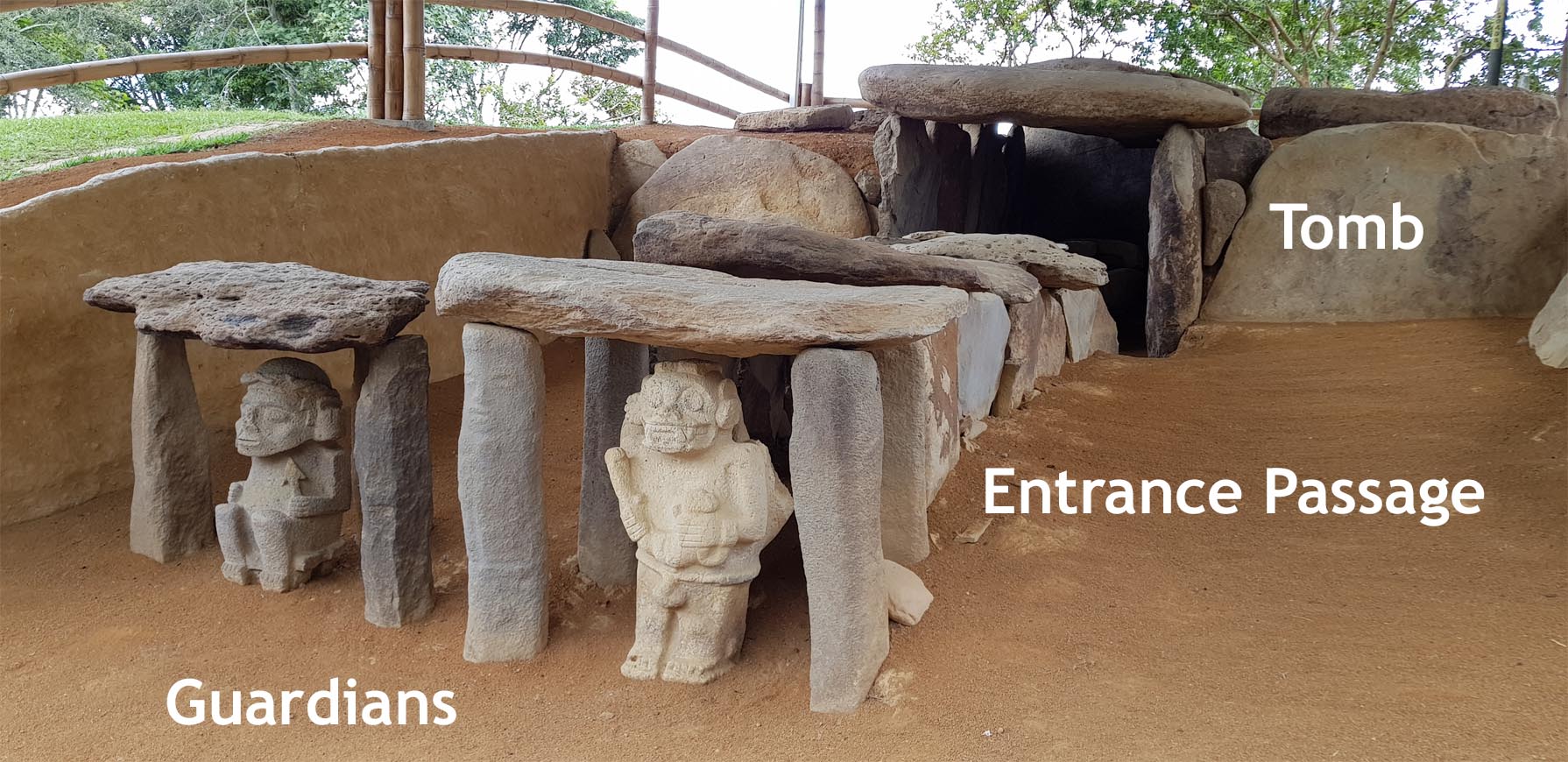
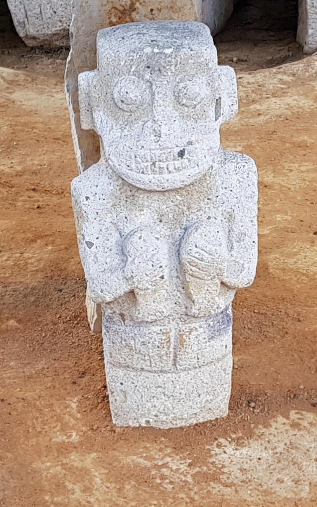
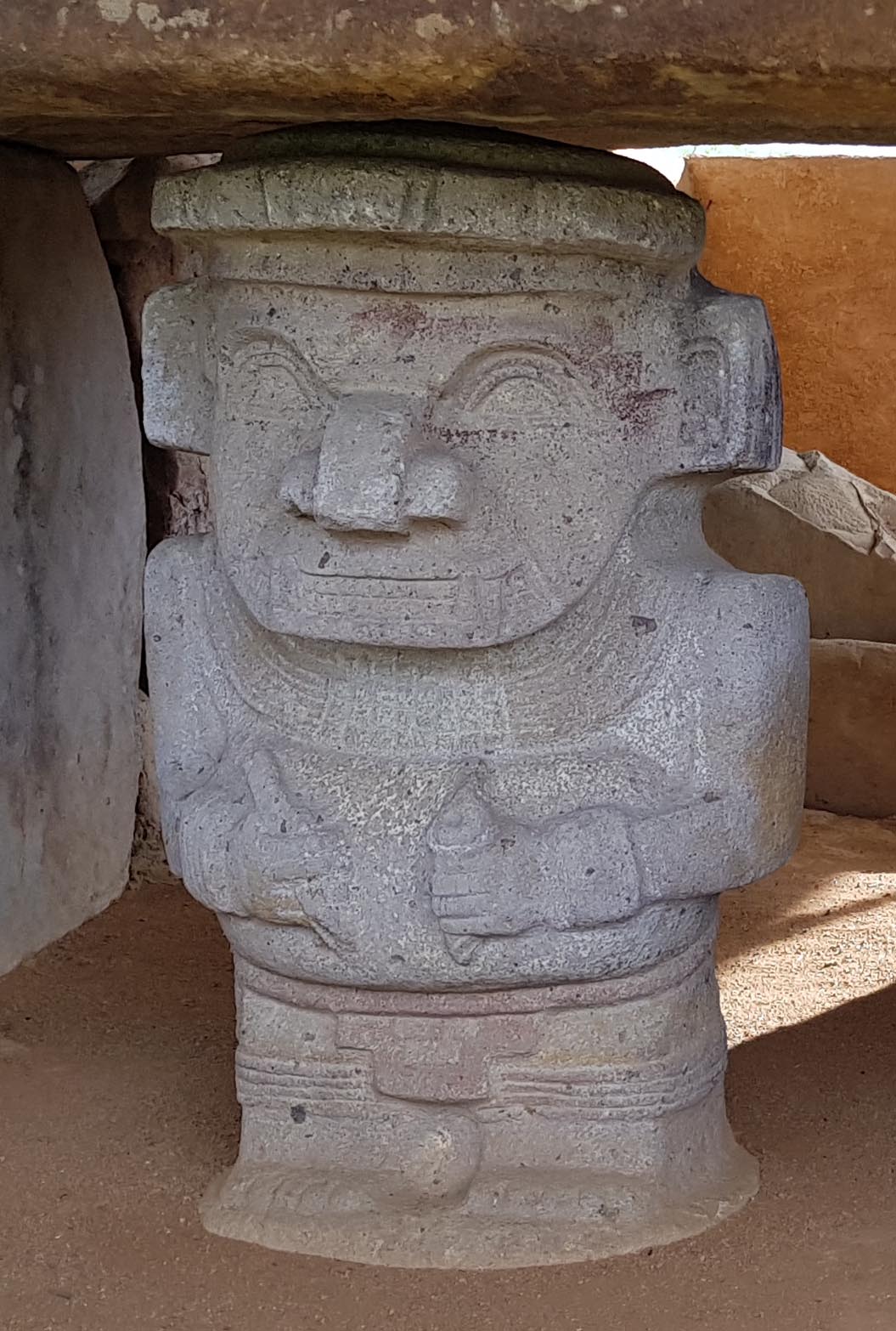
The drive to San Agustin takes five hours. We arrived tired and had trouble finding the hotel, which is a lovely hacienda with a small chapel that gives it the name Hotel Monasterio. It is about a half mile past the end of the paved road and has no sign so when we found it we were delighted, though it was more isolated than we expected. No one was available to drive us anywhere. We renegotiated our agreement with Hugo so that he drove us to see the sites as well as the coming and going from Neiva. Before unpacking or rest, we found that we could follow a tour group to one of the other sites, Alto de los Idolos. Alto de los Idolos was about a half hour drive away, again further than we imagined, but well worth it. In a manicured park, we visit huge carved stone monuments and tombs. These were built by some of the earliest chieftains in the Americas, during the early Formative period, as early as 1000 BC. Large mounds were built to cover stone tombs, and carved figures guarded the entrances.
We were at Alto de los Idolos just before sunset, and the setting sun lit the park in green and gold.We had dinner at the hotel and it was delicious, with the best-tasting broccoli I have ever eaten in a restaurant.
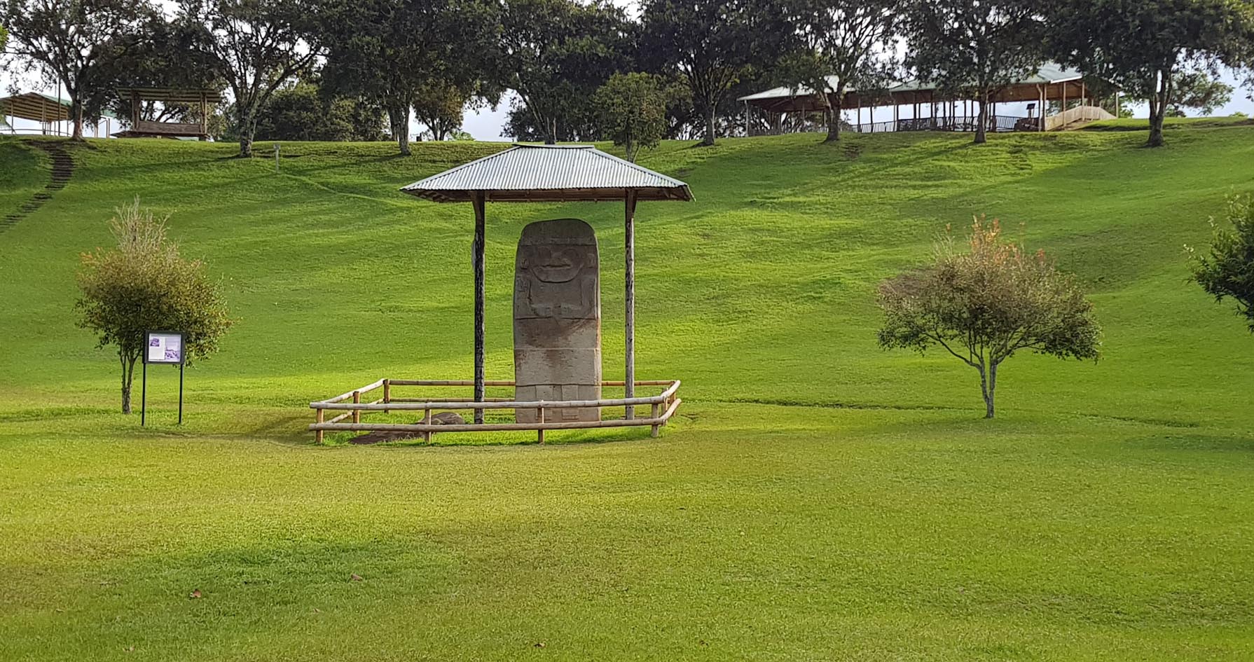
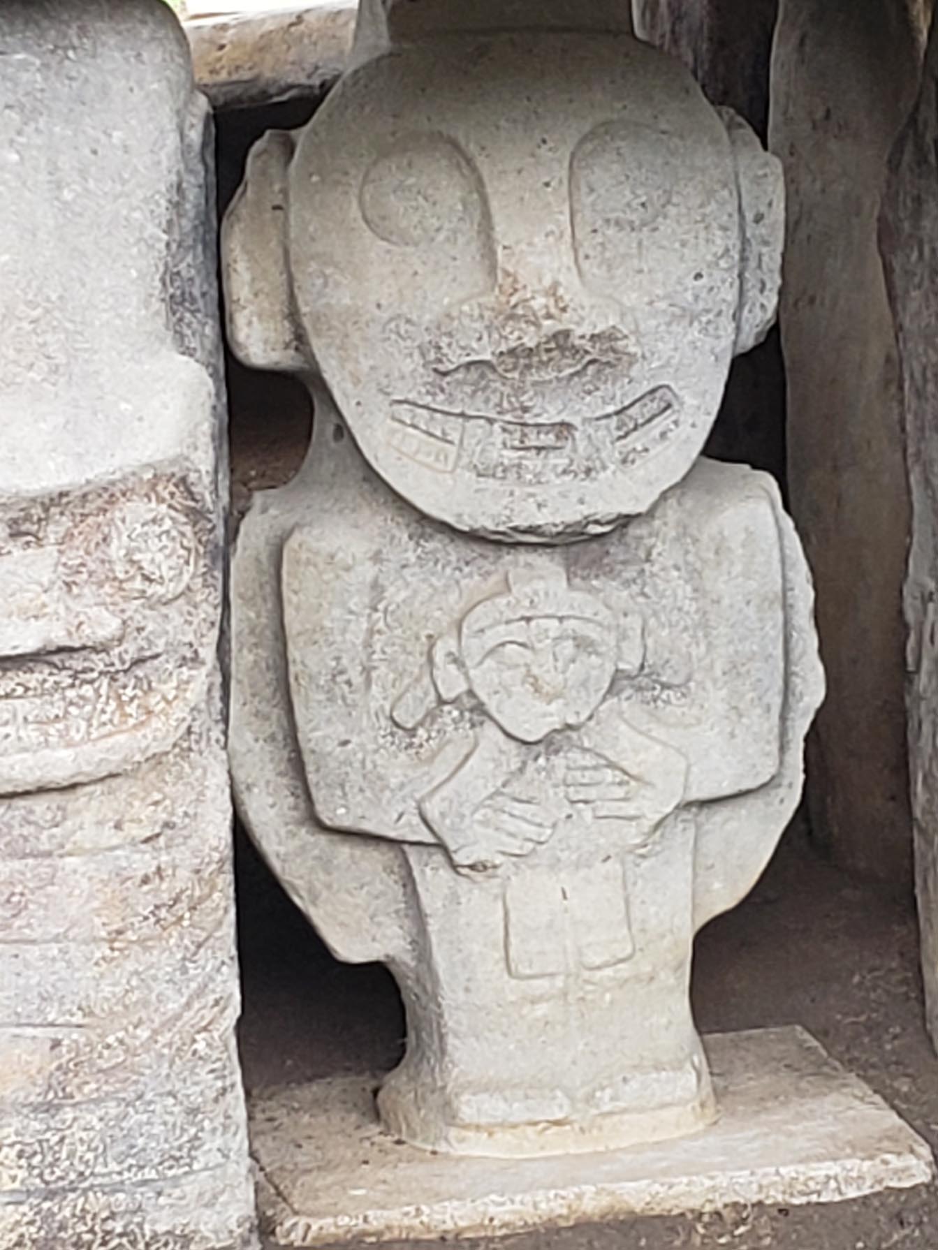
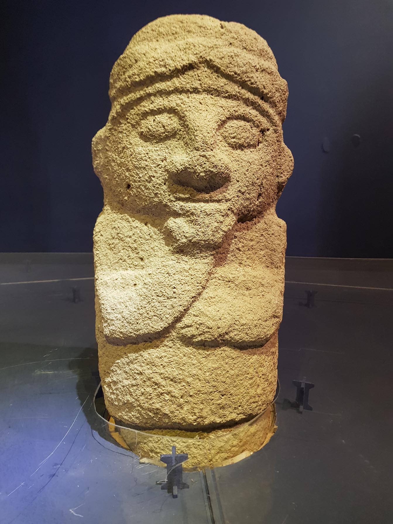
There were fantastic birds around the hotel, red tanagers, yellow and green birds, hummingbirds that are dark blue and purple. We ate breakfast and looked out over the landscape. The mist in the distance rises off the Rio Magdalena, the huge main artery of the region. It did not rain on us despite the low clouds.The San Agustin archaeological park encompasses four groups of stone monuments and tombs and an area of stream bed that was carved into channels and pools decorated with carved figures, the Fuente de Lavapatos. The monuments have focused themes. Each figure has large eyes, broad nose, fangs, claws and sometimes wears a helmet. The hands/claws are most often held close together and may be holding a captive (?), two fish (?), two staves, a cup, an arrow, a pencil (?), an ice cream cone (?). There is also “The Thinker,” Colombia style.
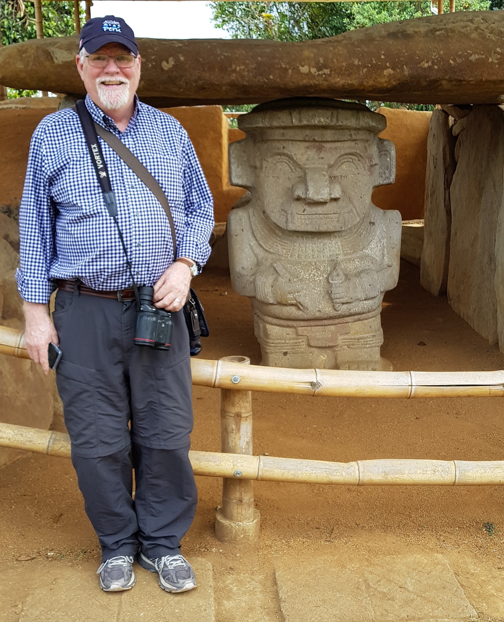
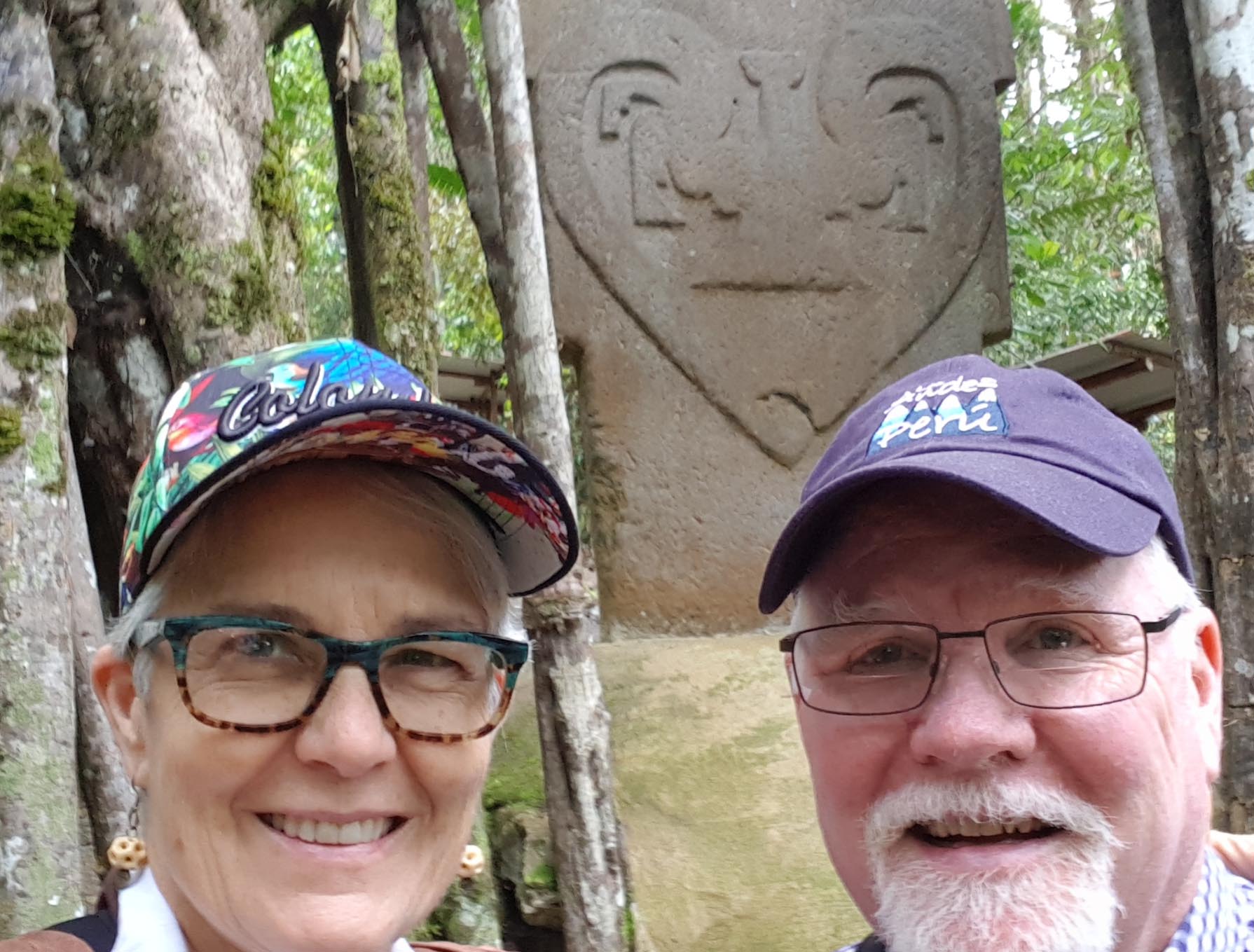
The entire circuit takes at least a half day to cover. Overcast weather made for a comfortable visit, and there were places to stop for coffee and souvenir shopping. I had a fresh ginger, lime, mint tea that was delicious. We finished off with a selfie.
We got back on the road again in the early afternoon for the five hour return trip to Neiva. For another view of visiting San Agustin, see this article in the NYT from last week. We seem to have visited at the same time!
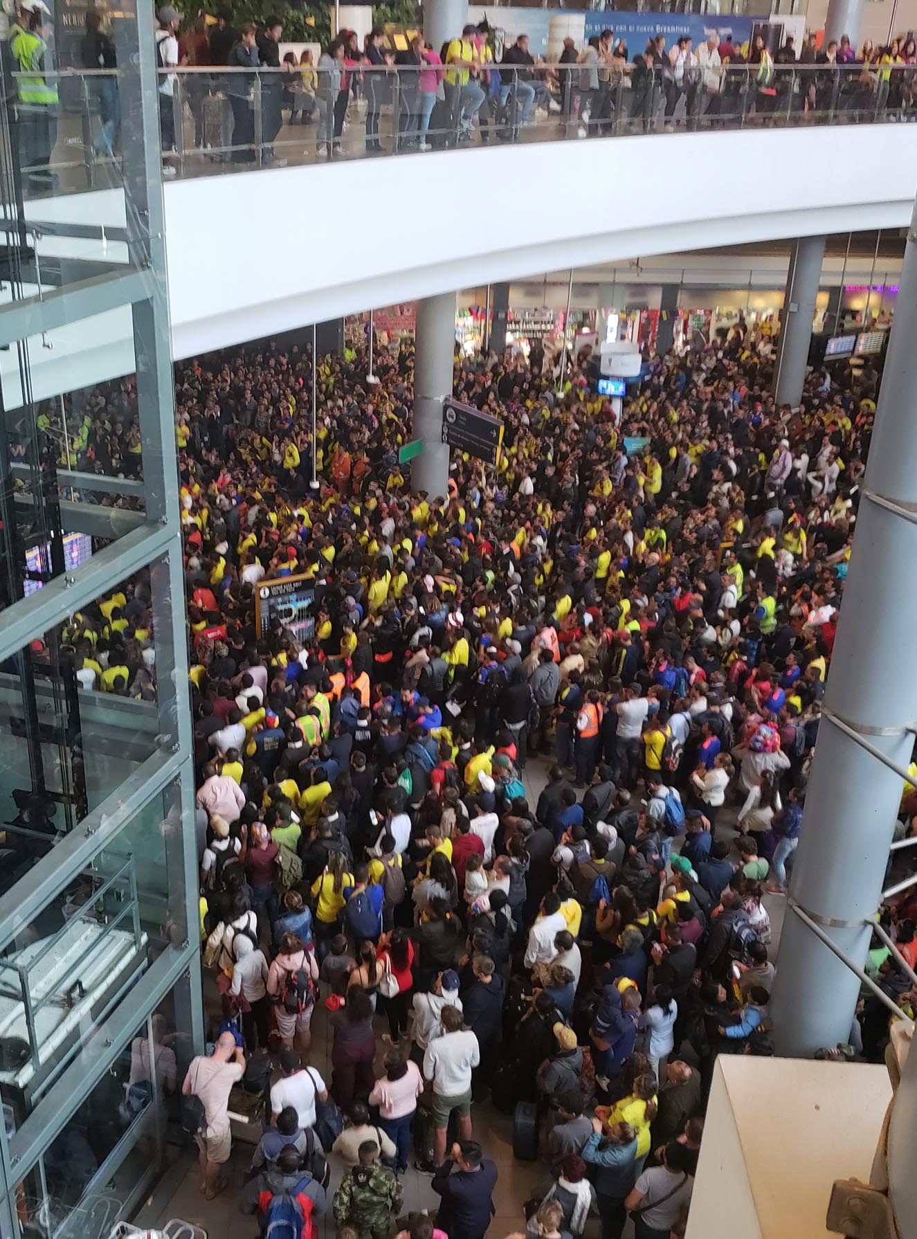
Our flight on to Barranquilla was the next morning at 10 am, so there was no time for a longer stay in Neiva and the San Agustin area, though there are many more things to see. We did happen to be on layover in Bogota during the final moments of the Colombia-England game of the World Cup. Everyone was watching until the bitter end, when Colombia lost on the final penalty kick.
The San Agustin archaeological park encompasses four groups of stone monuments and tombs and an area of streambed that was carved into channels and pools decorated with carved figures. The monuments have a limited range of themes. The figures have large eyes, broad nose, fangs, claws and sometimes wear a helmet. The hands/claws are most often held close together and may be holding a captive (?), two fish (?), two staves, a cup, an arrow, a pencil (?), an ice cream cone (?). There is also “The Thinker” Colombia style.
The entire circuit takes at least a half day to cover. Overcast weather made for a comfortable visit, and there were places to stop for coffee and souvenir shopping. I had a fresh ginger, lime, mint tea that was delicious. We finished off with a selfie.
We got back on the road again in the early afternoon for the five hour return trip to Neiva. Our flight on to Barranquilla was the next morning at 10 am, there was no time for a longer stay in the San Agustin area, though there are many more things to see. We did happen to be on layover in Bogota during the final moments of the Colombia-England game of the World Cup. Everyone was watching until the bitter end, when Colombia lost on the final penalty kick.
It just happened to be sunset, lighting the park in green and gold.
We had dinner at the hotel and it was delicious, with the best-tasting broccoli I have ever eaten in a restaurant. We were still in a panic about how we could have chosen a hotel so far from our destination. We double checked the map and discovered our error. We are indeed only 15 min from the San Agustin archaeological park. It was an awful few hours, but now our visit tomorrow will be reasonable.
There are fantastic birds around the hotel, red tanagers, yellow and green birds, hummingbirds that are dark blue and purple. We have breakfast and look out over the landscape. The mist in the distance is rising off the Rio Magdalena, the huge main artery of the region. So far it has not rained on us despite the low clouds.
The San Agustin archaeological park encompasses four groups of stone monuments and tombs and an area of streambed that was carved into channels and pools decorated with carved figures. The monuments have a limited range of themes. The figures have large eyes, broad nose, fangs, claws and sometimes wear a helmet. The hands/claws are most often held close together and may be holding a captive (?), two fish (?), two staves, a cup, an arrow, a pencil (?), an ice cream cone (?). There is also “The Thinker” Colombia style.
The entire circuit takes at least a half day to cover. Overcast weather made for a comfortable visit, and there were places to stop for coffee and souvenir shopping. I had a fresh ginger, lime, mint tea that was delicious. We finished off with a selfie.
We got back on the road again in the early afternoon for the five hour return trip to Neiva. Our flight on to Barranquilla was the next morning at 10 am, there was no time for a longer stay in the San Agustin area, though there are many more things to see. We did happen to be on layover in Bogota during the final moments of the Colombia-England game of the World Cup. Everyone was watching until the bitter end, when Colombia lost on the final penalty kick.
We came to Bogota for a single reason: to see the best gold museum in the world. The Museo De Oro is full of gold panned from streams around Colombia, hammered and cast into amazing shapes. One of the fascinating parts of this history is that several regions of Colombia made gold objects in clearly recognizable styles. One of the first exhibits you see takes you through these areas. This could exhaust anyone.
The Sinu style of gold-working used a lot of wire to make detailed shapes and poses, including the coolest gold artifact in the Americas, the golden raft.
Quimbaya work was thicker than the others because they had more productive sources of gold. Pieces were made with exquisite detail. The museum has so many different artifacts that hundreds of them are shown in a very short light show. It’s difficult to take in how many pieces there are. There are a few chunks of Colombian emerald, too.
This is a sample of what is in the museum. It’s worth a trip to Bogota. Our hotel in Bogota, in the historic Candelaria neighborhood, was lovely. Decorated with furniture from an elegant private home, The Orchids also served the best arepas we’ve eaten in Colombia.
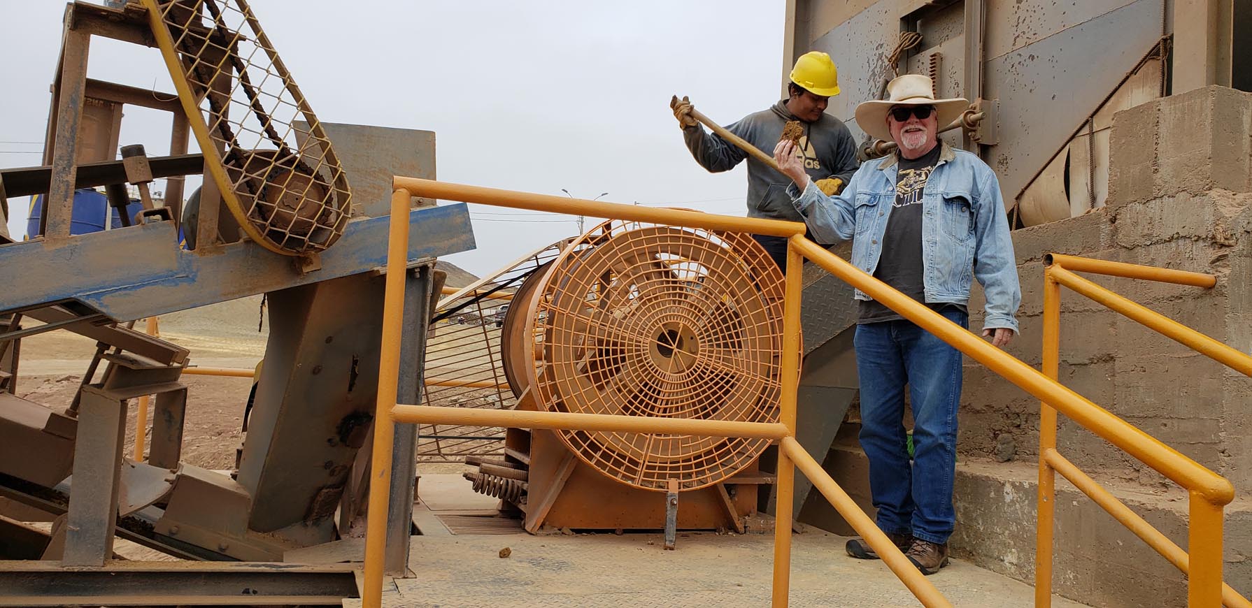
We had a chance to visit a gold and silver processing operation run by friends of ours. Even though the precious metals are invisible, it was fascinating to see how they are extracted from tons of earth, and why gold and silver mining involves moving mountains. First Jonathan put a piece of raw material into the crusher.A couple of rounds later, the little pieces of raw material are all the same size.
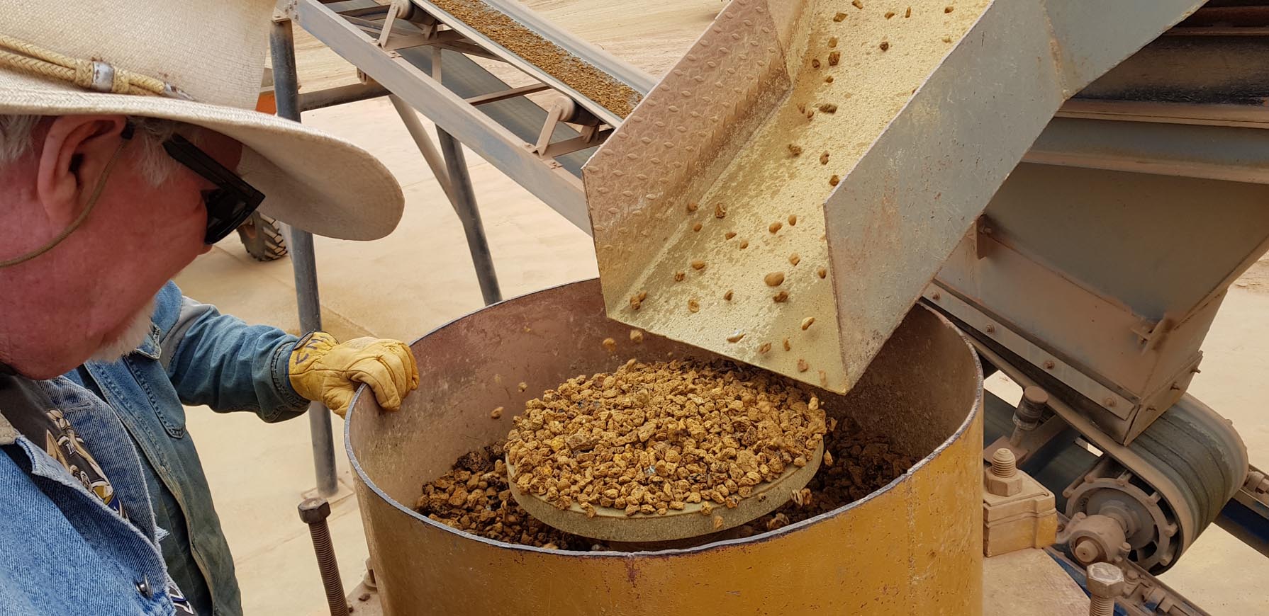
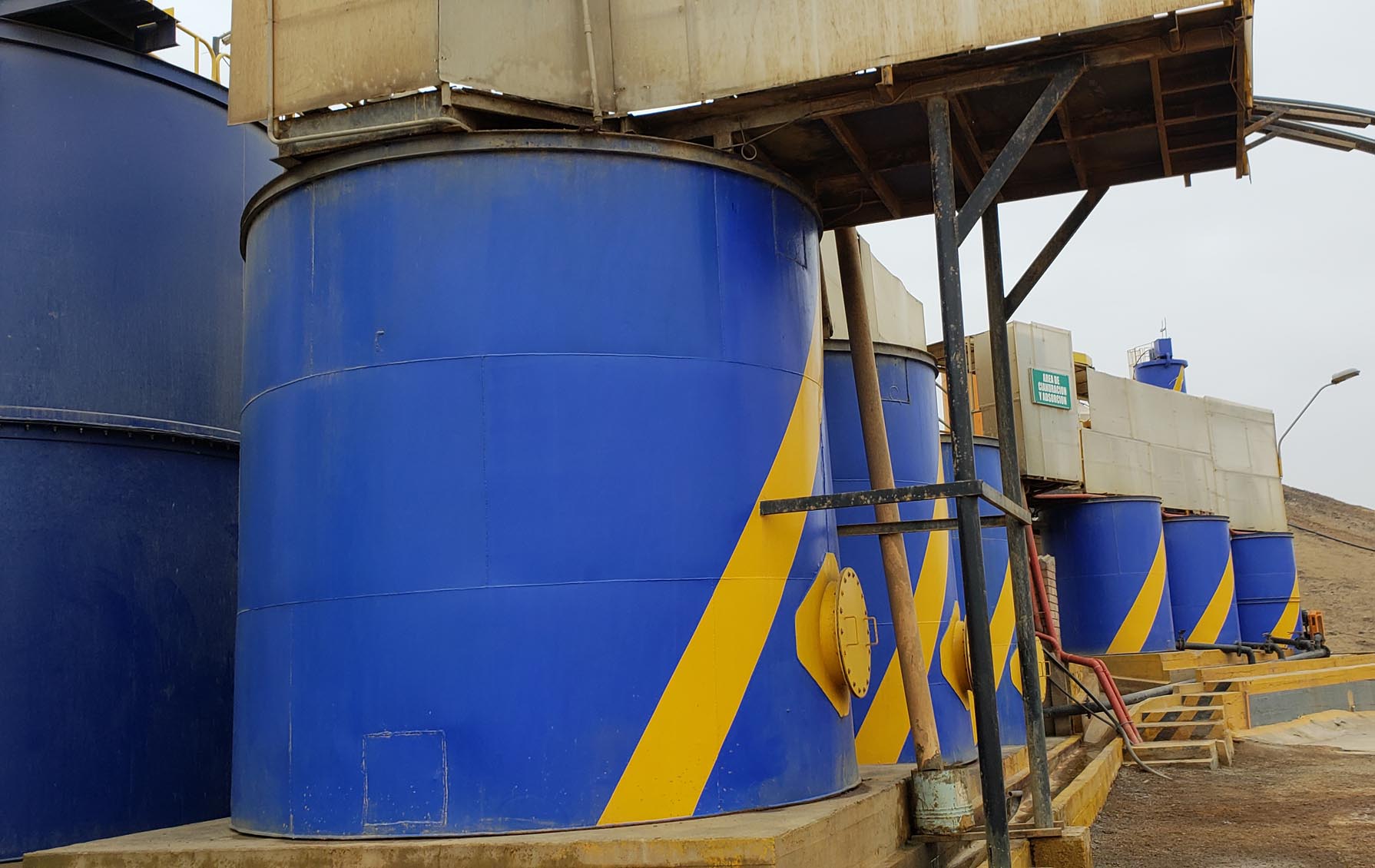
Each pile represents a truckload of material. The plant takes in metal-bearing loads from mines all over northern Peru. The raw material is tested several ways to assign a value and the supplier is paid. After that the loads are blended to create raw material that contains about 10 g of gold per ton. This goes into big drums with cyanide, sodium hydroxide and water and washes around and around until it is largely dissolved.
The liquid is put in tanks where it mixes with activated charcoal, the material in cigarette filters and water filters. The microscopic particles of gold and silver are absorbed by the charcoal. This takes about three days.
This charcoal has just been cleaned and dried and is ready to be used again.
The end of the process is the dangerous part. The gold is removed from the charcoal by processing with heat and alcohol. The alcohol is highly combustible, but at the end, gold and silver are separated from everything else.
The final step is melting the metal into an ingot that is a mix of gold and silver. In batch of material they process (multiple truckloads) the result is about 5 kg of gold and 16 kg of silver. The plant runs 24 hours a day with three groups of workers who live on site during their ten-day shift.Our neighbors, the hardworking guys who run the plant, Miguel and Tito. There weren’t stacks of ingots lying around, they whisk the bars off to Lima to be refined into separate blocks of gold and silver. India is a big market for their gold. September is wedding season there and lots of people want new gold jewelry for important occasions.
A few years ago, this was field season. We spent every June, July and August excavating at sites near Barranca, leaving home around 8 am and returning around 3:30, followed by clean-up, lab work, dinner and more administrative tasks. I remember it being cold in general, but I’m surprised by how different I feel this year. We are in Barranca in June by choice, without specific activities to do, and I don’t like the austral winter on the coast any better than I did when I was so busy I barely had time to notice. Most days are overcast. The ground is damp in the morning, with a few puddles of condensation from the trees. Since no one has central heating, it may be in the high 60s, even 70 outdoors, but it is the same temperature indoors. When you sit at a desk, you get cold.
Some days it warms up toward midday. I start out with pants, long-sleeved t-shirt, sweater and padded vest, wool socks and shoes. I shed layers, change to shorter pants for a walk on the beach, put on a lighter vest, add hat and sunscreen, and take a walk. Return home, rinse feet, dry feet, put socks, shoes and long pants back on and gradually add my layers again through the afternoon. If we sit on the front porch to watch the sunset, which is not visible through the clouds, and play cards, I may end up wearing fingerless gloves and a knit hat. It’s quite a look.
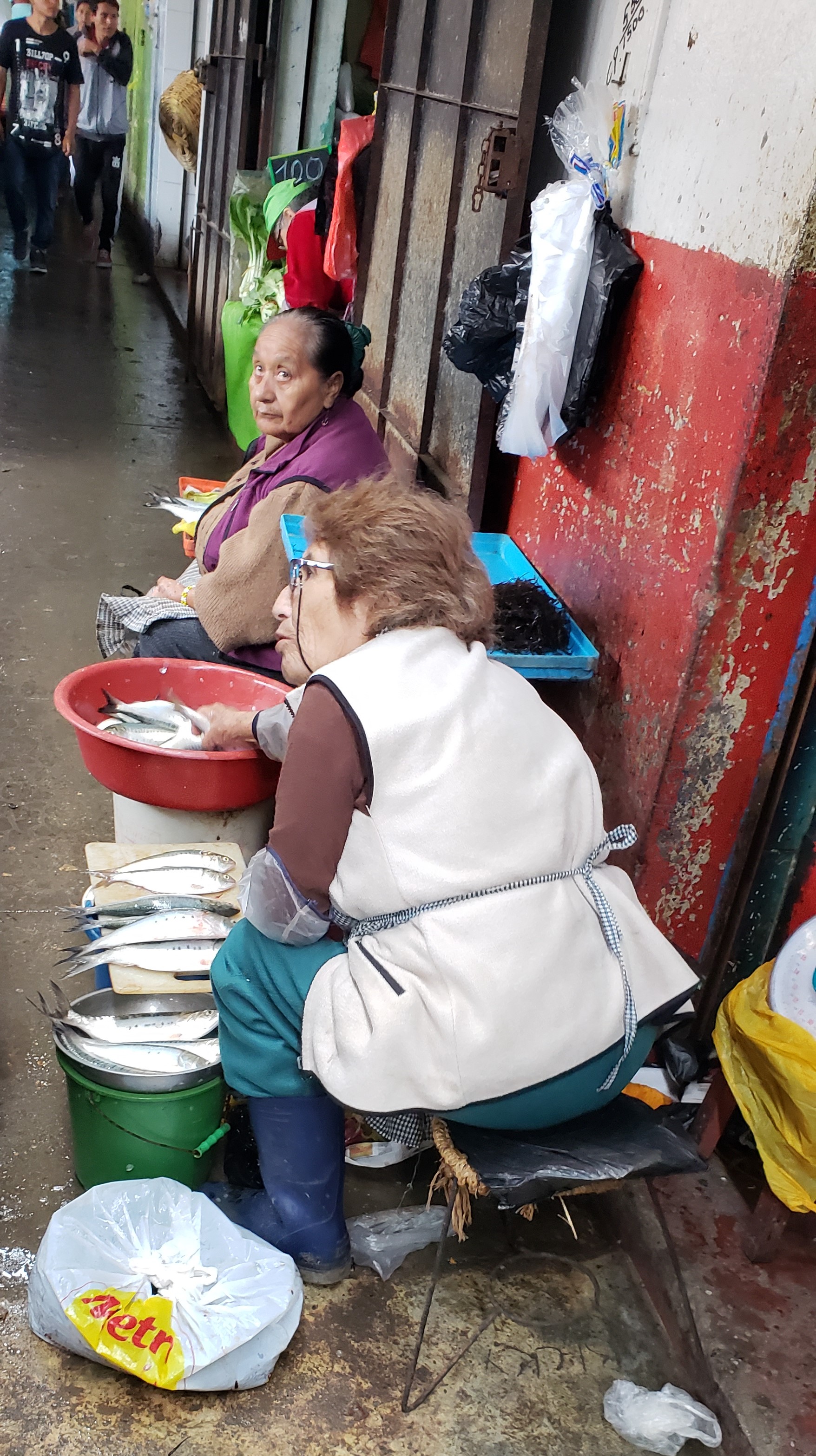
In town, though, life goes on through the seasons. Jonathan stopped to buy lamb. Then we strolled the fish aisle to find a fish for dinner. These ladies are selling fish and chatting up a storm.
A woman sells roast pork sandwiches from the real thing. Her stand is squeezed between the street and sidewalk on a corner. Lots of foot traffic!
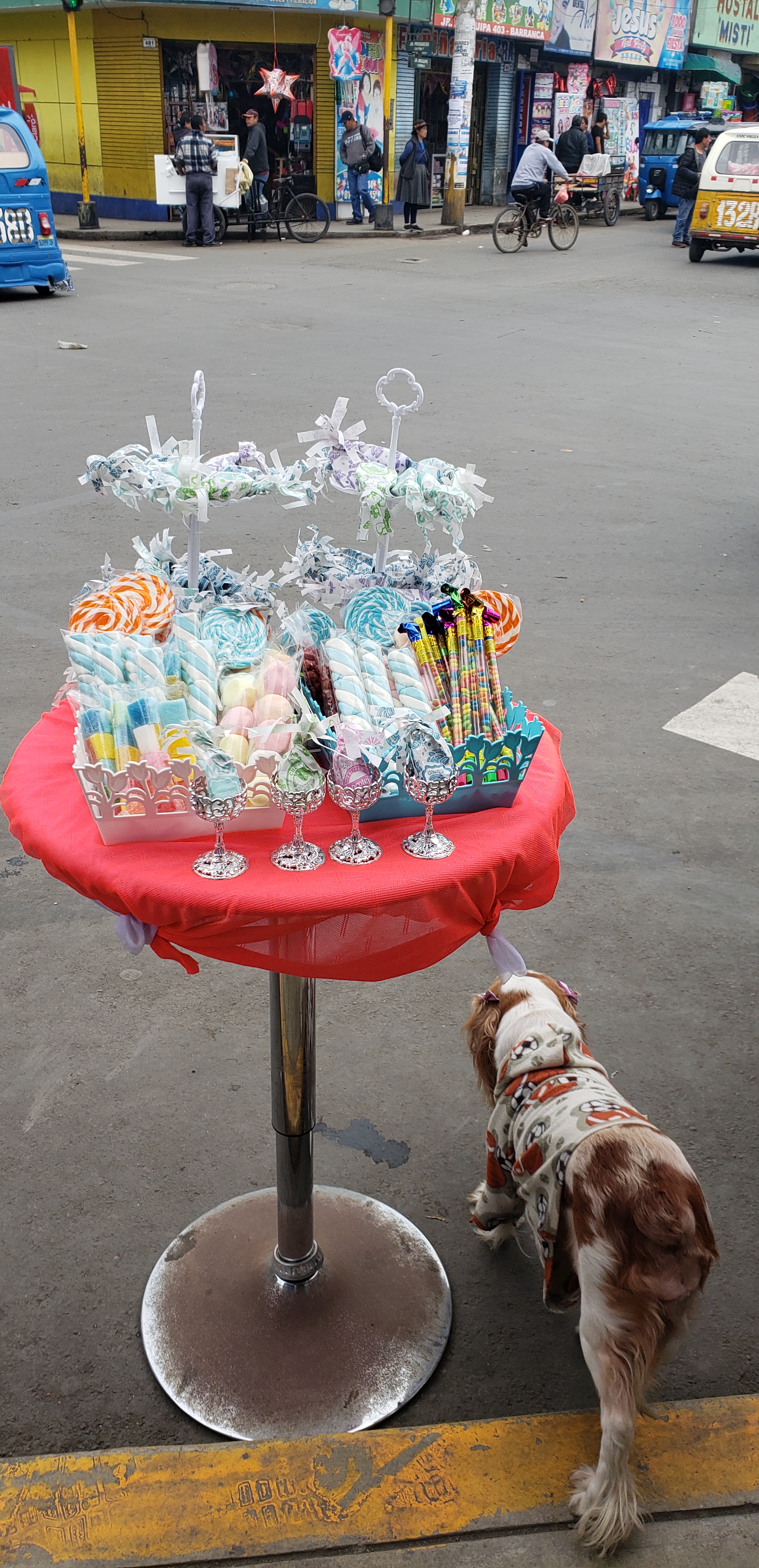
We passed a display of decorative marshmallows on a stand in the street. Every day there’s something new to see.
There are beautiful flowering trees this week in Lagrange. They bloom and fade so rapidly that I didn’t get a photo of many of the white pear trees that are widely used in landscaping. I love the pink flowering redbuds. This tree looks like it is dancing in the street.
We saw wonders in Bolivia, a remarkable plain of salt, the capital of an ancient empire, rare birds. In between those high points we flew around La Paz in a gondola, then drove across miles of altiplano where we passed quinoa fields, grazing herds of cows, horses, sheep, llamas, alpacas, vicunas and even pigs. We saw an Andean condor with its 8-10 ft wingspan as well as the bird I called a “flying peach”. We had one of the best dinners of our lives in La Paz and ate as much excellent Bolivian chocolate as we could in Sucre. Why do I plan never to return?
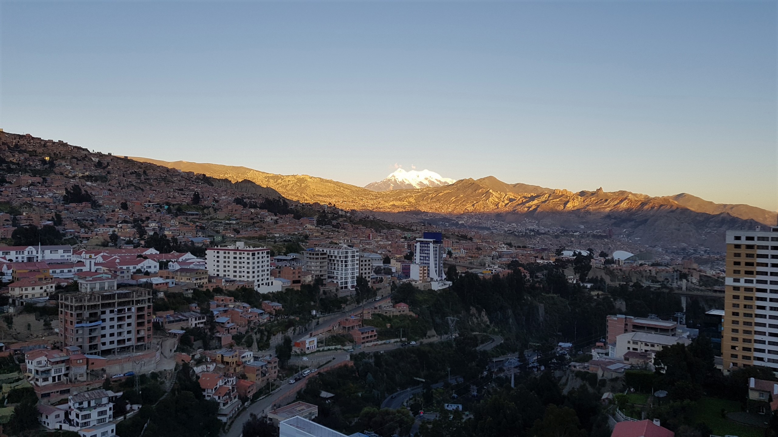
Altitude. More than half of Bolivia is tropical, but the best known part of Bolivia is the altiplano, a grassland area between 3500-4000 m above sea level, about 11,500-13,000 ft. My head ached most of the first week. Jonathan’s asthma made him short of breath. We both had trouble sleeping. Adjusting to high altitude takes time and flying from Lima at sea level to the El Alto airport in La Paz (4,050 m), in less than two hours, was a huge shock.
Getting to the wonderful places in Bolivia takes a lot of effort. Our usual scheme of renting a car and driving around was perfect when we wanted to pull over at a shallow lake and look at birds, or stop to check out ruined chullpas, ancient burial towers. Driving in major cities was nerve-wracking and it was very nearly impossible to find our way. Maybe we’re just getting too old for this. We hate the thought, but it’s out there. By the end of our trip we were both tired, ready for a well-seasoned, properly cooked meal where the hot dishes were hot and the cold dishes cold followed by a good night’s sleep in a comfortable bed–one of life’s great pleasures that is not usually available on the road.
Good Things About Bolivia
Cell phone service and data worked very well and cost us about US$10 each for a month of service, a bargain. We used Entel because it appears to have better coverage in Bolivia and had no trouble. We didn’t make many calls, but used the data for mapping our routes.
Gasoline was inexpensive, where else can you say that? The Bolivian government subsidizes gasoline, and resists making regular increases. We spent less than US$20 to fill the tank of our rental RAV4. It costs about triple that to fill up in Peru.
Food costs are low and there is a wide variety of products available, many coming from the lowland portion of the country that is focused on agriculture (and removing tropical forest…).
Textiles. If you want weaving, Bolivia is for you. We found the most interesting and highest quality weavings in Sucre and the Tarabuco market, in the Tarabuco and Jalqa styles. There are many other styles from different regions. Typical of Bolivia, there are specific markets and towns that sell the greatest variety of each. There’s a lot of travel involved.
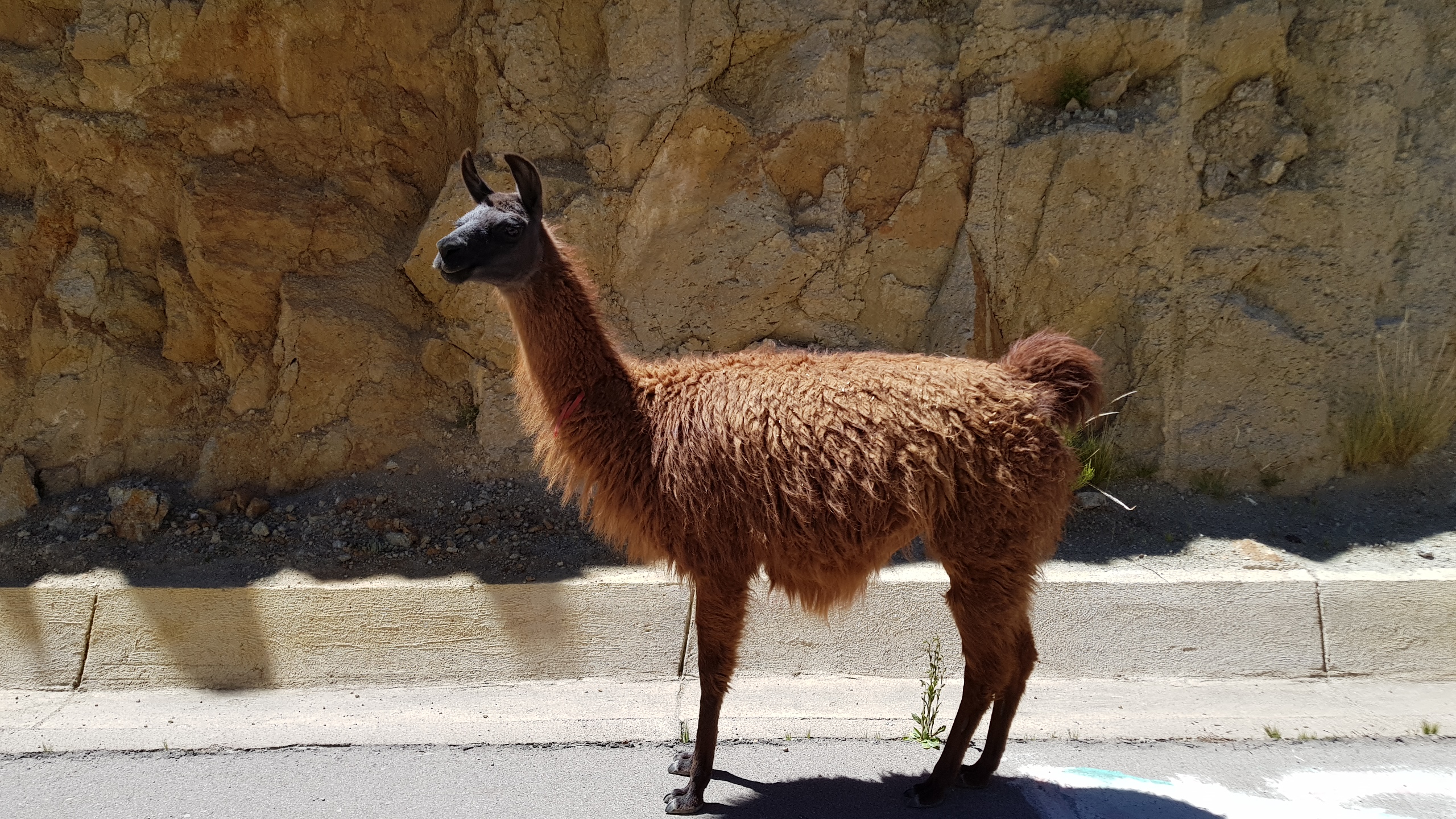
Llama in the road.
Wildlife. We saw vicuna grazing by the side of the highway, and a lot of other animals, too. You have to be careful not to hit them with your vehicle. Bolivia has a tremendous variety of birds, too. There is lots to see every day, and specialized tours for anything specific you want to find.
Minor Annoyances
The google maps algorithm for directions works very poorly in South America so far. In both Peru and Bolivia, it sends us on unnecessarily complex routes and detours. We have to critique and second-guess every route that is not highway point-to-point.
There is no international mail service. I took my postcards to the Post Office and the man behind the window looked at me blankly. “We have no directions for this process at this time.” What? No international mail.
You have to give your name and passport number every time you get gas, part of a vain government effort to prevent smuggling of petroleum products.
To pay for a service by putting money in a specific bank account, a common practice in parts of South America, you not only have to provide your name and passport number, but an explanation of what the payment is for (e.g. lodging), but also where the money comes from. I had to explain that I am retired and receive a pension.
US citizens require a visa. Don’t forget to fill out the forms and pay your $160.
The final indignity was having our luggage stay behind in La Paz when our flight left for Lima. Two days later it all turned up safe. Just one more Bolivian moment.
Tiwanaku museum
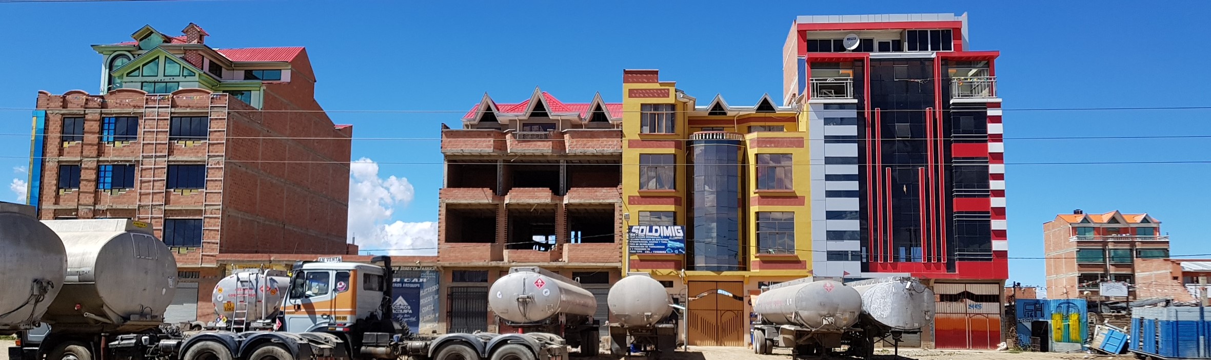
Advertising in La Paz
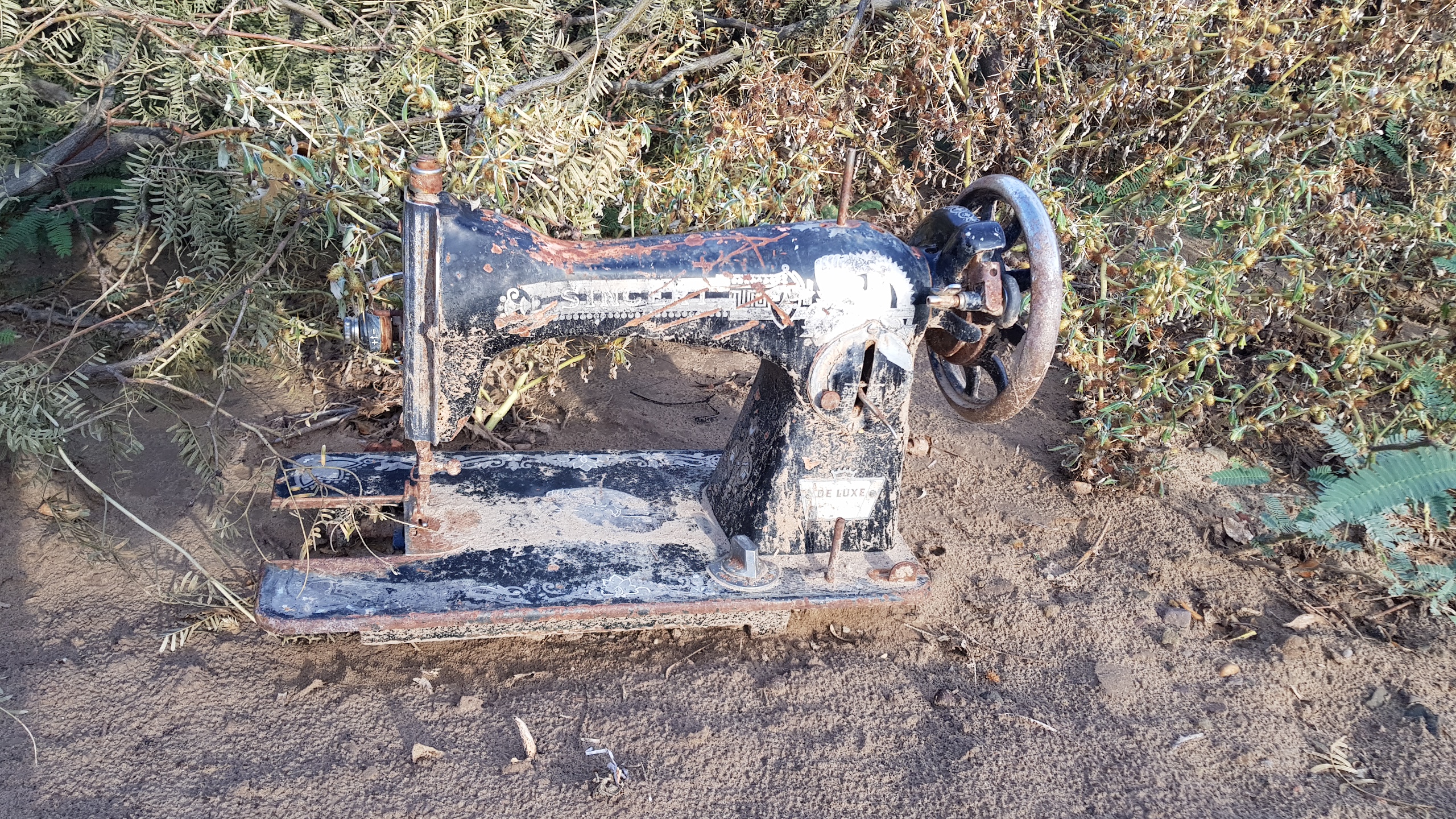
Abandoned in Perereta
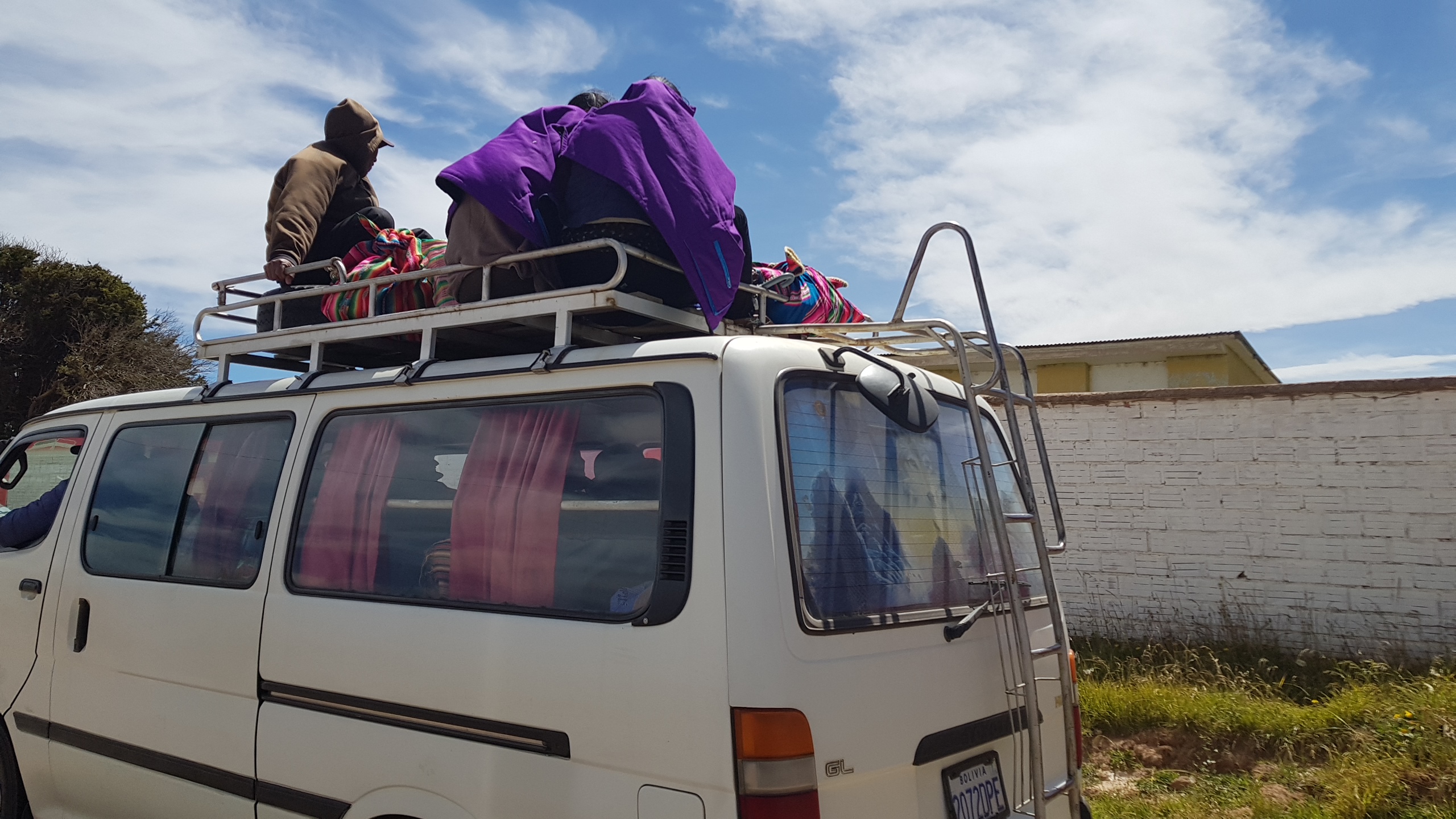
In Bolivia, some passengers ride on top of the bus.
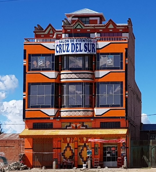
We couldn’t help but notice the houses built on top of apartment buildings near the airport in El Alto, on the plain above La Paz, Bolivia, since they are brightly colored and decorated like casinos. The more we found out, the more fascinated we became. These buildings are considered “Neo-andino” architecture by some, and are credited to a single architect, Freddy Mamani Silvestre. Mamani also paints and sculpts brightly colored works that we saw in several places in La Paz.
The buildings and bright colors are an expression of Aymara pride and economic power that has developed since Bolivia elected its first Aymara president, Evo Morales, in 2006. (He’s just been elected for a third term.) Mamani says he is inspired by Aymara folklore, colorful dance costumes, bright textiles, and archaeological symbols from both Tiwanaku and the Inca. His buildings have been criticized as kitschy and overly decorative, but he claims that his intention was to liven up the brick expanse of El Alto, where he grew up. El Alto began as an overflow suburb of La Paz populated mostly by indigenous people. Today, it is Bolivia’s second largest city. La Paz is located in a valley that is completed filled with houses up to the edge. El Alto is where housing spills over onto the altiplano where there is the potential to expand away from La Paz for miles.
Newly affluent Aymara families in El Alto have adopted Mamani’s style. The overall plan is for a family to create a business and living space. The ground floor has commercial spaces, while the second floor is an event space to use or rent for weddings, quinceaneras, and other events. Some of these are double-height ballrooms decorated like the inside of a pinball machine. Higher floors are offices or apartments for family, while the top floor is the “cholet” (from “Cholo chalet”), a house, often with a gabled roof, on top of the structure. Who lives in a “cholet”? A Cholo and a Cholita.
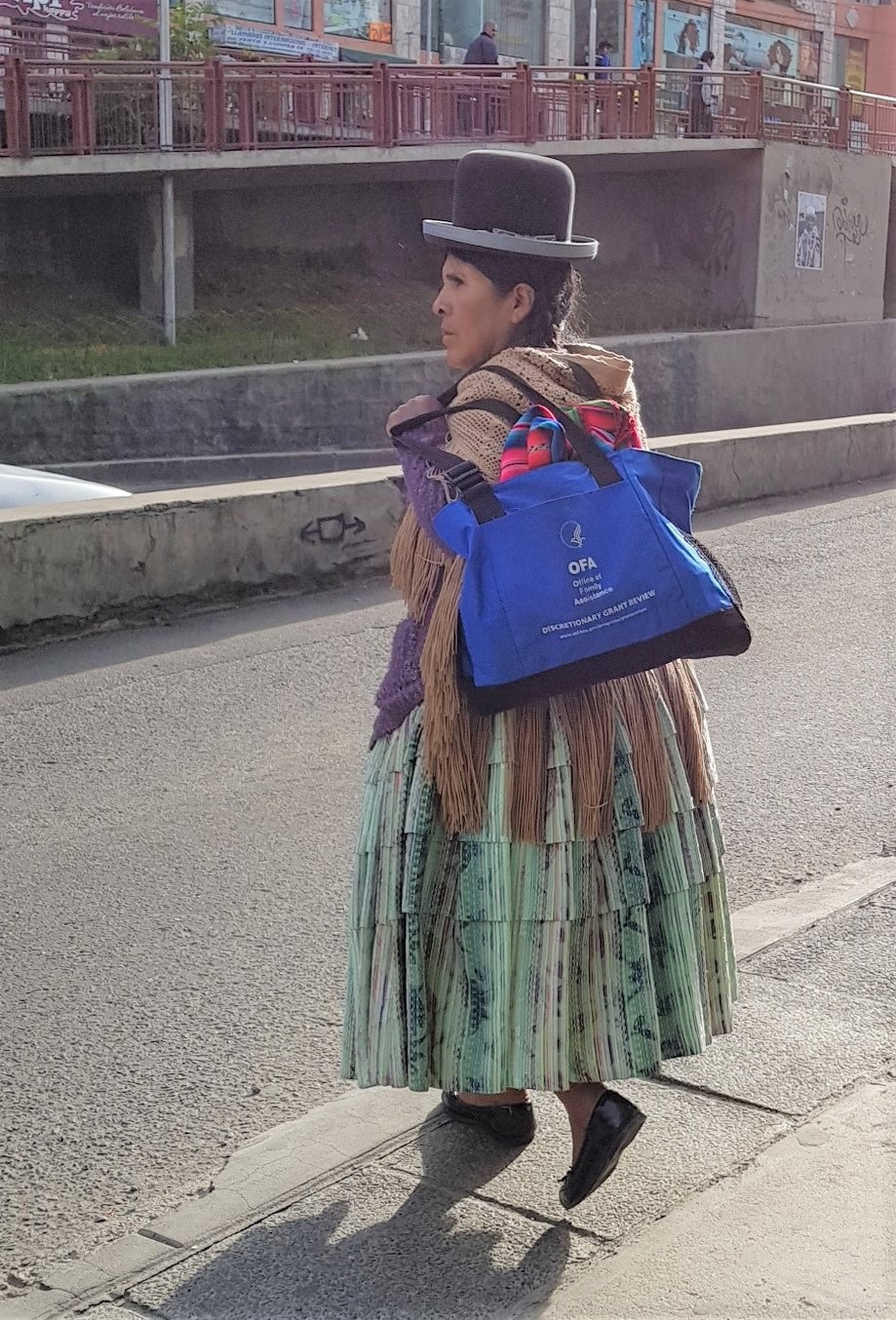
“Cholo” is one nickname for indigenous people. Sometimes people call themselves cholos, and in El Alto and La Paz, a “Cholita” is a woman of means who continues to wear traditional dress of many skirts, or pollera, an elegant shawl with very long fringe and a bowler hat that may be decorated with an elaborate metal ornament to match her shawl pin. You can tell a Cholita from a country woman by the fact that she usually carries a bag or briefcase and not the striped aguayo, the square of cloth that Bolivians use to carry everything. She may be hailing a taxi rather than boarding a bus.
There are detailed photos of Mamani’s Neo-Andino houses in El Alto in this book:
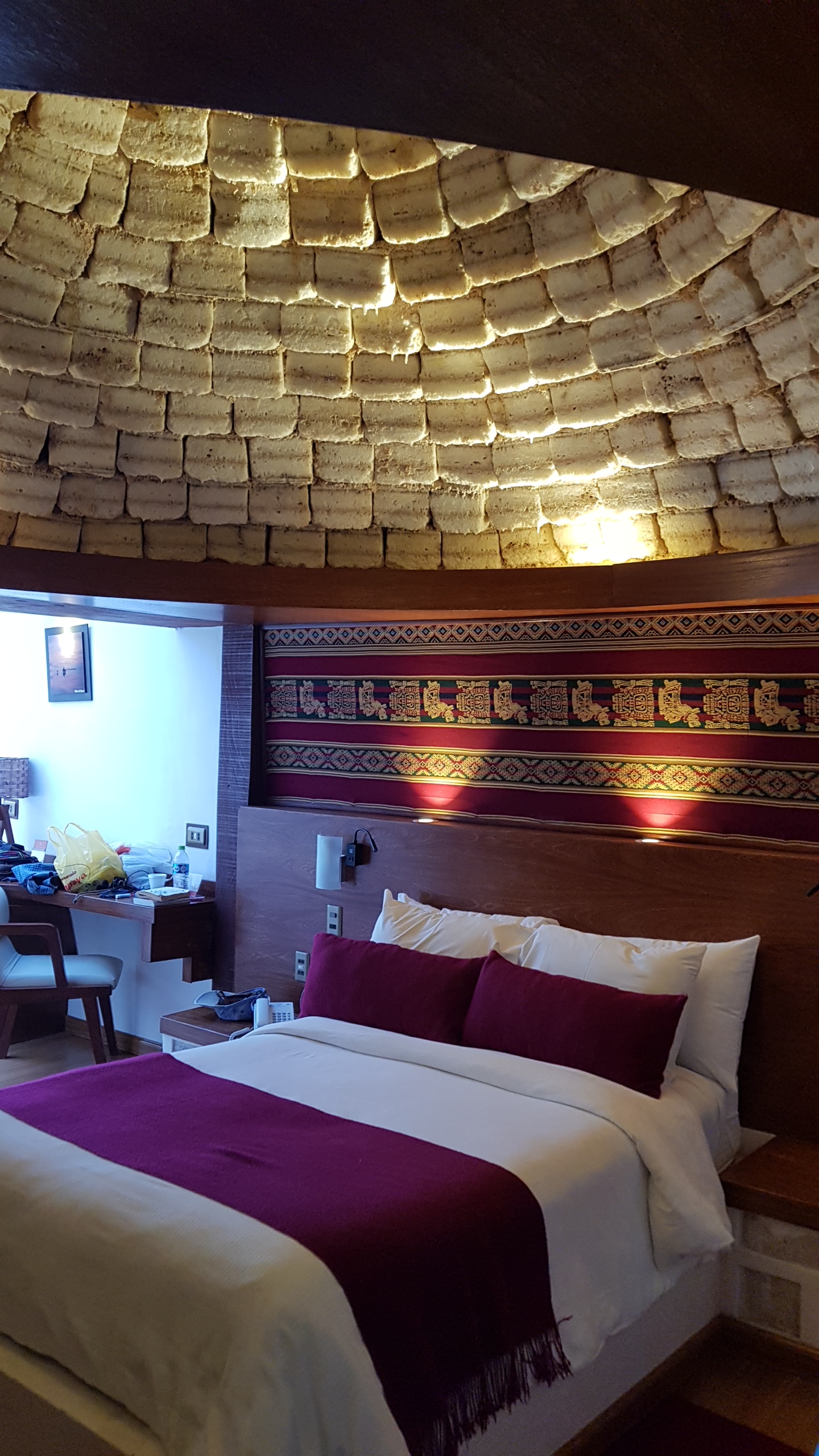
We drove from Sucre to Colchani, a settlement near the Uyuni salt flats/Salar de Uyuni. We stayed at the Palacio de Sal, a hotel made with a lot of salt mined nearby.The domed ceiling of our room was made of blocks of salt We went on a day-long tour of the area around Colchani with a driver, Orlando, and guide, Edson. What started as a lark proved to be a rare experience. The Salar de Uyuni is the world’s largest salt flats (110 x 90 km), approximately 120 m deep. As you drive out into the salar, the surface turns from slushy gray to bright white. You lose all sense of perspective because there are no objects in the background–it’s all white. It’s a very weird environment, and the white all around you flattens perspective until you look like cutouts on a plain background. We had lunch all by ourselves in the middle of the salt flats, feeling akin to extras in a Fellini movie.
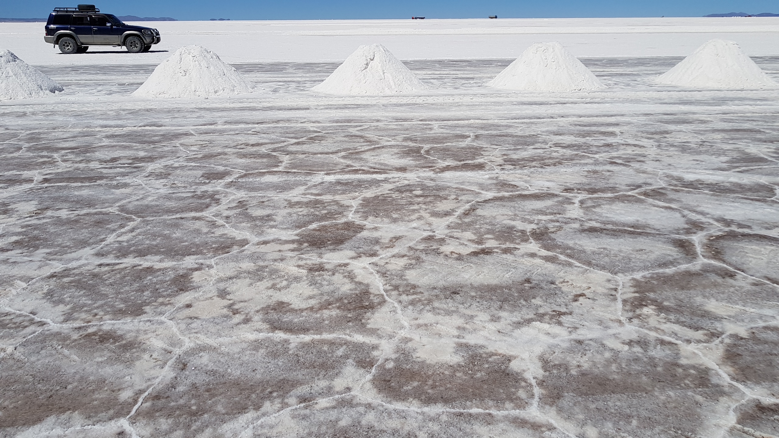
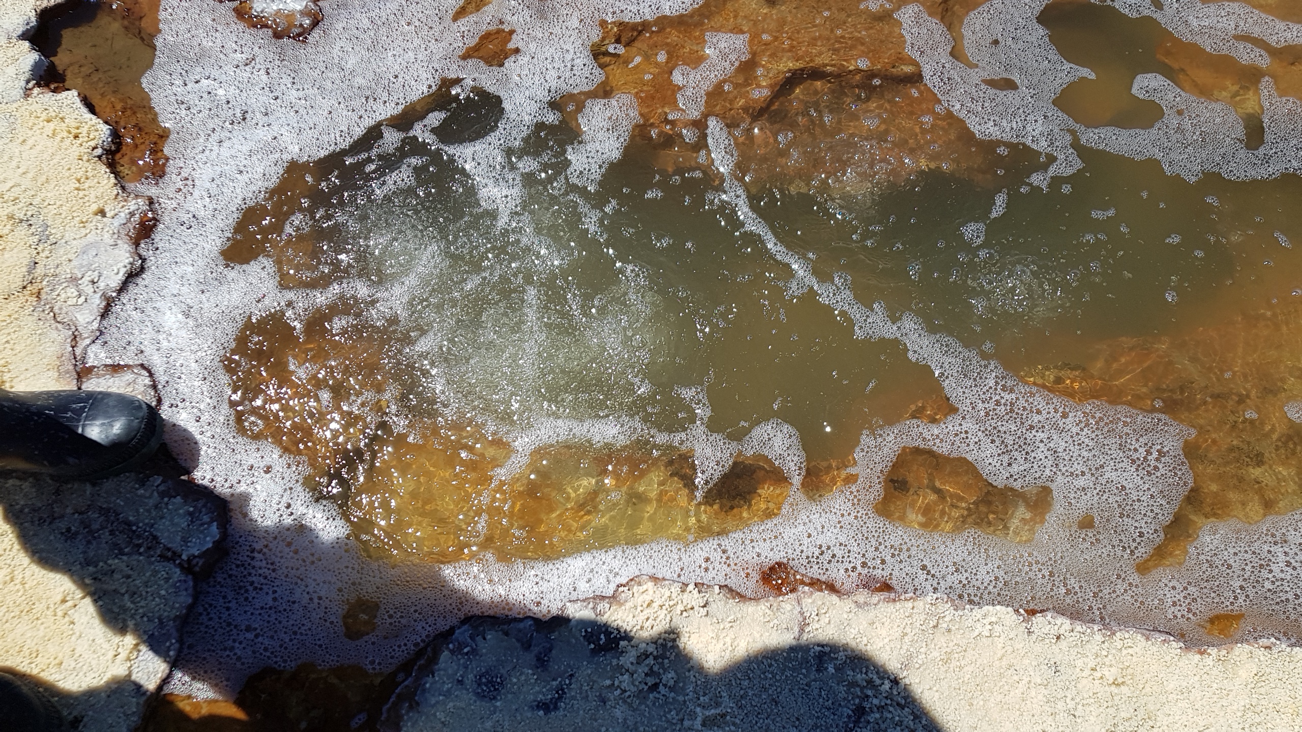
Like traveling in the desert, you need a driver who knows his way on invisible roads. Orlando claimed to use the hills and mountains in the distance to check his location. At one point we drove for more than an hour across the salt (no road) without reaching the edge of the salar. The salt is mined for consumption within Bolivia but not exported. From a distance the salt looks like snow on the ground. It looks a bit like that up close, too. Where the salt has been scraped from the hard surface, you can see a network of hexagonal cracks. Underneath the salt, water bubbles up. The boiling water looks like it would be hot, but it is ice cold and very salty. Salt crystals form inside these bubbling holes (called ojos/eyes). Edson reached into one and pulled out a clump of crystalline salt. During the rainy season, runoff from rivers turns the salar into a shallow lake. The water can be up to a meter deep, and vehicles avoid the deep spots during those months (Dec.-Feb). We visited Isla Incahuasi in the middle of the salar, home to several species of birds and lots of cactus. It’s completely surrounded by salt.
We stopped at what looked like a ski lodge, the site of the first “Palacio de Sal” hotel that was almost completely made of salt. It was moved when the pollution from the hotel (water, trash, sewer) made it clear that building out on the salar itself wasn’t a good idea. The ruins of the hotel are now a lively way station on the largely featureless salar.
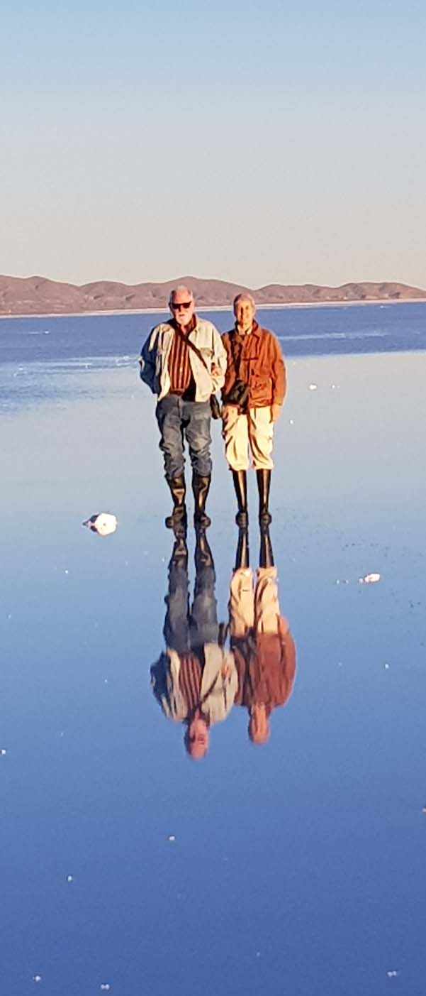
When there is shallow water over the salt, up to about 2 cm, it’s possible to see exact reflections in the water. The rainy season is over, but we found a patch that was still reflecting.
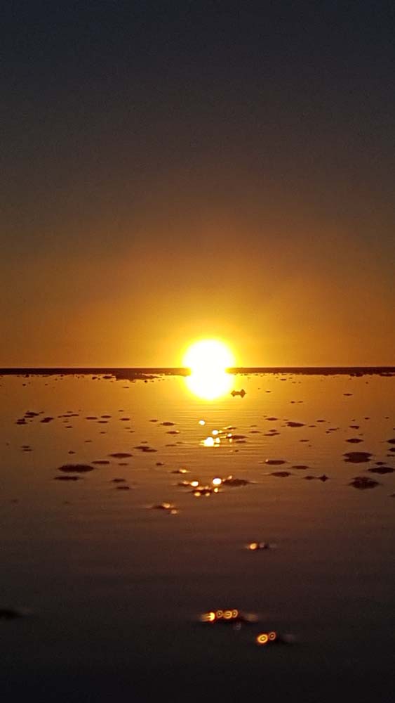
We ended the day watching the sun set over the salar with glasses of Bolivian wine (Campos de Solana). We’d never heard of Bolivian wine, so it was a pleasant surprise and capped a truly remarkable day.
There are tours that last 2-10 days and circle southwest Bolivia, visiting farflung corners of the salar, unusual stone formations, lakes of different colors, remnant volcanoes and archaeological sites. Our day trip was wonderful, but there is much more that can be seen.
We spent three nights in Sucre. The Hotel Monasterio used to be a monastery and still has some great decor–Bolivian Baroque? It was comfortable and placed us in the heart of Sucre. We walked down to the central plaza for dinner each night and found good places, La Taverne (French-Bolivian), Cosmo Cafe, and Cafe Florio (Dutch-Bolivian).
This slideshow requires JavaScript.
During the day we visited the central market
The ethnographic and Indigenous Art museums.
Tarabuco weaving
Airplanes over farm fields
Three tupus/pins on a traditional dress
What Cholitas wear today for special occasions.
Virgin Mary on a rock
We happened to be in Sucre on the day of the Tarabuco Market 65 km from Sucre. We hired a driver to take us there, wait three hours, and return us to Sucre (300 Bolivianos). The market is known for textiles and there were wonderful items all over the place. We looked at rugs, ponchos, wall hangings, table cloths, bags and lots of other things. There was a regional gastronomy competition. The dishes seemed to consist of potatoes, wheat berries, broth and chili peppers, though I don’t think it was very spicy. There was chicha to drink, but neither of us are fans of fermented corn. Most of the women wore traditional dress to enhance their presentation.
We strolled the main plaza and side streets looking at weavings.
I tried on one hat that looked like it escaped from a marching band.
Another is modeled after Spanish conquistadors helmets. Both men and women wear them.
We bought a bright red patterned rug and a salmon-colored tablecloth as well as a crocheted hat for me and a suitcase to carry it all home.
 We saw a few birds and are still waiting for more of the local fauna to step out.
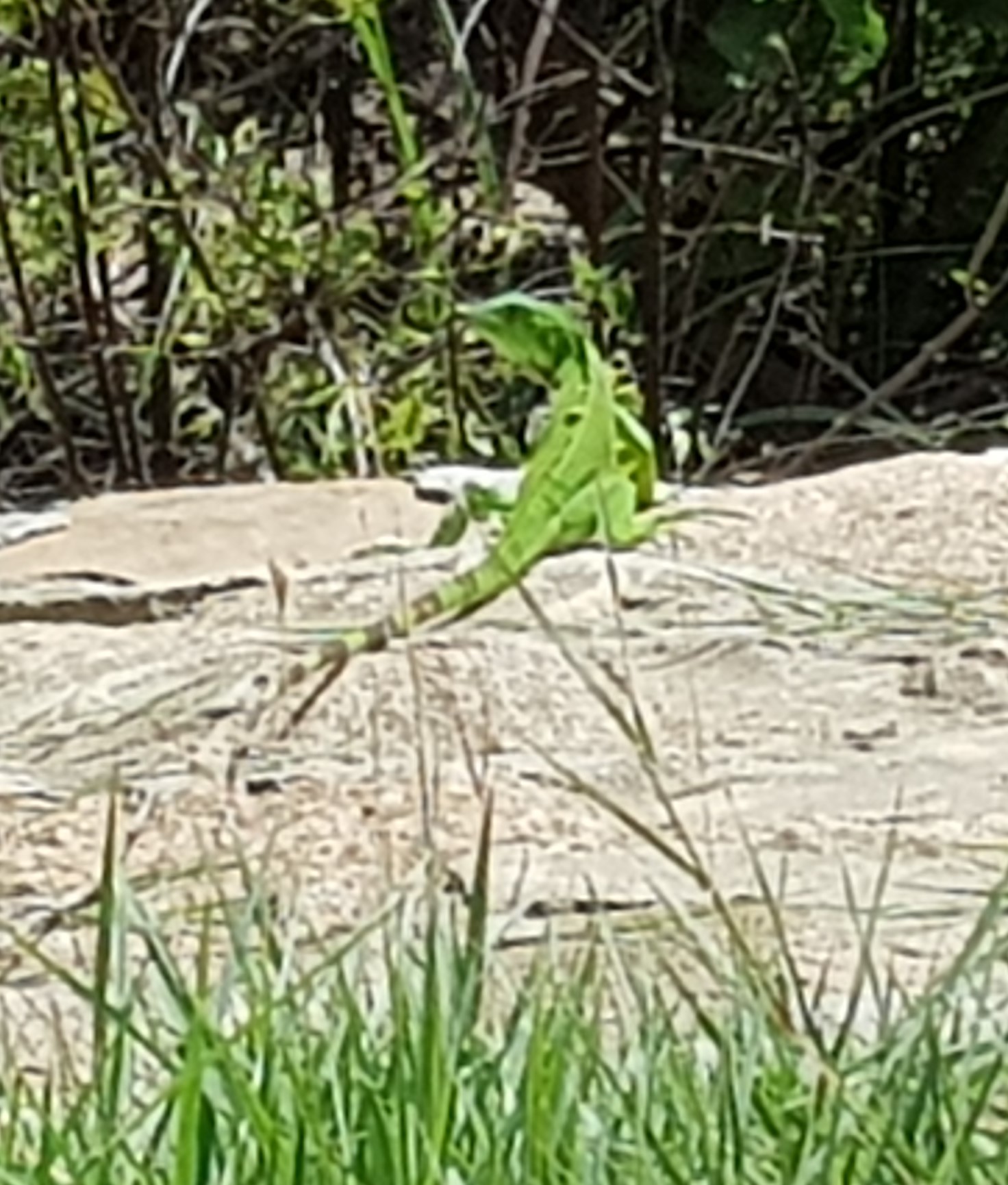
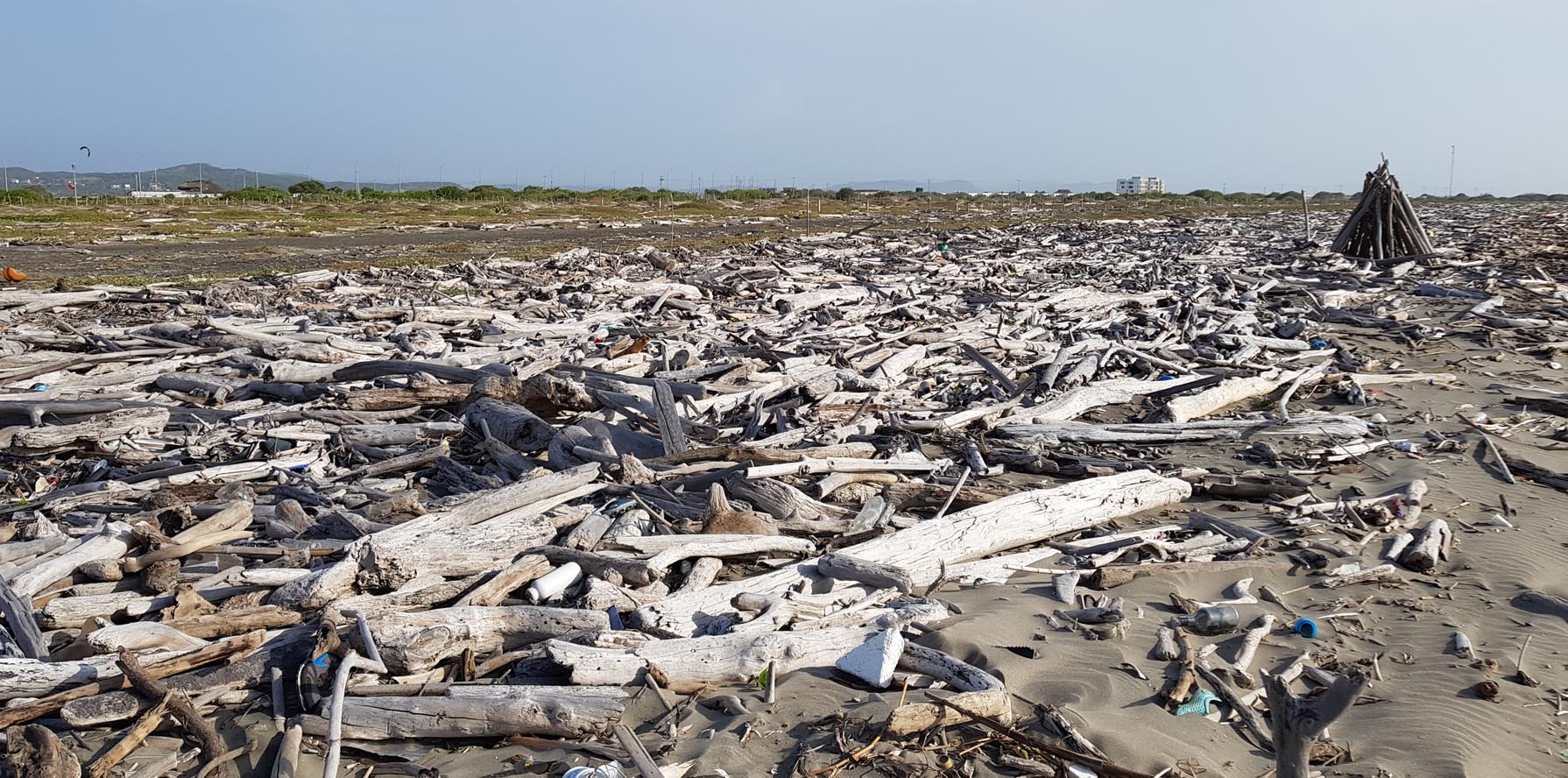 When we went out to the sea side of the Ensenada we found an astonishing beach full of driftwood. There are huge logs and twisted shapes of all kinds.
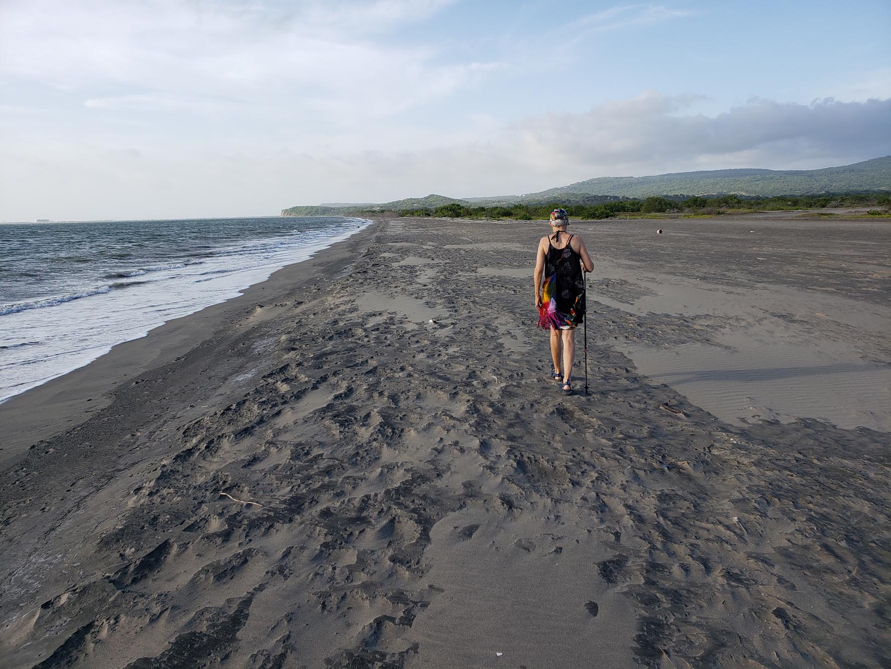
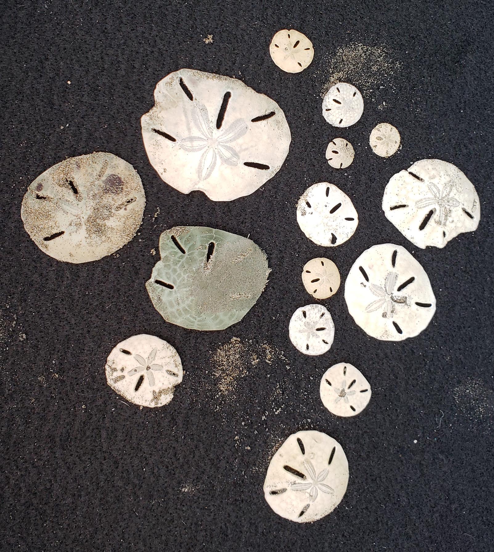 The next day we visited Playa Mendoza, where we found sand dollars.
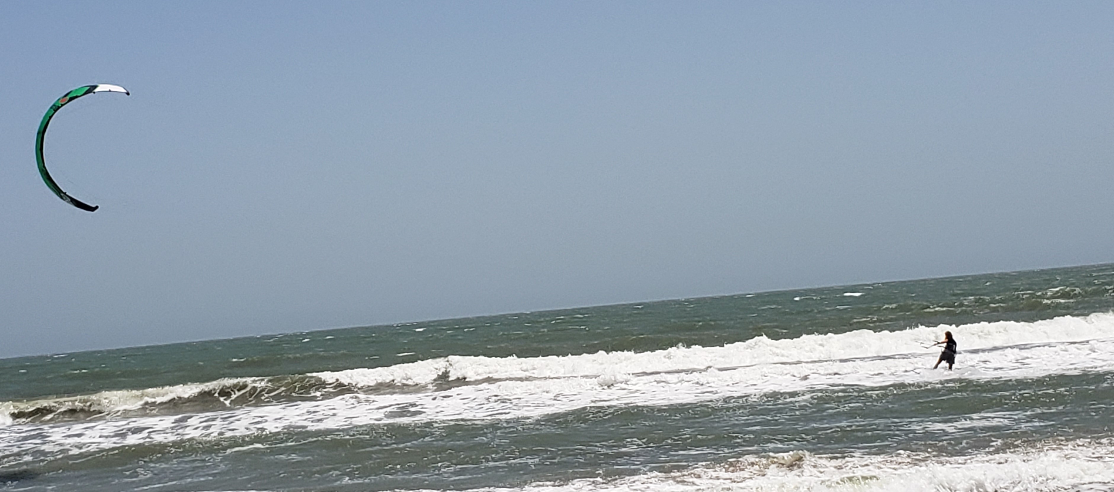 The people who live in this area full time are those who staff the beachside businesses, teach kite-surfing or build new villas for the weekenders, as development extends ever further along the coast between Baranquilla and Cartagena.
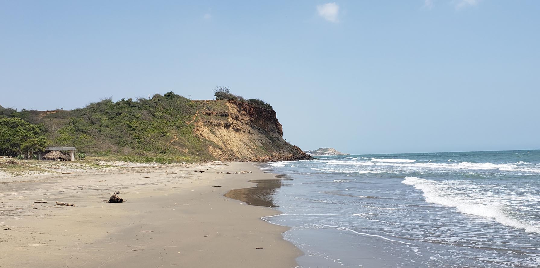 The pace of life suits us fine, as we visit beaches in the morning and late afternoon. We are at home for a dip in the pool, lunch and rest in the shade while it is hot.