
In the opening photo above, you should notice the tall buildings of the business district of Sacramento, the low, gray bulk of the Crocker Museum in the trees along the far bank of the river, and the rider on the jet ski who was swirling up and down the river as we watched. There’s SacramentoContinue reading “Food and Culture in Sacramento”
Tag Archives: Attractions
Historic Sacramento
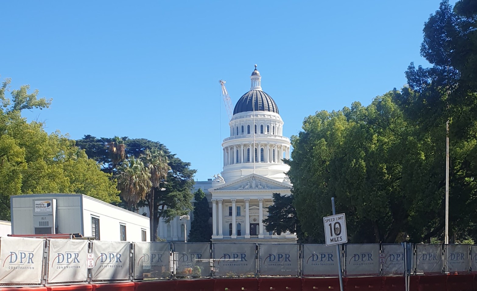
Sacramento would be a lovely place to live if only they could do something about the weather. It’s October, yet the late afternoon temperature has hit 100 degrees about half of our days here. People quickly learn to get out early and finish walking the dog, taking a stroll, jogging (if they must), because byContinue reading “Historic Sacramento”
Local Color: The Eureka Street Art Festival

This week, the Eureka Street Art Festival has painters in place at fifteen localities around town, working on new murals. We spent the afternoon driving around town looking at most of the murals indicated on the map for the event. Painters have through the weekend to complete their work, and as a result, there wereContinue reading “Local Color: The Eureka Street Art Festival”
Shopping in Willemstad and Good to Know About Curacao

(The banner photo for this post that you may or may not be able to see depending on the device you are using is the Aida Perla cruise ship, with about 1,600 passengers, docked in Willemstad, Curacao, Nov. 25, 2023) I only ventured into the downtown area a couple of times. I wasn’t interested inContinue reading “Shopping in Willemstad and Good to Know About Curacao”
Where to spend August
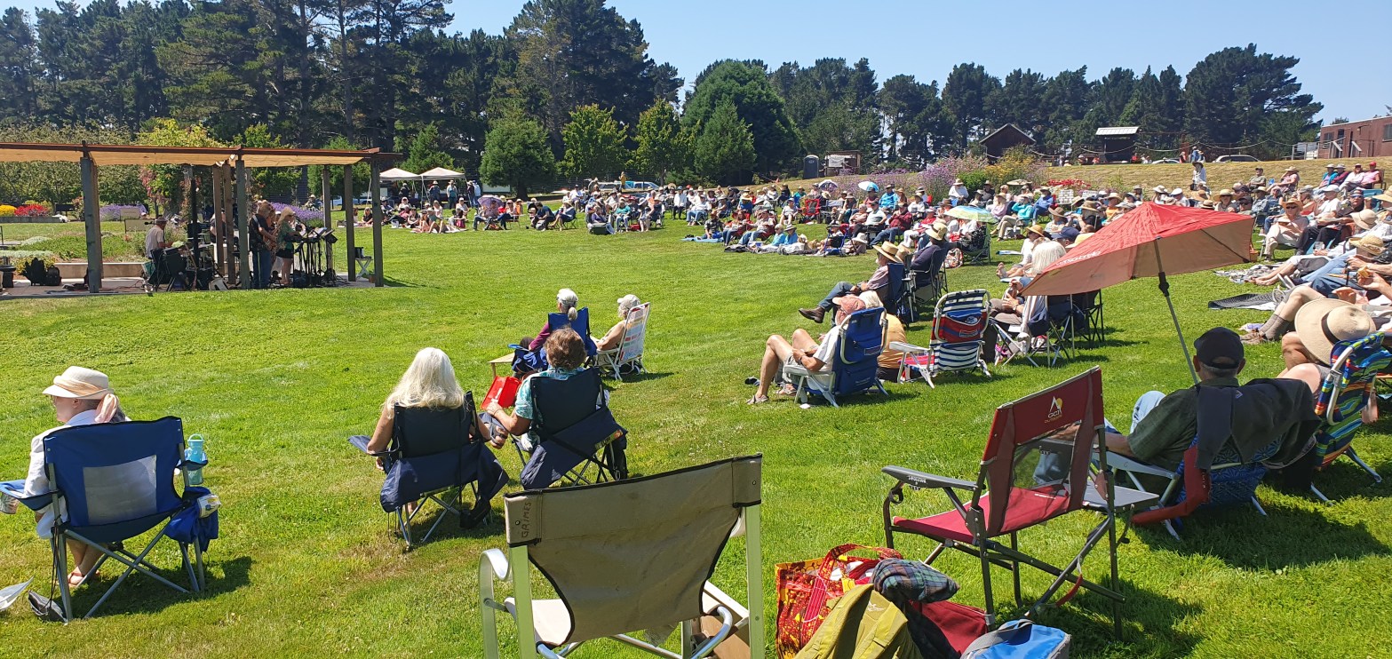
You can go anywhere in the world in April and May. (Springtime in Paris!) But where do you go in August, when everyone in Italy is on vacation, Europe is overrun with Americans, and it’s broiling almost everywhere? Eureka, California, is your answer. Summer didn’t really arrive until around the Fourth of July, and nowContinue reading “Where to spend August”
Fern Canyon walk
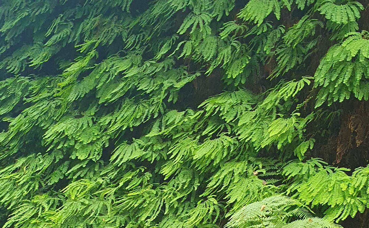
Fern Canyon is a natural gully of fern covered walls up to 50 feet high along both sides of a stream near Orrick, CA. The access road is five miles of unpaved gravel and dust. There are several dips over ruts from storm runoff, and two places where you drive through water in the creek.Continue reading “Fern Canyon walk”
Summer in California: the Fortuna Rodeo
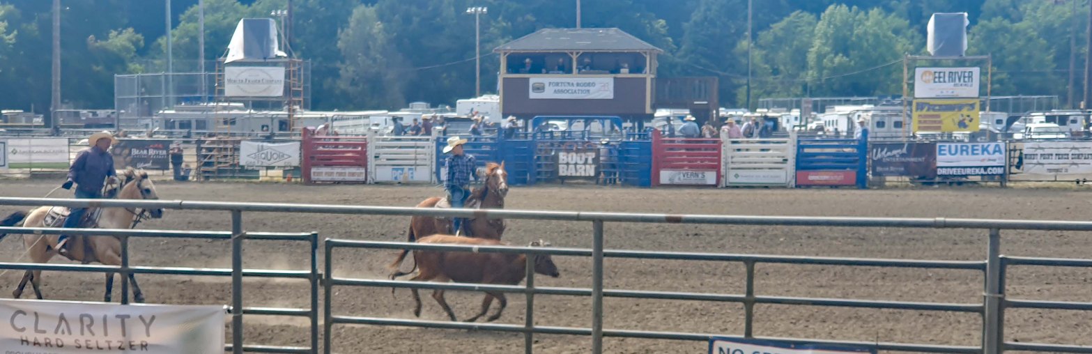
June through September are the months of summer in Humboldt, but July has the best sun. The Fortuna Rodeo is a fixture of summer, taking place the weekend after July 4. Amanda and Jim are fans, so we went along, and they were right, it’s one of the best activities out here. Our choice wasContinue reading “Summer in California: the Fortuna Rodeo”
The Acropolis, Athens

We developed our visit to Athens by seeing the Acropolis from different angles, from the tops of the nearby hills, and from the base of the hill on different sides. The Parthenon is the big central temple, and the day came when it was time to climb to the top and see it up closeContinue reading “The Acropolis, Athens”
Weekend in Mendocino
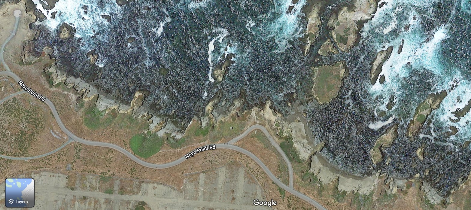
The sun, moon, and earth are aligned only at the new moon or the full moon. When this happens in combination with the earth’s closest approach to the sun (winter) the gravitational effects of all these bodies are combined and produce king tides. The high tide is above normal levels, and the low tide asContinue reading “Weekend in Mendocino”
London month/All Good things
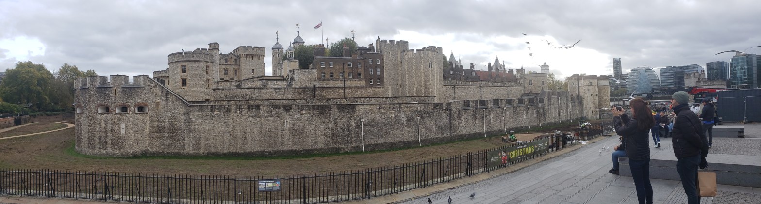
Best month ever! That’s what I usually say at the end of our month-long stays. When people ask what place we liked best in all our travels, we like the place we are right now. This year in London the weather was gorgeous (one day! of rain, only one!), the mudlarking was a lot ofContinue reading “London month/All Good things”
