I’ve been doing so many things that the space between posts has gotten longer. Most of our activities involve walking on beaches or visiting ruins that date between the twentieth century and 3000 BC. A real highlight was the cemetery that includes ruins of Asseroe Abbey in Ballyshannon.
Nothing is left of the Abbey but the back wall that is incorporated into a farmer’s stone barn, but there are fragments tucked in around the cemetery.
Nearby is a bridge that may be the oldest surviving stone bridge in Ireland. It has three arches and crosses the tiny Assaroe river.
The churchyard is the largest remnant of Assaroe Abbey with many old graves and headstones.
There is a stile that includes a fragment of trim from around an arched doorway. It’s the lowest stone in the group.
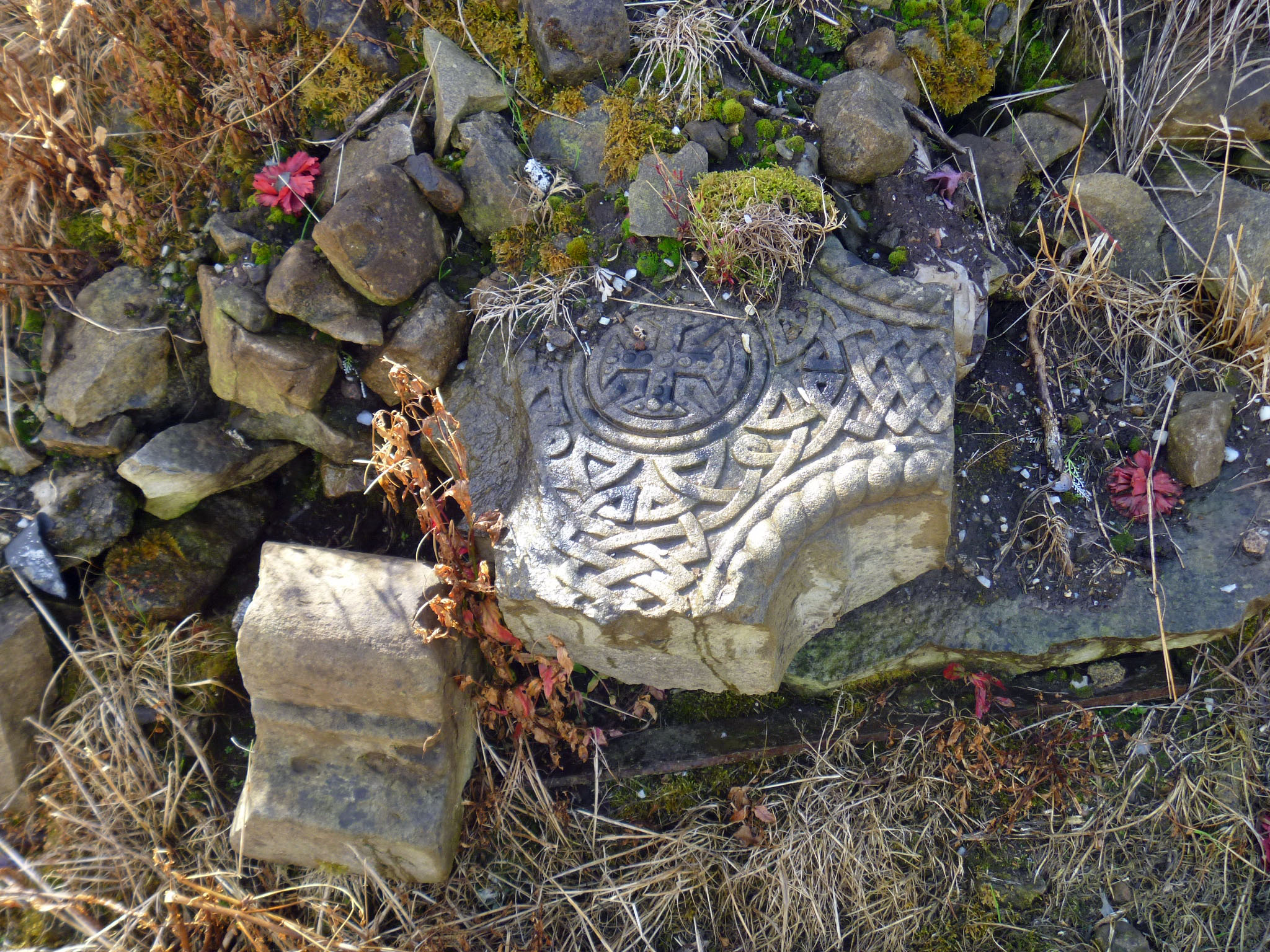
Inside the cemetery there are headstones from several centuries. The oldest have been incorporated into the walls. The headstone below has been reused by a later individual. You can see the elaborate carving on the upper portion, but the lower portion has been chiseled off. It was probably a dedication to a different person. It might even have begun, “Here lies…..”
Some pieces have broken and no one seems to know what to do with them.
There are pieces of ironwork that are merging with the stones they used to mark.
The cemetery is not large, but it is full of history and stories known and unknown. It is one of my favorite places of those we’ve visited.
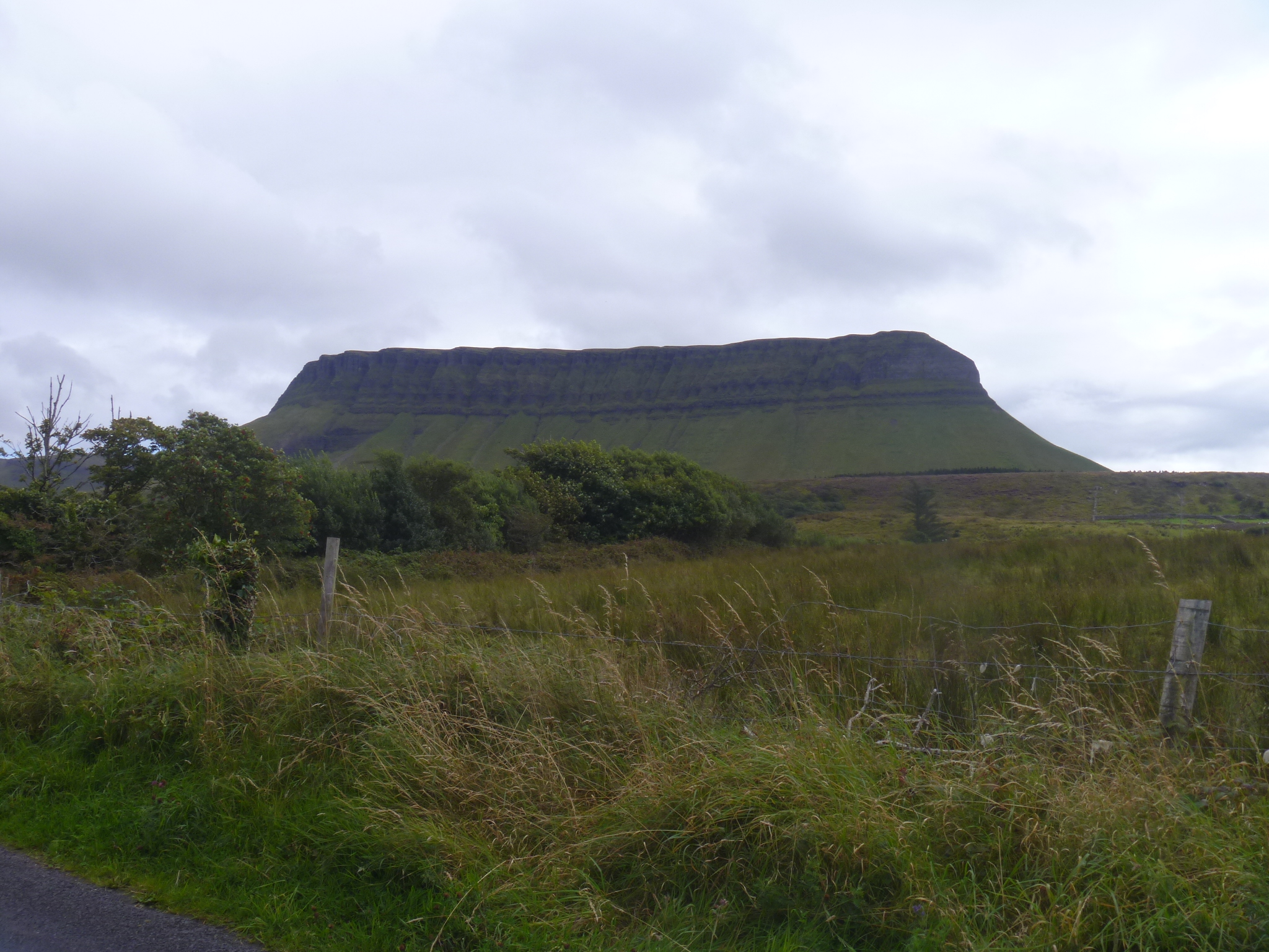
Benbulben is a striking feature on the Donegal landscape, or is it Sligo, or Leitrim? County boundaries are close together here and this mountain plateau can be seen for many miles. We followed the Benbulben Forest Walk to skirt the edge of the mountain, admiring the velvety moss green drape of its slopes. The tiny white flecks on its surface are sheep that graze all the way up to the rocks. As you walk from one end to the other of its rocky face, Benbulben changes from a knob of rock to a wall of cliffs to a row of jagged teeth looming over the valley.
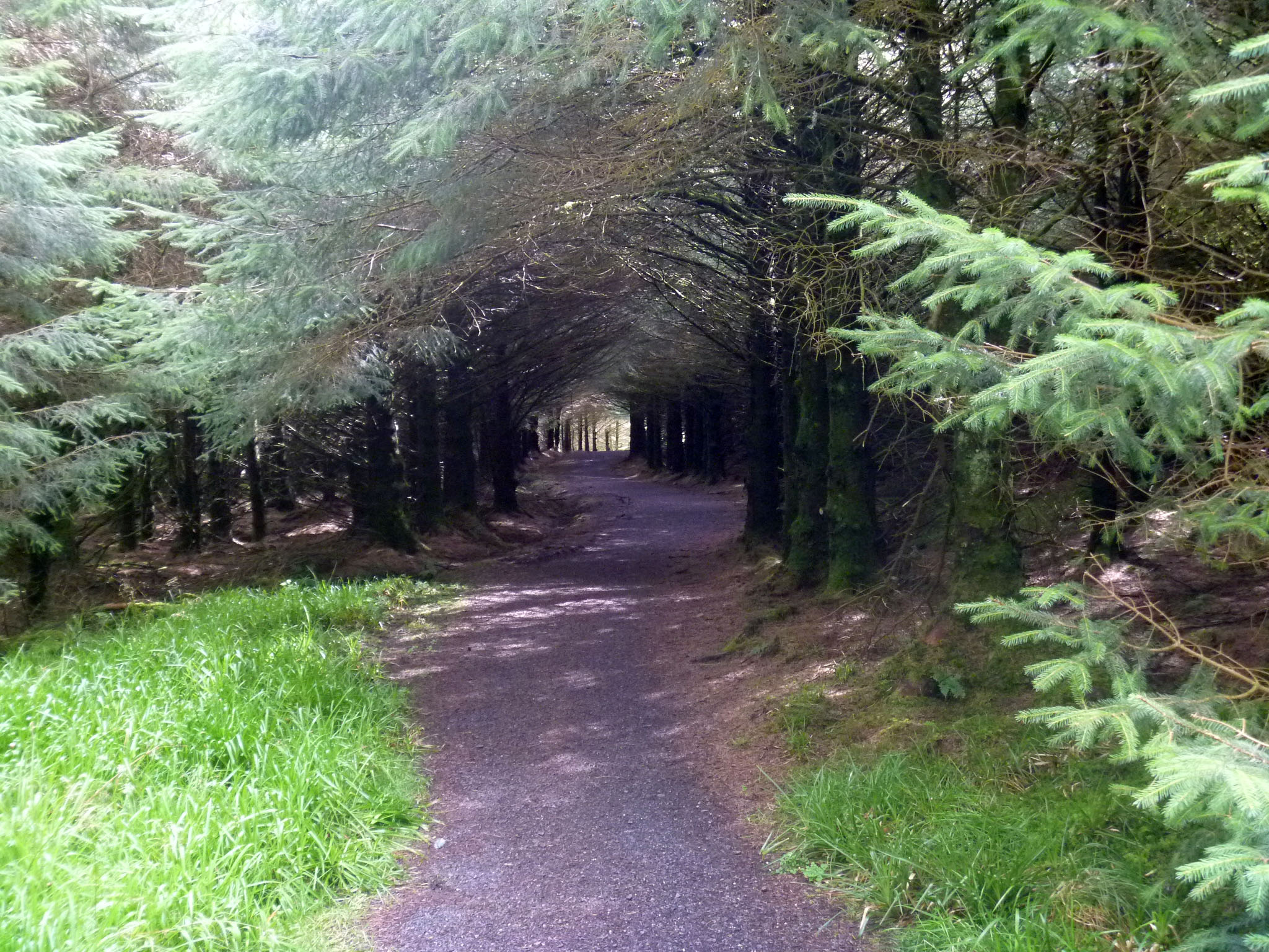
Our walk started in bright sun, then shifted to overcast and to rain. We stood among the pines of a forestry plantation to escape the gusts for five minutes and then the rain was past.
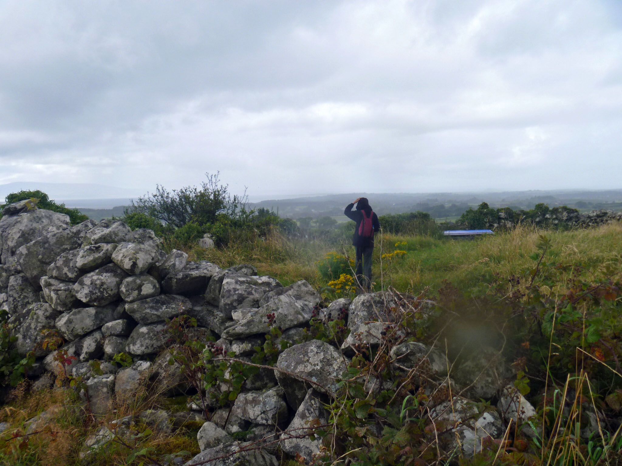
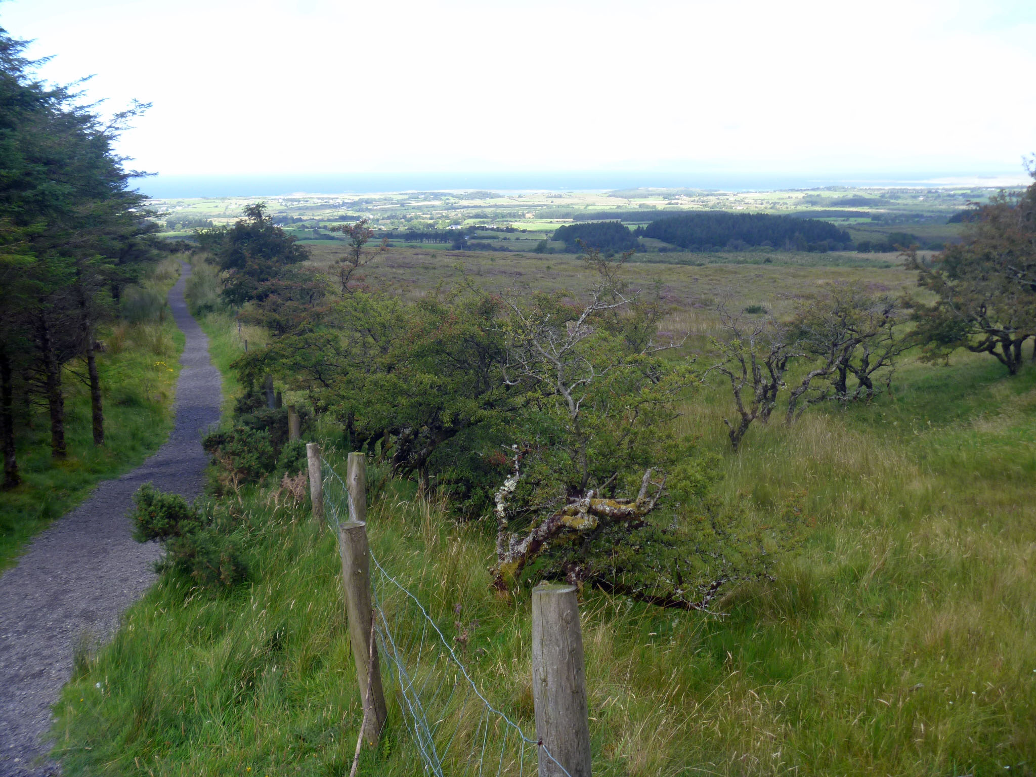
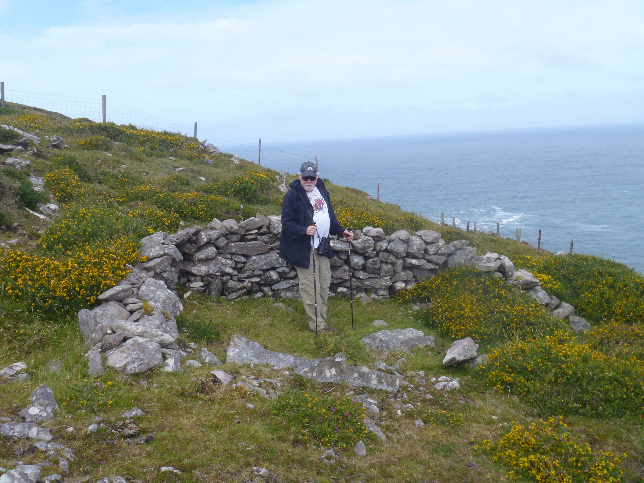
We stopped to look at the ruin of a medieval farmstead, Cashel Baun, that we found along the path, then continued on from the park to a place called Luke’s Bridge, around the side of Benbulben. Luke’s Bridge is a trailhead for hiking up onto the plateau at the top of Benbulben. We saw four hikers making their way down the final stretch after what surely had been a long morning. Anyone can climb the trail as long as they have the legs, boots, raingear, water, snacks and desire to do so.When you put your back to Benbulben you can see fields and pastures and the Atlantic in the distance.I have been reading about “overtourism” lately, the fact that popular places have become so full of tourists that there is no room for local residents. Tourist hotels and rental properties squeeze housing availability and raise prices. Streets are packed with people day and night–sometimes things get rowdy. Many people who travel are in favor of sustainable tourism but no one wants to give up seeing a famous sight. We all seem to want limits on visitors right AFTER we’ve been there.
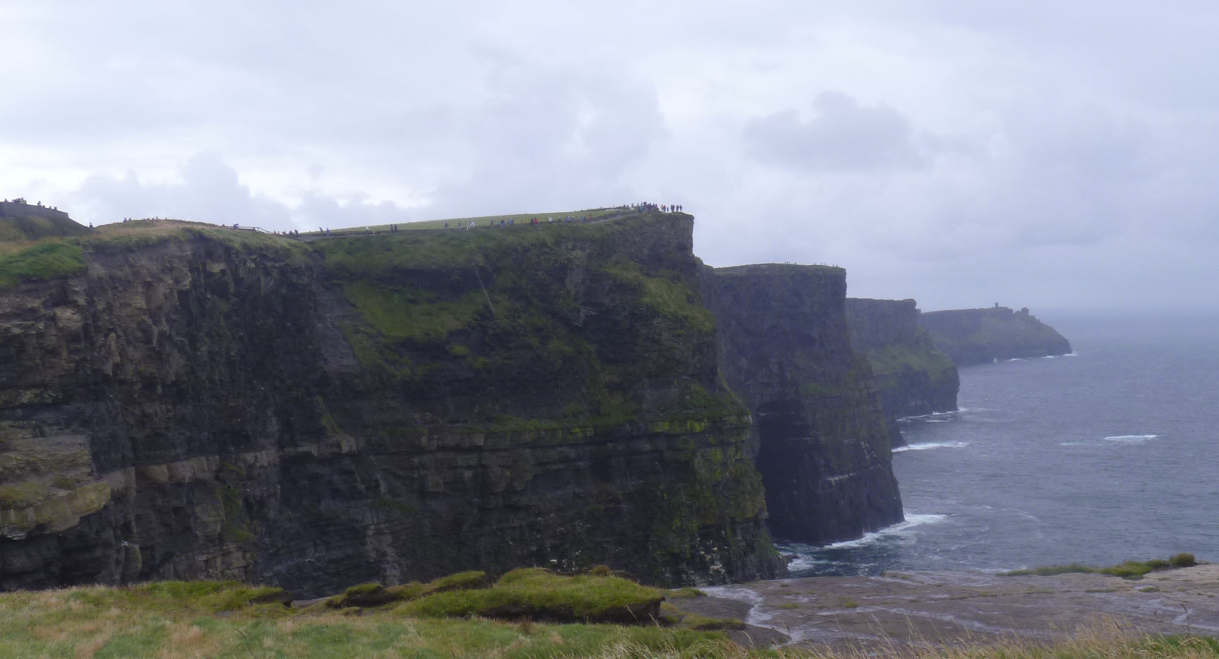
Now that I’ve been to Benbulben, I think it was a better experience than visiting the Cliffs of Moher, which were full, full, full of other visitors. There were a few other cars in the parking lot at Benbulben and we passed two other groups of walkers. Would I have passed up visiting the Cliffs of Moher had I known about the crowds? I don’t know. After we visited the Giant’s Causeway and saw the number of people there we decided not to visit the Carrick-a-Rede rope bridge nearby that most visitors stop and see. We understood there would be just as many people there and since the experience is to cross a long rope bridge between mainland and island, there isn’t anything to do but stand in line and wait your turn (timed tickets started this year). The line is said to be 90 minutes on most days. It didn’t sound like fun at that point. I’m glad we passed on it. There are lots of places to visit in Ireland that are still uncrowded and beautiful.
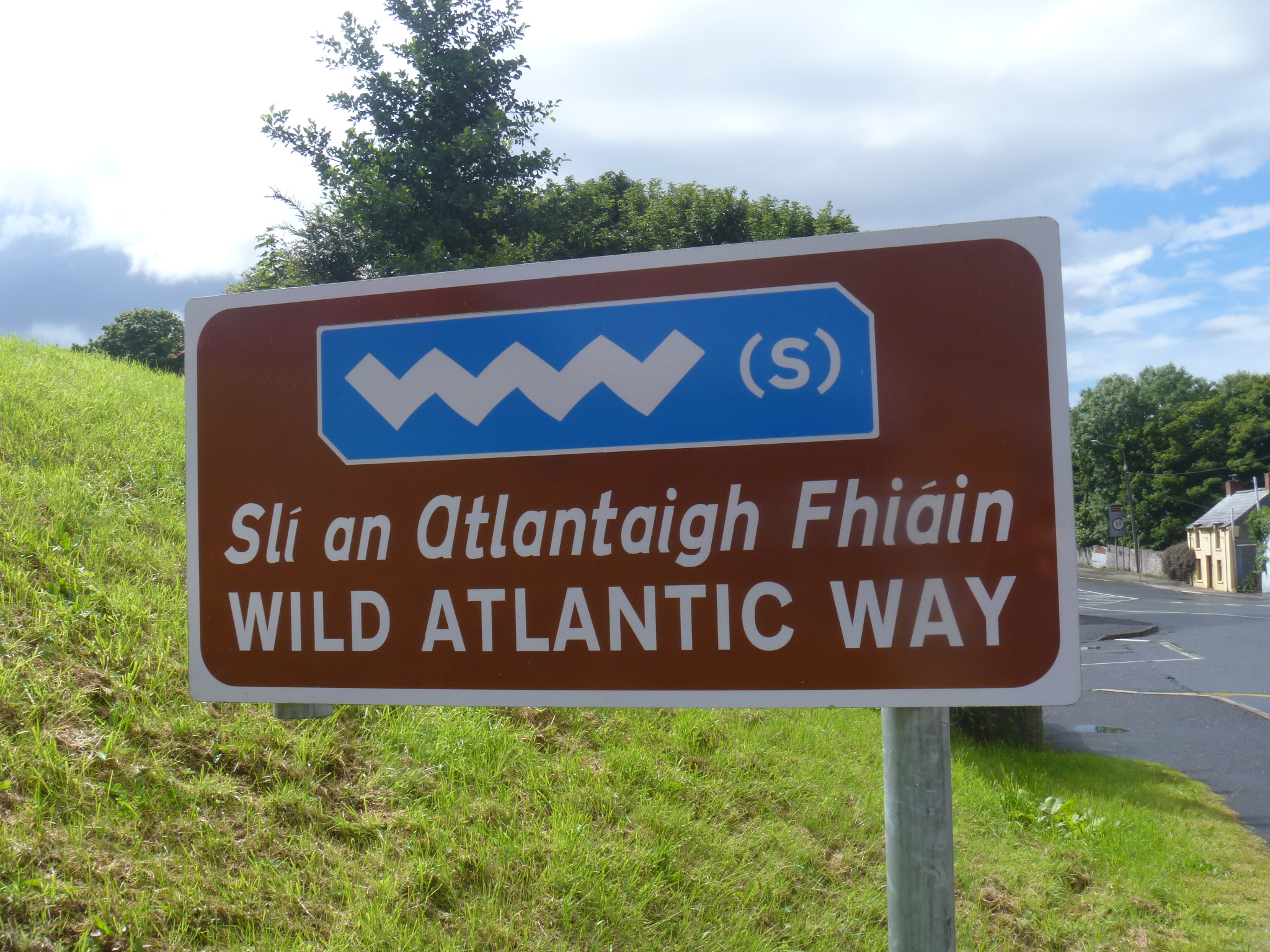
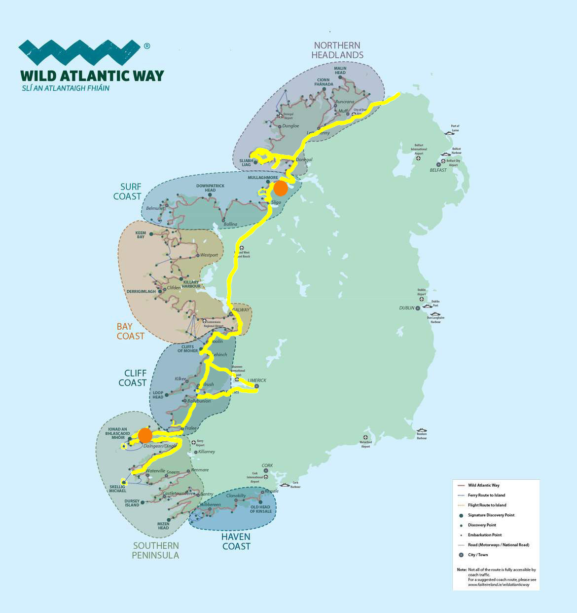
Promoting the tourist potential of the west coast of Ireland is the Wild Atlantic Way, an initiative started in 2014 that marks 2500 km of roads, from Cork on the south to Malin Head, the northern tip of the country. I, for one, am not convinced that the west coast of Ireland needed to be flogged as a destination. It has a substantial reputation already. The Wild Atlantic Way does have a memorable stylized wave logo (vvvv). The route includes many scenic roads like the Slea Head Drive outside Dingle, and Conor Pass.
Along Slea Head Drive
Conor Pass
There are also lots of beaches. Since we love beach combing, we visited every beach on the Dingle Peninsula. Then we started north. This is Fenit Beach, northwest of Tralee.
It’s not all beaches. The arrows pointing down small country roads may encourage visitors to go just a bit further. We decided to find the ruins of Wardtown Castle. I later read that it’s the ruin of one of the first Palladian structures in Ireland.
Wardstown House
Sadly, it burned down and not much is left. It was a good ruin, in any case.We’ve followed the WAW around half of the Ring of Kerry, all around the Dingle Peninsula to Banna Beach in north Kerry. We went to Tarbert, on to Limerick, the Cliffs of Moher, the Burren, and into Galway. We haven’t driven every kilometer of the route, but now we are extending our reach north from Sligo to the Slieve Lieg and beyond. Sometimes we’ve visited an area for one of the sights and been captivated by the scenery instead. That’s what happened at the “Ghost Village of Port”. The ruins are nothing special but the views are wonderful. There is another beach and another cliff around every corner.
We’ve seen birds on land and seabirds on the rocks. We’ve watched ships sailing by, sailboats tacking back and forth. We’re on the lookout for whales, but haven’t seen any yet. (Whale Watch Ireland 2017 is this coming weekend. I hope the whales will come out for it.) We pass ruins everywhere, from a 20th century Coast Guard station to neolithic ring fort and dolmen (tombs).
For anyone traveling with children, there is a Wild Atlantic Way passport you can buy and then get a stamp in the local post office of every participating town. If you get 20 stamps, they will send you a prize. I can imagine kids watching the map like little hawks to avoid missing any stamps. It could be fun.
Here are some things I’ve seen that remind me that nature is amazing all on its own.
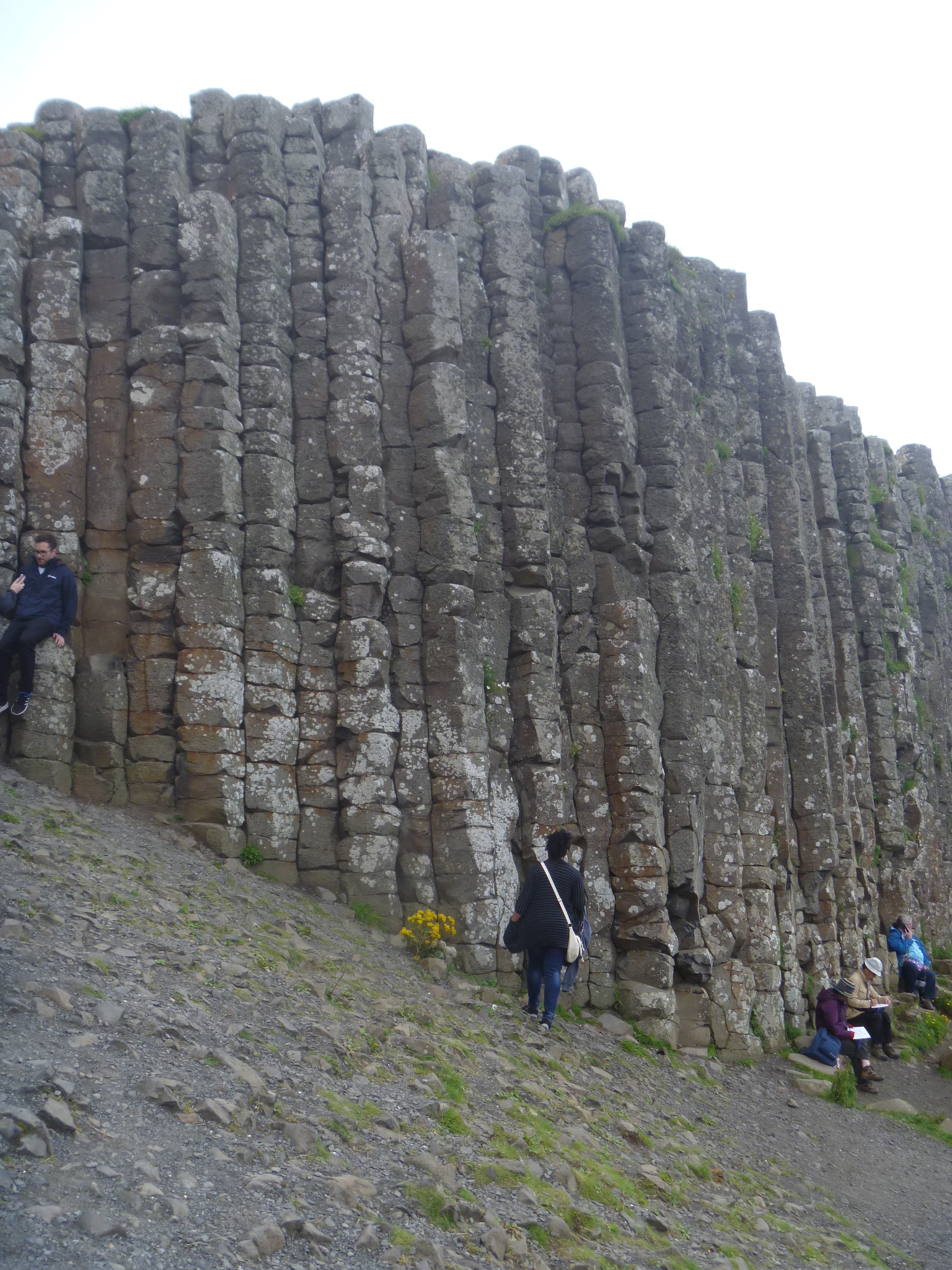
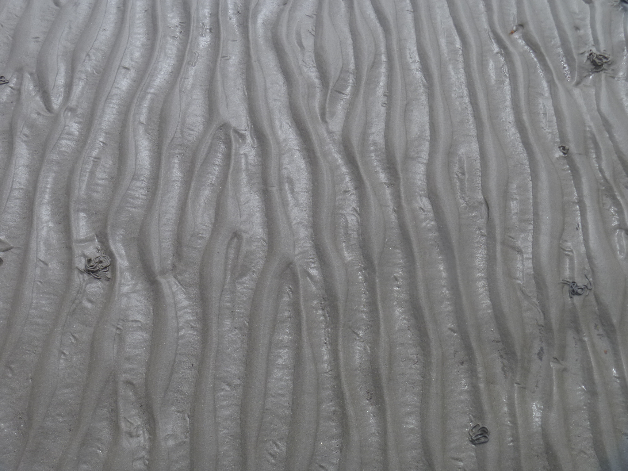
On the left are the vertical columns of basalt at the Giant’s Causeway. On the right are ridges in beach sand.
We visited Giant’s Causeway and the next day went to Dunluce Castle, not far away.
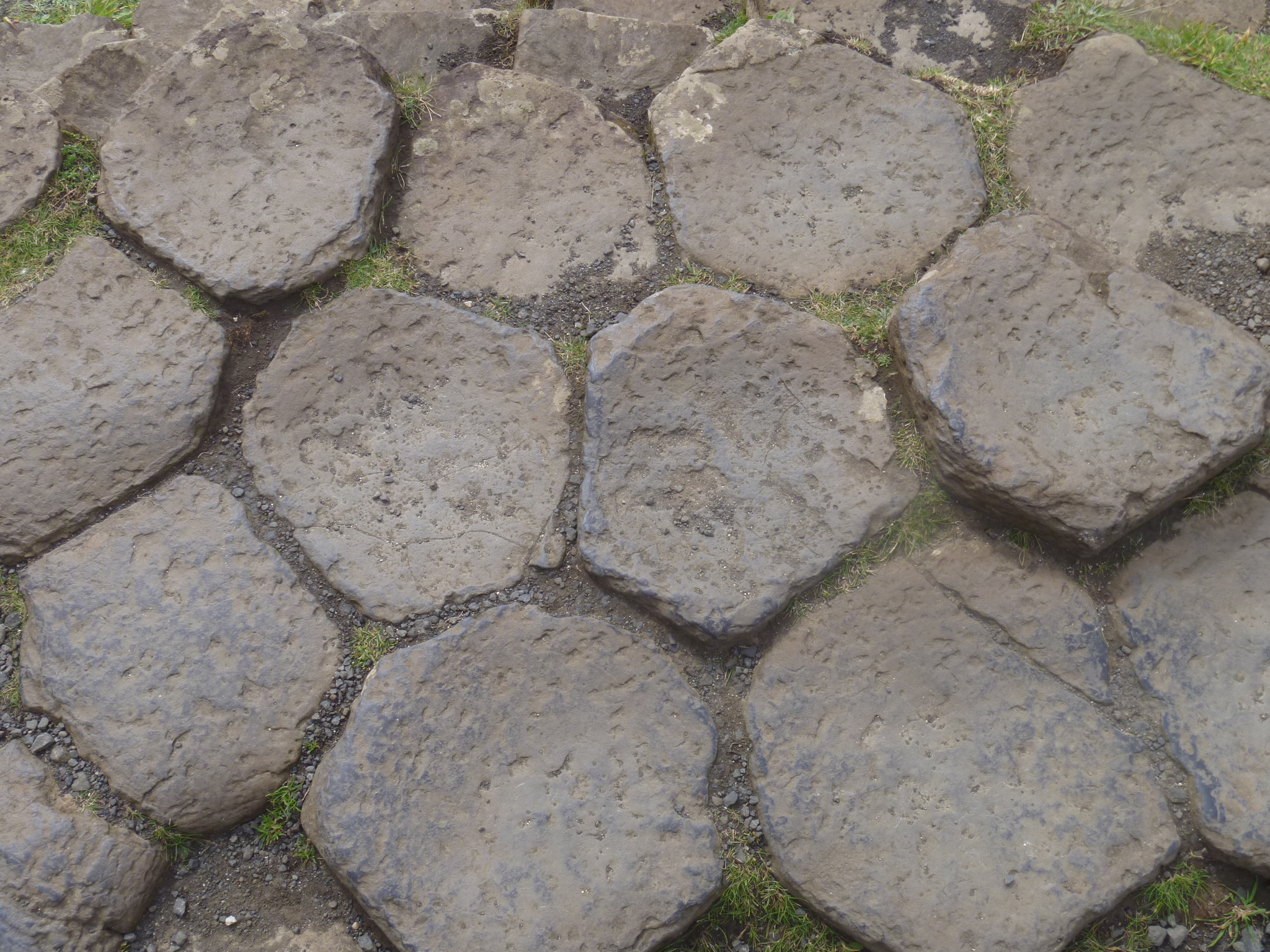
The Giant’s Causeway is made of basalt columns. The tops are visible here. On the right you see a wall at Dunluce Castle made with basalt quarried from Giant’s Causeway. They cut off the tops of the stone columns to use in the wall–the five and six-sided pieces. Notice that the man-made wall isn’t nearly as lovely as the natural formation.
Can you identify the source of these two patterns? They are from land and sea. See below for answer.
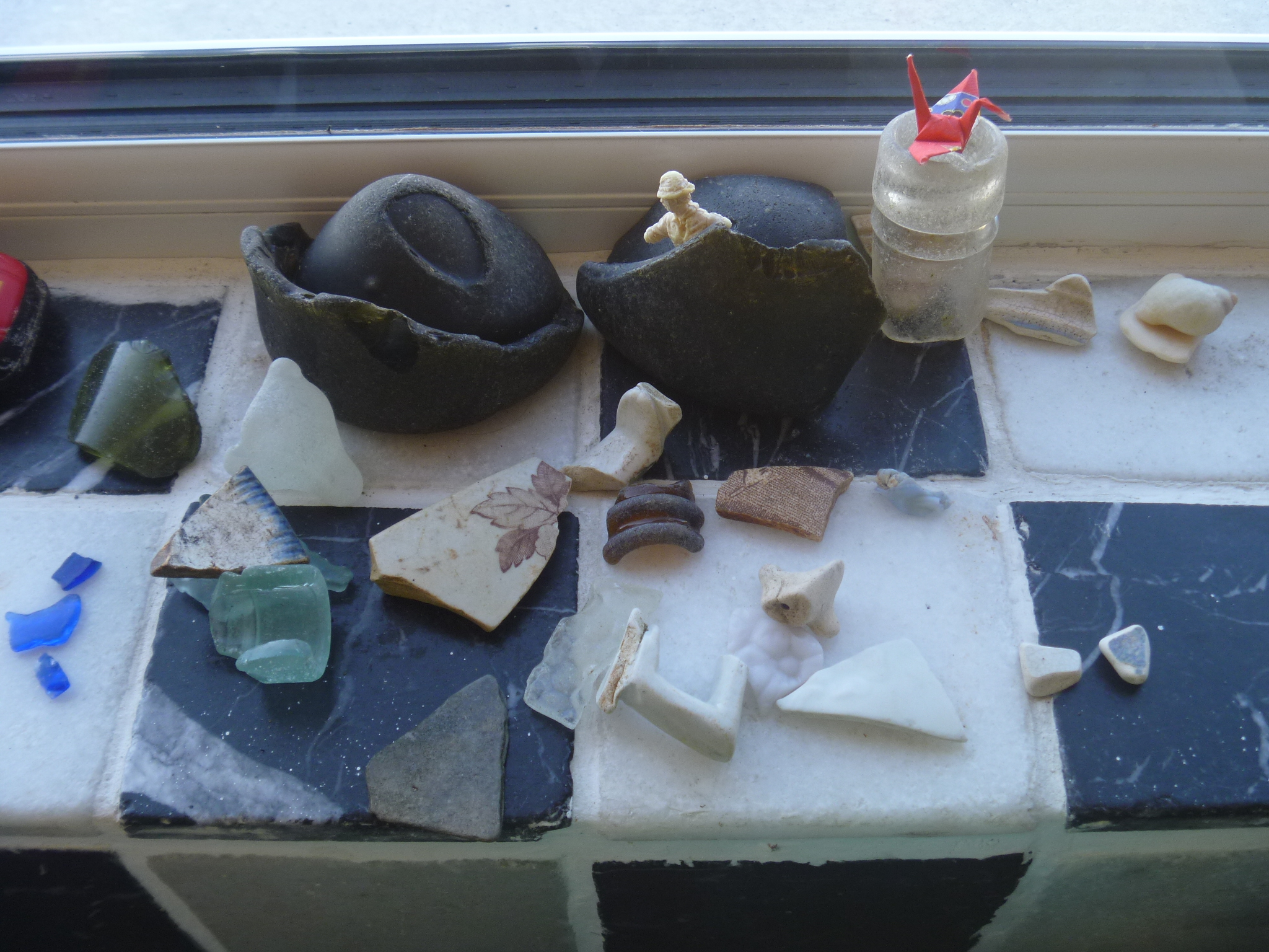
We set out on a loop from Bundoran to Manorhamilton, on to Rosinver, then back to Bundoran. We started with the farmers market in Manorhamilton that turned out to be very, very small. After buying a few things, we went in search of a ring fort and we found a site, but it wasn’t the one we were looking for. Having mostly struck out, we saw a small hand painted sign at the start of the last leg of the drive that said “Scenic Drive” and so we turned that way. The map showed a route between a bog and a lake, possibly a good spot for some birdwatching.The road turned out to be a narrow lane, where the plants brush against both sides of the car. The bog was either on the side of or over the top of the mountain and we were on a hiillside far above the lake, Lough Melvin. The sun was out and the view was gorgeous over blue water and islands, with Bundoran and the sea in the far distance. It could not have been lovelier. We picnicked and looked out over the lake with our binoculars and realized there was NO ONE on the lake from one end to the other. It’s a Friday afternoon of a national holiday weekend (August Bank Holiday) in a popular tourist area and not one single person was on Lough Melvin. We decided to go down to the edge of the Lough. We found a perfect place, a tiny rowboat harbor and boat launch ramp. No one was there, despite the boats. We strolled along the shore and were met by three horses and a pony checking to see whether they knew us. After they trotted off, we walked the edge of the lough, which is pebbly and rocky. You’d need water shoes, but the water is warmer than the ocean. Perhaps with the ocean so near, no one bothers with the Lough except to fish. In the US, there would be a giant development somewhere along the lake. As we walked along the shore, we found fragments of glass and pottery that had been tumbled in the water. It was some of our best beach combing, and there was no beach.
After our long stroll marveling at the absence of people, the bright sunny day, great sights and finds, we headed for home, and saw an animal cross the road. Almost as dark as a black cat but with a weasel head. It may have been a pine marten. Another rarity capping a rare day.
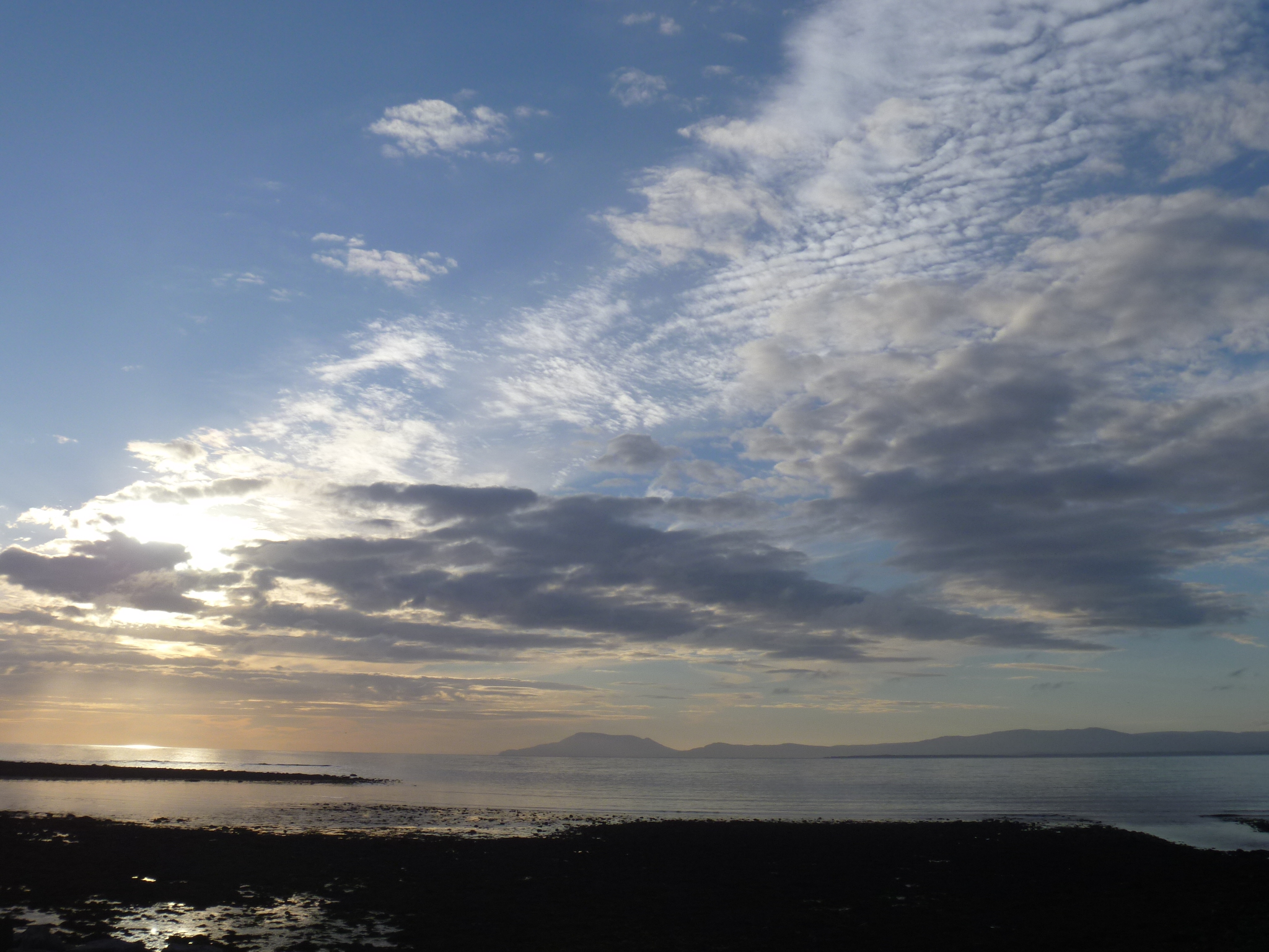
We are settled in Bundoran, north of Sligo. The wow factor here is the sea just over the back wall. It is always there and really wonderful. The sunset and evening sky has been clear our first two nights, a bit different from Dingle where we often had heavy clouds, fog, or rain at night.We are in Tullaghan, a hamlet that has two pubs and a lot of summer/second homes. We had tea with our hosts, who came from Dublin to meet us since we are staying for a full month. They were very kind, left us cookies and cake and all the instructions. Later we met our next door neighbors, Frances and Paul from a town near Belfast, here with their three children for a vacation. They were here last year and are back again.
The house is two stories and has all the mod cons (washer/dryer, dishwasher, microwave) that I missed in Italy. We are comfortable and looking forward to visitors later in the month.
This slideshow requires JavaScript.
We’ve visited a couple of beaches and located the stores. Now we’re ready for adventure.
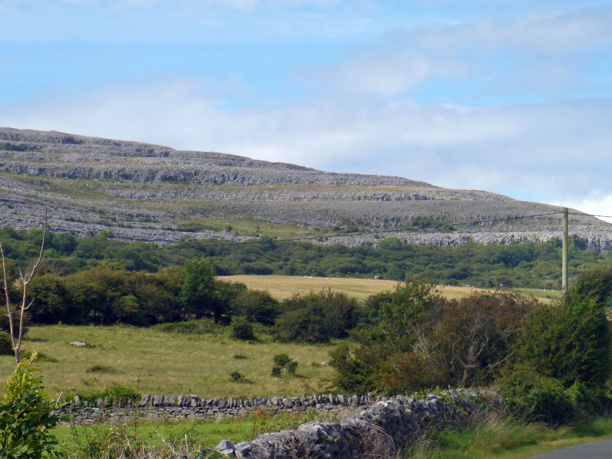
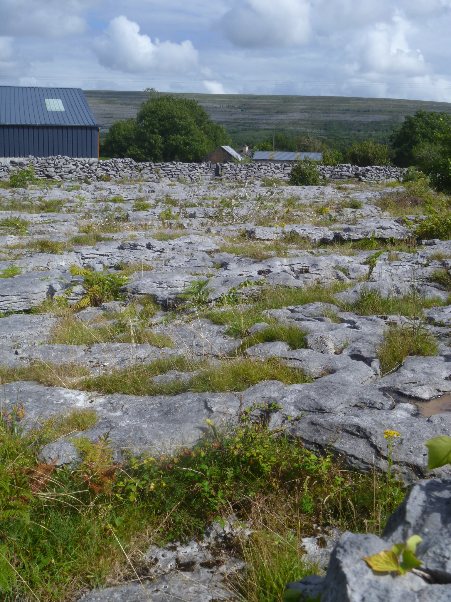
On our way north along the coast of Ireland, we stopped to see the Cliffs of Moher, one of Ireland’s staggering sights. People look tiny standing on the edge of the 390 ft. high escarpment. It was impressive (Look for the tiny, tiny people on the top of the cliff).Before you rush to book your trip, keep in mind that we were there with 20 bus loads and hundreds of cars full of other visitors. The Cliffs of Moher is one of the most popular sights in all of Ireland, with about 1 million visitors per year. That’s more than 2,000 people a day all year long. That’s a lot of people. From the cliffs we headed toward Galway, our overnight stop halfway to Bundoran. The road cuts through an unusual geologic formation called The Burren. From a distance you see gray, stony hillsides. These rocky places are home to unusual plant species of both alpine and mediterranean origin. We stopped to take a photo and when I got out of the car and looked over the nearest stone wall, I was face to face with The Burren. Plates of gray stone cover the ground, with plants growing up through the cracks. I couldn’t imagine why anyone would wall in an area like this. (From Wikipedia):The rolling hills of The Burren are composed of limestone pavements with criss-crossing cracks known as “grikes”, leaving isolated rocks called “clints”.
OK, whatever you say. Grikes and clints. It is a remarkably stony landscape. I have never seen anything like it.
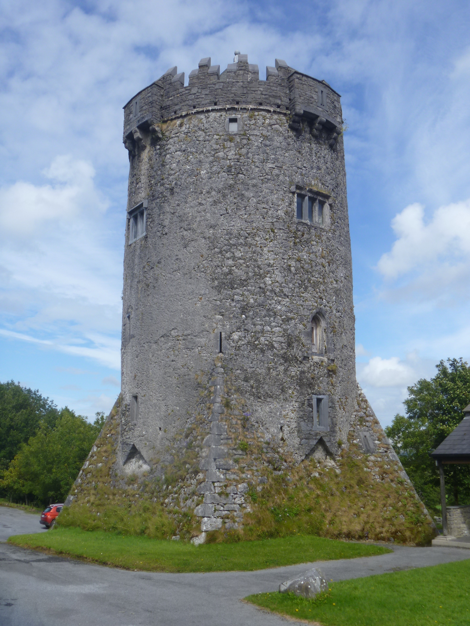
Further on, we passed a castle and found out it is the Burren School of Art. It would be a lovely place to study.
We ended the day with dinner in downtown Galway and a stroll through the pedestrian area. It was very lively as we happened to be in town on the first night of the Galway Races. The horse races were being broadcast on every TV. They ended around 8:30 pm and by the time we finished dinner women and men in their best Race Day clothes were pouring in for an evening on the town.
I have learned a few things about Ireland in our first month here. Most people are friendly and everyone seems glad to be here. People often refer to our surroundings as “god’s own country.” There are many signs of prosperity, even a construction crane in Dingle. Restored houses dot the peninsula, usually with well kept gardens. There are abandoned stone houses, but few abandoned storefronts in town, and no charity shops.
Seals near Cloghane
I’ve learned that life in Ireland can be very different even for people of the same age. I spoke to a young woman cutting hair. She was just back from some months working in Melbourne and plans to return to travel. We talked about what Australia was like and what she saw while she was there. New Zealand was one of her favorite stops along the way. She returned to Dingle when she heard there was a job opening–she has an excellent family grapevine in the area.
I spoke to another woman of about the same age who said she was not from the area. I asked where and she said, “North Kerry.” That means the other side of Tralee, maybe an hour’s drive away. She and her husband moved to Dingle for his job. They have two small children. Her friends and family look at Dingle as terribly remote because of the narrow roads. Tourists singing the praises of Dingle don’t impress her at all. “Why do you live there?” ask her family. She said they don’t see her family much, often three weeks between visits. I couldn’t tell her how close to her family that seems to me, since I see my family twice a year, maybe three times. She would think me heartless.
We’ve walked all the beaches on the Dingle Peninsula that are more than a few meters long.
Coumeenoole Beach
Our beachcombing has been a pleasure and we’ve enjoyed the wind and tides. Though Dingle is very popular as a vacation spot and the town is full of visitors, we often had the beaches to ourselves.
On the right is Coumeenoole beach, where the movie Ryan’s Daughter was filmed. That was in 1970, but apparently people still visit to see the location. Much of the coast is rocky and steep, another reason that in a month we managed to visit all the beaches.
Brandon Point
There are spectacular clifftop walks. We spent a morning at Brandon Point, looking out over the Atlantic. “Next stop, Boston,” joked a hiker we chatted with in the parking area.
Overlooking the sea at Brandon point are abandoned houses that may date back as far as the famines that began in 1841.
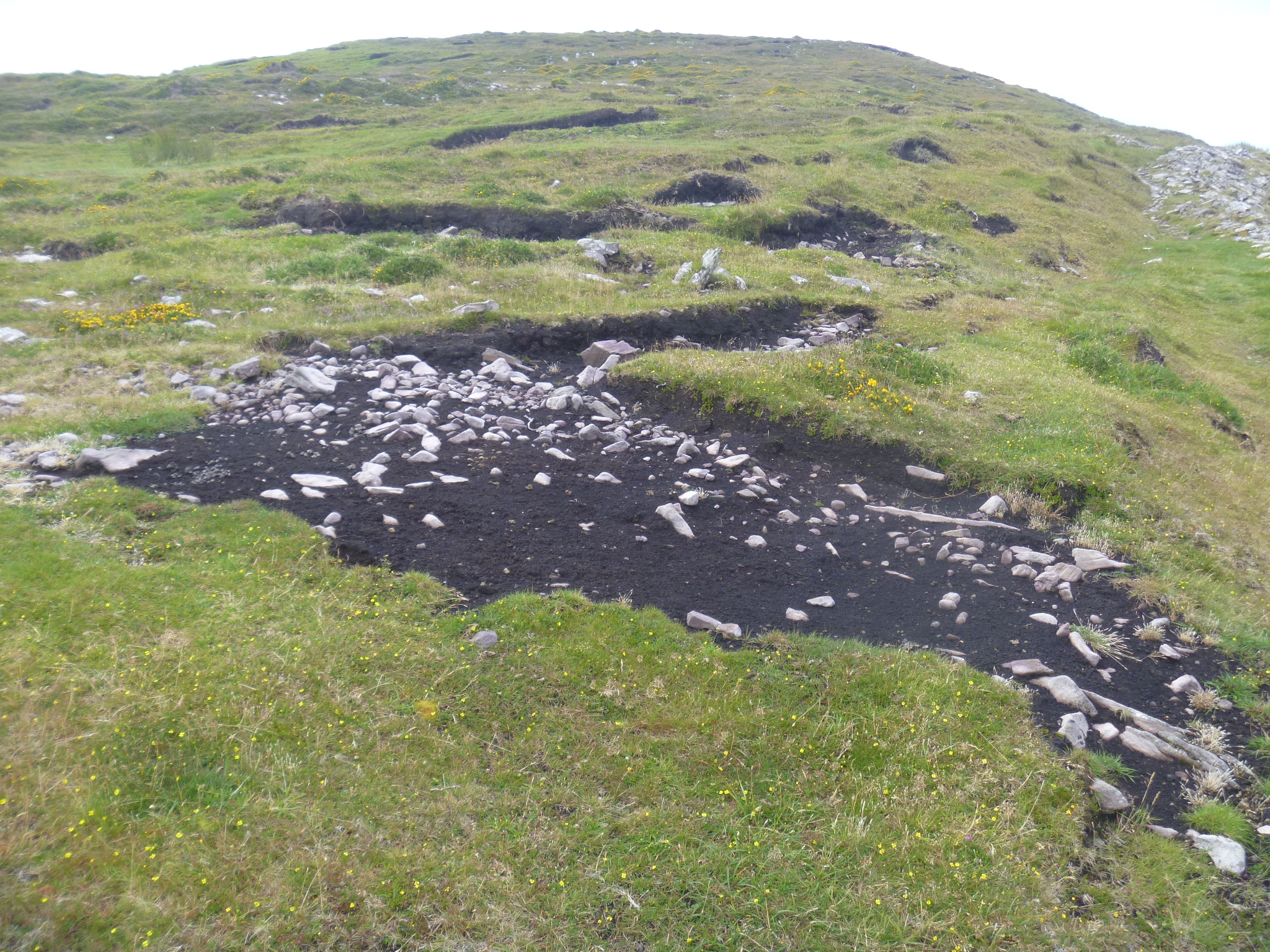
Archaeological sites are thick on the ground. Since everything is built of stone, my colleagues must tear their hair out trying to figure out which comes first. Everything from the Neolithic (8000 yrs ago or so) to the early 20th century is built of the same stone. There weren’t a lot of household goods, so there aren’t a lot of castoffs and broken pieces lying around. The pottery pieces that archaeologists rely upon to tell the age of a settlement are long gone or buried. We visited only a fraction of the 1200 or so archaeological sites on the peninsula, but we have enjoyed the fact that there is often an informational sign on sites even when they are not marked on maps. Many sites are melting into the fields, but how many stone enclosures can a person visit? How many can be restored when they all look alike?On Brandon Point, peat is still cut for fuel. The hillside is scarred from digging and someone had just set aside their tools, a peculiar peat shovel and a fork used to spread the peat blocks to dry.
In addition to the abandoned farmsteads and peat-cutting on Brandon Point, we’ve seen Ogham Stones, early Christian crosses, monastic settlements, beehive huts and many historic houses that collapsed in place after the famines drove people away. When the population of Kerry was over 293,000 in 1841, there were tiny farms everywhere. In 2016 the population of Kerry was 147,500. I have trouble imagining double the present population with no automobiles.
We will miss the lovely view from our living room, yet we are on to another adventure. We head to Bundoran, a summer holiday town on the west coast of Ireland in the north, nearer to Belfast than to Dublin.
Harry Clarke isn’t a name well known outside the world of stained glass, though he should be. An Irish artist who died at age 42 (in 1931), at the time of his death he had completed 40 commissions, including one in Dingle for the convent of the Presentation Sisters. In the 1990s, the order decided to reduce its presence in the region and The Diseart Center of Irish Spirituality and Culture formed to take over the space, including the chapel with 12 individualistic, dramatic stained glass windows of Bible scenes. They are very much worth visiting.
Clarke lived during a period of artistic upheaval. After the Pre-Raphaelites, but during the Celtic revival in Ireland, Art Nouveau in France, Arts & Crafts in the UK, Art Deco, too. He used elements of many styles in his work. Clarke also illustrated works of Edgar Allen Poe and Hans Christian Andersen. Some of his drawings resemble the work of Aubrey Beardsley.
This slideshow requires JavaScript.
One of the features of the windows is the fine-line painting on many of the individual pieces of glass. There are details that make some panels seem like a game of Hidden Pictures. I don’t know whether Clarke ever created any non-religious images, but I would certainly be interested to know what he might have created. He created 9 stained glass panels illustrating a poem by Synge, “Queens”. Originally created for a library in a Dublin area estate, the panels were sold to a private collector in 1996 and their location is no longer known. The price was a record for Harry Clarke’s work. Since most is located in religious structures, it is rarely for sale.
Check the link below to see whether there is any of his work near you.
The Diseart Center, where the stained glass windows you see here are located, offers classes in Irish culture, language and themes related to spirituality.
The boatman made the quip as we left, “Tell them this year summer came on Monday!” That’s because the weather is never forecast to be as fine as it was on our trip out to Great Blasket Island last Monday. The sun shone all day long. The boat ride from Dunquin to Great Blasket was smooth and the 35 passengers smiled and chatted all the way.Great Blasket Island was an independent community lived there from early in the 19th century until Nov. 17, 1953. They were completely Irish speaking, cut off from the mainland as they were. The distance is short, but the water can be rough, and boats were the traditional naomhog, or currach, rowboats framed of wood and covered with tarred cloth.
As the Irish language fell into disuse in the 19th century, linguists and writers discovered the community on Great Blasket and visited to study the language or expand their proficiency. Visitors such as the poet Robin Flower encouraged the islanders to write about their lives and several did just that. The strong tradition of storytelling among people who have to entertain themselves on long winter evenings seems to have eased the transition to writing stories in a book. Best known are: An tOileánach (The Islandman) by Tomás Ó Criomhthain, Peig by Peig Sayers and Fiche Blian ag Fás (Twenty Years A-Growing) by Muiris Ó Súilleabháin. The remains of each author’s house is marked on the visitors map.
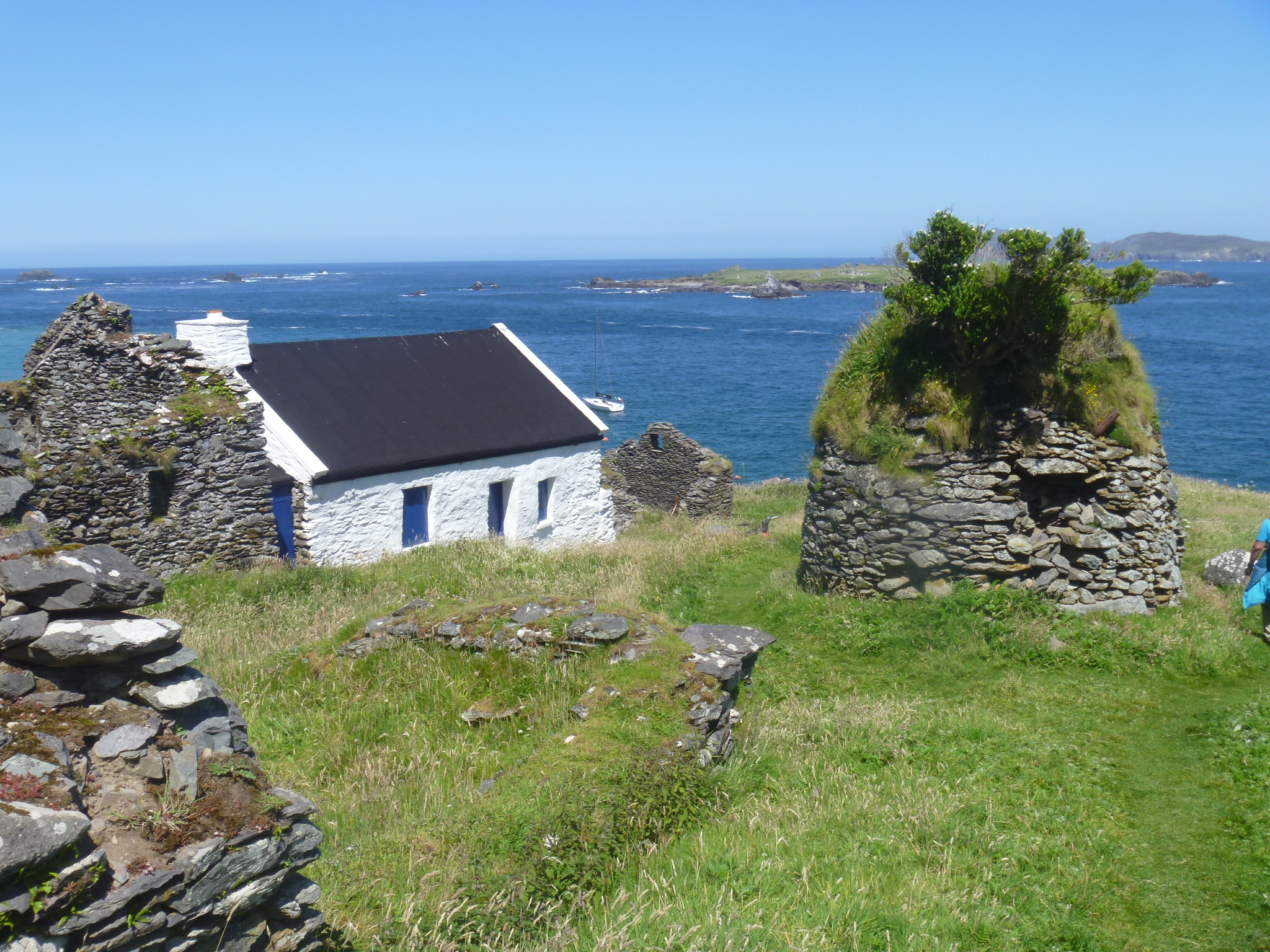
Most houses lie in ruins today, though one was being renovated during our visit. That’s puzzling because there’s only seasonal ferry service, no central water source, no electricity, no store, all part of the reason the island was evacuated years ago. We looked at the ruined community and hiked up the spine of the island. At the peak of the island, I could see the faint outline of the Skellig Islands on the horizon to the south.
Blasket harbor–tiny
At the harbor
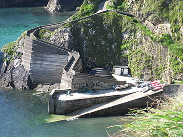
We waited for our trip home just above the tiny boat landing on Blasket. Arriving at Dunquin we struggled up the steep incline from the beach. (This is an internet photo–see the upturned naomhog boats in the lowest bend of the ramp.)
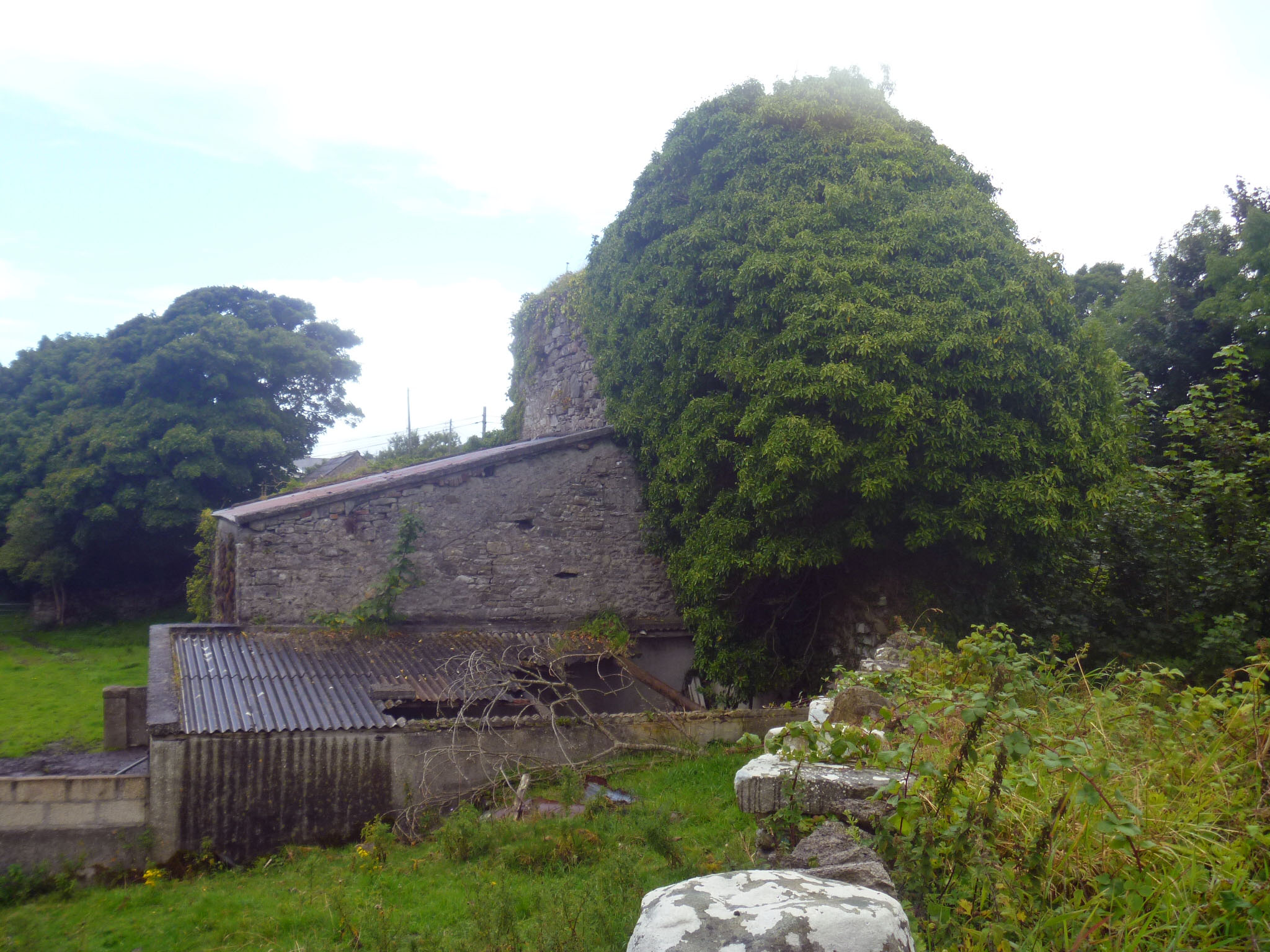 A real highlight was the cemetery that includes ruins of Asseroe Abbey in Ballyshannon.
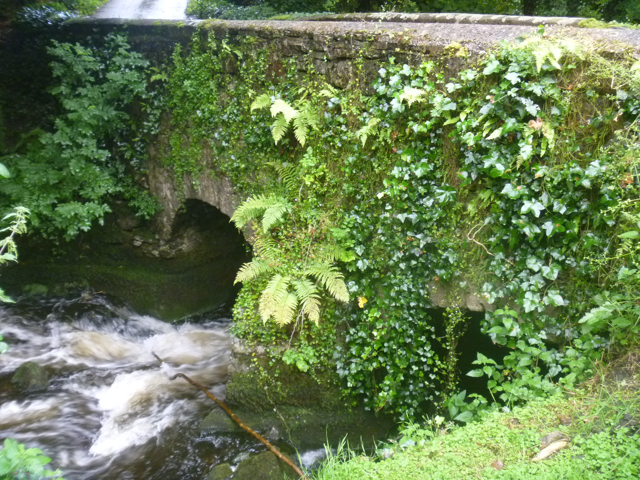 Nearby is a bridge that may be the oldest surviving stone bridge in Ireland. It has three arches and crosses the tiny Assaroe river.
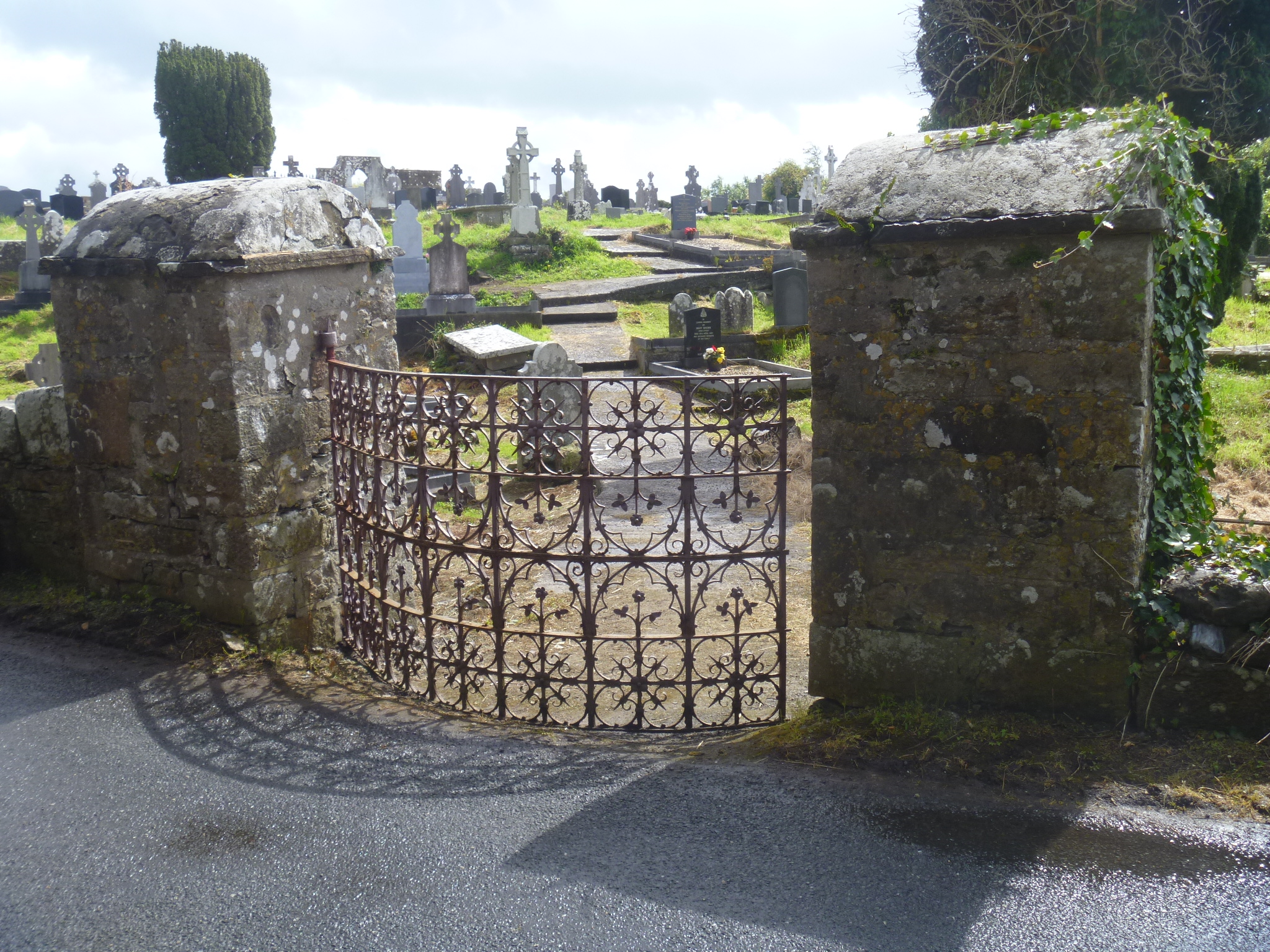
 There is a stile that includes a fragment of trim from around an arched doorway. It’s the lowest stone in the group.
 The headstone below has been reused by a later individual. You can see the elaborate carving on the upper portion, but the lower portion has been chiseled off. It was probably a dedication to a different person. It might even have begun, “Here lies…..”
 Some pieces have broken and no one seems to know what to do with them.
 There are pieces of ironwork that are merging with the stones they used to mark.
 Benbulben is a striking feature on the Donegal landscape, or is it Sligo, or Leitrim? County boundaries are close together here and this mountain plateau can be seen for many miles. We followed the Benbulben Forest Walk to skirt the edge of the mountain, admiring the velvety moss green drape of its slopes.