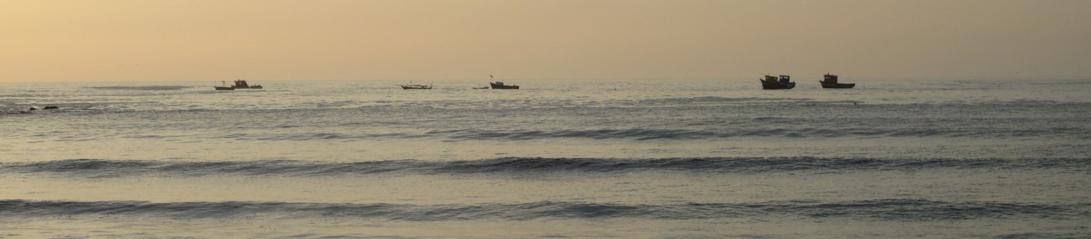
Today was a landmark day, finding us back on an international flight to Peru. It’s been 20 months since we were last in Peru, and when we left, we planned to return in early November, 2020, just over a year ago. Since then, we’ve lived in different levels of quarantine for the pandemic, gotten vaccinated, and then booster shots. To prepare for this flight, we also got Covid tests, though they are not required. Good thing, too, because our results are still not back, and our flight to Peru takes off in less than two hours. We also filled out a health affidavit for the Peruvian immigration authorities that took each of us about five tries to complete, save, email to phone, and make screen shot. (Now it’s done, and we’re checked in for our flight.)
Since we were last in South America, I turned 70 (how did that happen!?) and somehow all our aches and pains have gotten slightly worse. Our seats on the plane are a bit less padded, our stamina has decreased a little bit, and a full day of travel seems even more tiring than it used to. We face an uncomfortable question. Should we keep up our life of travel, or is it time to ease up? This is entirely our choice. We can still afford to travel, and we have always worked our various medical appointments into our plans. I still see an eye specialist every month, no matter where we are. Jonathan saw a bunch of doctors while we were in the US to track down the source of a nagging cough. He can continue with that when we are in the US, though most doctors would prefer to have him around for a test, a few weeks, a consult, a few weeks, another test, another consult. This gets frustrating for us, as there seems to be an open-ended procession of things to do and we’d like to set a departure date.
For now, we are back on the road, weighing whether to spend the next travel season of March through October visiting Europe as we had planned, or whether we might do better to spend those months testing places we might want to settle in the US. We can rent for a month, or three months, or even a year, but we will have to move again at the end of each stay.
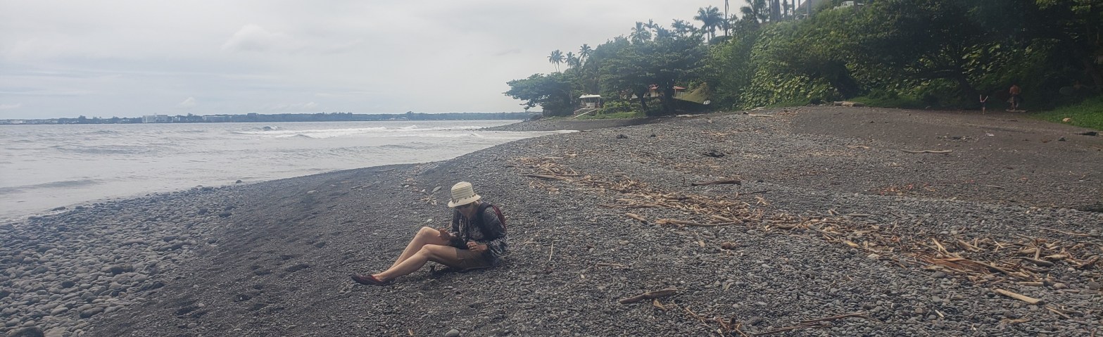
Last year, during our extended visit in California, we thought perhaps we’d look for a longer-term place to rent near Monterey. It’s beautiful, there are lots of trails to hike and ocean shore to walk. By the end of our stay, though, we realized that California is going to be short of both water and housing for the foreseeable future. Is that our best choice? Before we settle for living in a man-made environmental disaster, we’d like to try a few other places, starting on the east coast of the US. We haven’t given up on our desire to be near the ocean. We will spend many of our afternoons in Peru walking down the length of our beach and back, trying to sort our priorities. I’ll keep you posted.
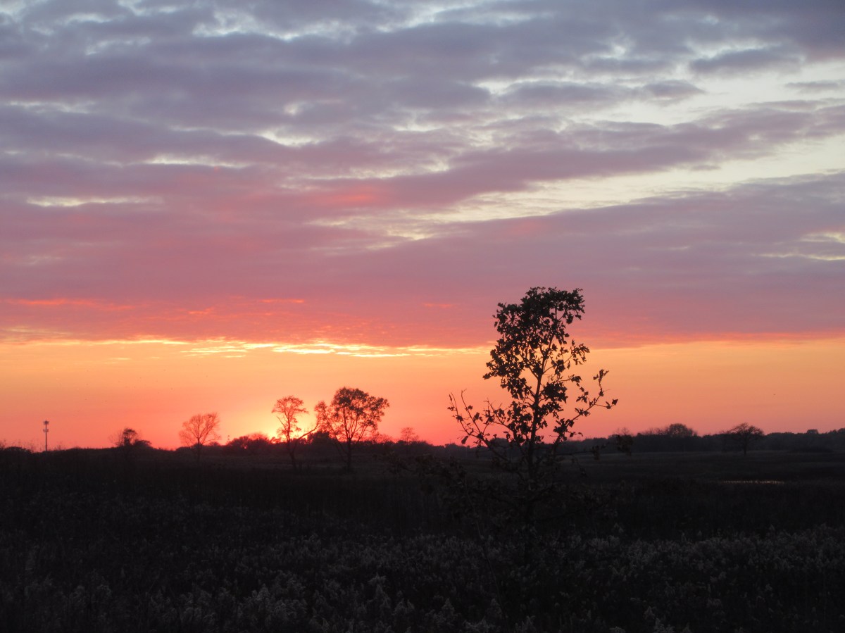
There were a few beautiful days at the beginning of November when every day’s walk was gorgeous. Springbrook, Herrick Lake, and Greene Valley forest preserves have been our regular stops. Whether it’s midday or sunset, we always find something beautiful or interesting or both. We saw a bald eagle at Greene Valley, then chatted with a woman who said the eagles have been regular visitors for some time.
We go out almost every day, though I tend not to take pictures on the cloudy days. On one beautiful day we went into Chicago to see The Magic Flute at the Lyric Opera, and spent ten minutes on the bridge over the Chicago River watching a tall building under construction. A construction crane was perched about 20 stories up in the air on the central shaft of the structure. Its huge boom picked up a rectangular piece as big as a shipping container and v-e-r-y slowly swung it around the building, then brought it to the side under construction, where it gradually disappeared into the framework. Everything about it was remarkable. How did they get the crane up that high? What will they do with it after construction is complete. How do they get the huge piece into place and release it? Modern construction is an amazing process. The city is a forest of concrete and steel with its own wonders to observe.
Goldfinch
It turned cold, I got my warm coat out of the storage unit and began wearing my heaviest shoes. We haven’t been seeing many birds lately. All the species that migrate south have taken off for warmer places. We still see the hardy locals: robins, cardinals, sparrows, chickadees, goldfinch, bluejay. As many of these pass through our yard as visit us on our bird walks.
Kingfisher
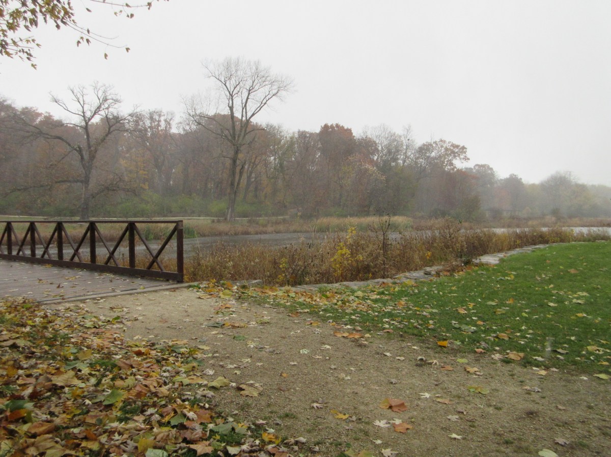
We took a last stroll at Churchill Woods in Lombard, where we’ve seen many different birds on previous visits, and it began to sleet as we got to the far end of the path. We stood in the shelter of the trees and bushes for a few minutes, watching waves of sleet blowing along the surface of the river. We saw a pair of large owls fly to a tree on the edge of the woods, then swoop into the forest. Walking back along the river, a kingfisher perched by the river, vivid against the branches. The sleet let up long enough for us to play pooh sticks on the bridge, spot a woodpecker, and finish our walk.
As much as I enjoy our walks in the woods, and as much as we have appreciated the many parks and forest preserves in this area, I am ready to fly south for the winter.
[The photo at the top of this post shows branches of a black walnut tree that has dropped its leaves but not all its walnuts.]
My title is from a poem I had to memorize in grade school, and it still comes into my mind almost every year when the light slants sharply in the late afternoon, and the trees change color. The month of October sped by. It’s always a month of transition, when we return to the US from our travels, visit family and friends, see a few doctors, and head to Peru for the winter.
Veterans Memorial Park, Naperville
Our plans often change during this period, and this year was no different. Initially, Jonathan was heading to Peru just a few days after we arrived in Chicago, and I planned to follow three weeks later. As it turned out, we have both been in Chicago for six weeks, changing our flights to mid-November. We planned to visit our daughter Lillian and her husband Neil on our first weekend back. It is always fun to see the improvements in their house in Champaign, and to taste Lillian’s cooking with Neil’s delicious home-brewed beer. Rather than that being our only visit this month, the silver lining in our extended visit has been the opportunity to see friends in and outside the Chicago area, and take some walks through the trees as they change color.
I took a swing around the eastern US, with a stop in Asheville, NC, where the trees were just changing, the farmers market was full of pumpkins, and the mountains are always beautiful.
From there, I went east to Syracuse, where I visited my mother (She turns 97 in Feb.). We ran errands, visited the cemetery, and decorated for Halloween. We were able to visit my brother Tim and his wife Margie at their home on Otisco Lake, a beautiful spot. I took a few walks around the property of The Nottingham, where mom lives, and found some lovely places. I made a short exploration into the Westcott neighborhood near Syracuse University in search of a resale shop and found an area full of wall murals and interesting shops. I’d like to go back when I have more time. In the evenings, I chatted with Sharon, friend of my sister Catherine, who put me up sight-unseen! We had a good time swapping stories. Ordinarily, I stay with mom, but that isn’t allowed in these times of Covid. It’s a good break to have to leave the Nottingham at night, and on my last night, Tim, Margie, Sharon, mom, and I went out to dinner together. It was an excellent visit.
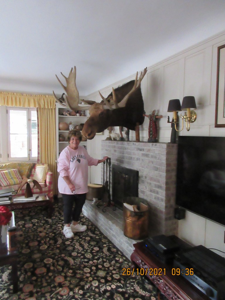
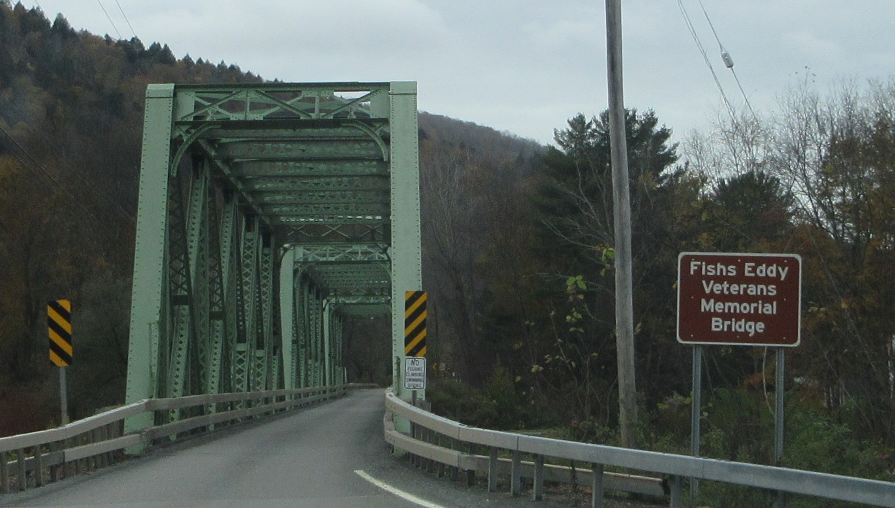
The month wasn’t over yet. From Syracuse, I drove through a downpour to Nyack to visit archaeology friends. The rain didn’t bother me particularly, as traffic was light and the roads were not flooded. I got to see the Adirondacks full of rushing streams. Dave and Lori live in a wonderful old house, carefully restored by Dave over the years, and full of remarkable things they’ve collected. I turned to look into a sitting room and burst out laughing. “I haven’t seen a stuffed head that big since Hemingway’s house in Cuba!,” I choked out. Lori assures me that the moose died a natural death (really). I think it’s almost as tall as she is.
We had a spin around Nyack to look at historic houses, and incidentally, Halloweeen displays. It is a beautiful community, and the views out over the Hudson are spectacular. From nearby, we could see the new Tappan Zee Bridge, a long span across the river, stretching away into the distance.
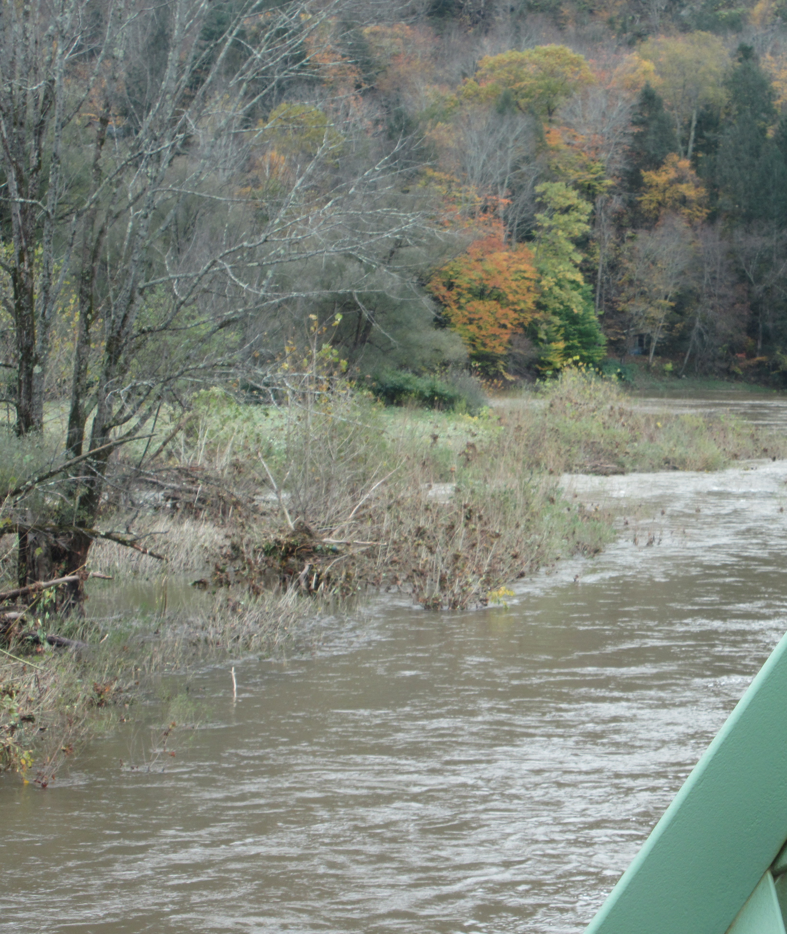
I drove back the way I came, ogling the flooding of low-lying stream banks and flood plains, glad that the rain had stopped. The rain muted the colors of the changing leaves, and many were knocked down by the rain, but the drive through the hills is lovely, and a weekday drive through this region is pretty quiet.
I arrived back in the Chicago area in time to spend Halloween with our friend Peggy, who put on the lights in her front garden at dusk. A parade of trick-or-treaters stopped by, and we helped hand out treats. And so, as quick as a snap of the fingers, there went October.
I have written more about Hawaii than any place we’ve visited in quite a while. Part of the reason is because we had visitors (after a year!) and went to see many different things. It also turns out that I like the Big Island very much. The weather was perfect, 75 degrees F with breeze every day, morning and night. We had one day when it rained most of the day, and the rest of the time the weather was lovely. We had far fewer bugs than we expected from a tropical climate, too.
We left Hawaii after a month of exploring, and yet there are still many, many places that we haven’t visited. Keep in mind that our idea of a good time includes visiting every place along the shore that has a name, even if it turns out to be the edge of a cliff. We also like to drive to the end of every road and walk to the end of the trail from there. Not everyone would enjoy this, but we do.
We saw the rare Palila on the slopes of Mauna Kea (photo: Restore Mauna Kea dlnr.hawaii.gov)
We did some bird watching, and even saw a couple of the rarer birds on the island. This pleased us no end, but so did seeing escaped cage birds here and there (colorful finches, parrots).
(L) My photo of an I’iwi–great view of its tail feathers! (R) Internet photo of an I’iwi
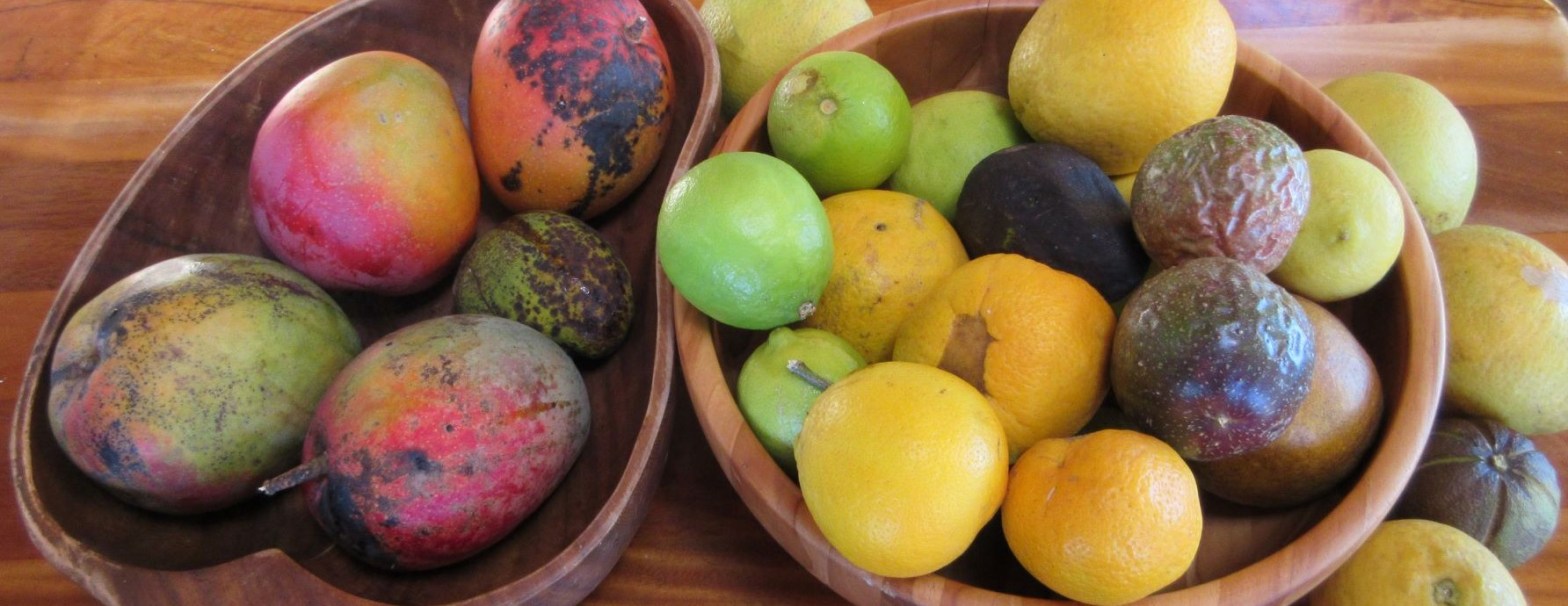
One last treat we tried, malasadas, came via Amanda, from a friend who has spent a lot of time here. Every day, two women arrive at the same pullout along the highway with a tiny blue house on a trailer. They heat up their fryers inside and open their window around 11 am. Every malasada (donut) is made to order. We tried malasadas filled with peanut butter, lillikoi (passion fruit), haupia (coconut pudding), pineapple, and mango, and one plain malasada rolled in Japanese powdered umeboshi (dried salted plum). “Malasada” in Spanish means “badly roasted.” I don’t know exactly how you get to donuts from that, though I read that it’s based on the contrast between their crisp exterior and soft interior.
I chatted with a man while we both waited for our malasadas. He and his wife were in Hawaii for their 20-somethingth visit, spending two weeks in several places, for a total of six or eight weeks, and he always comes for malasadas.
While we waited, we watched a young man opening drinking coconuts. He could balance the coconut and whack off a chunk at the same time, managing not to injure himself or spill the coconut.
We liked our malasadas well enough, but they are, after all, donuts. If that’s your thing, you’ll love them.
Considering the range of our activities on Hawaii, no matter what you like to do, you’ll find a bit of it here.
Hawaii is known for beach vacations, surfing, leis, and mai-tais. There is a lot of interesting history here, too, and we had a chance to explore some of it during our visit.
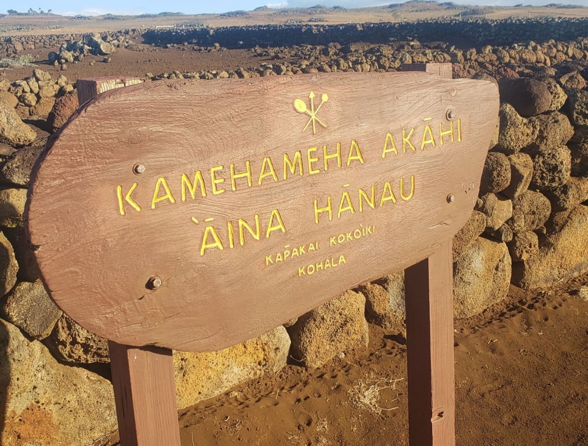
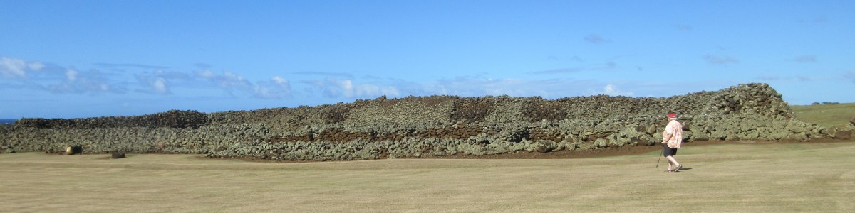
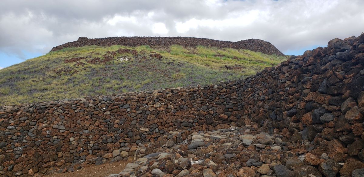
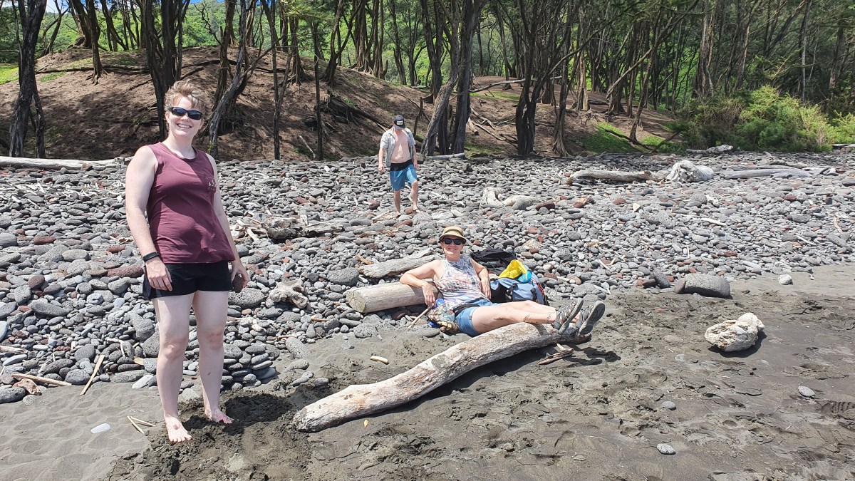
We started just down the hill from our house, at the birthplace of King Kamehameha (Kamehameha l or the Great). It’s the banner photo for this post. We didn’t realize how close it was at first, because the access road to visit the site is a lumpy 4WD track that parallels the runway of the tiny Opolu Airport and then runs along the shore until it ends near the site. What remains of Kamehameha’s birthplace are low walls of lava that outline a large compound with a few generous sized interior rooms that was the family home, originally finished with thatched roofs. There would have been easy access for fishing from the shore or boats, even chances to go surfing.
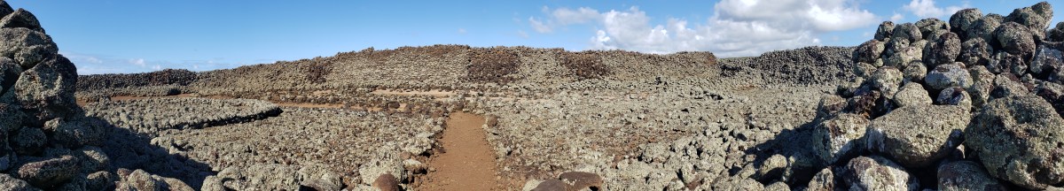
Very near by is the Mo’okini heiau (hey-ow), a ceremonial center that was the focus of large gatherings and offerings. There are many heiau around Hawaii, ranging in size from a single large rock on a stone platform, to huge enclosures. Mo’okini is distinctive as one of the oldest and largest heiau on Hawaii. It was also a luakini heiau, a place used for animal and human sacrifice. An associated tale recounts that the heiau was built of stone passed hand to hand across eleven miles from the source to the Mo’okini site. The structure is an enormous rectangle made of stacked dry stone that is roughly 250 ft x 120 ft in size. The walls are ten feet thick at the base.
Exterior of Mo’okini heiauEntering the Mo’okini heaiu
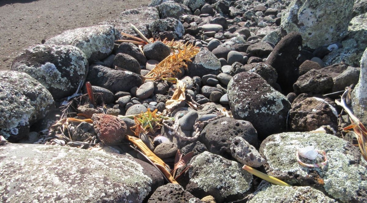
It is still possible to walk into the Mo’okini enclosure and get a sense of how imposing it would have been to participate in a ceremony there. Some visitors leave offerings of flowers, fruit, braided leaves, rocks, crystals, and shells.
The story goes that due to intergroup conflicts, Kamehameha was moved from his childhood home to a more remote location in the Waipio Valley and grew up there, safe from family enemies. Captain Cook arrived just as the future King Kamehameha I was building his chiefdom, and provided examples of European warfare. Kamehameha hired European advisers, and began to use cannons, guns, and even had a 40 ton ship of his own built in Honolulu in 1796. Battles were fought among chiefs on Hawaii and after defeating his rivals to become King, Kamehameha I expanded his ambitions to the other islands, succeeding in uniting all of the Hawaiian Islands by 1804. This historic first made Hawaii a political power, as it was an important way station for whaling ships during the first half of the 19th century, and a port for trading ships heading from Asia to the west coast of North and South America.
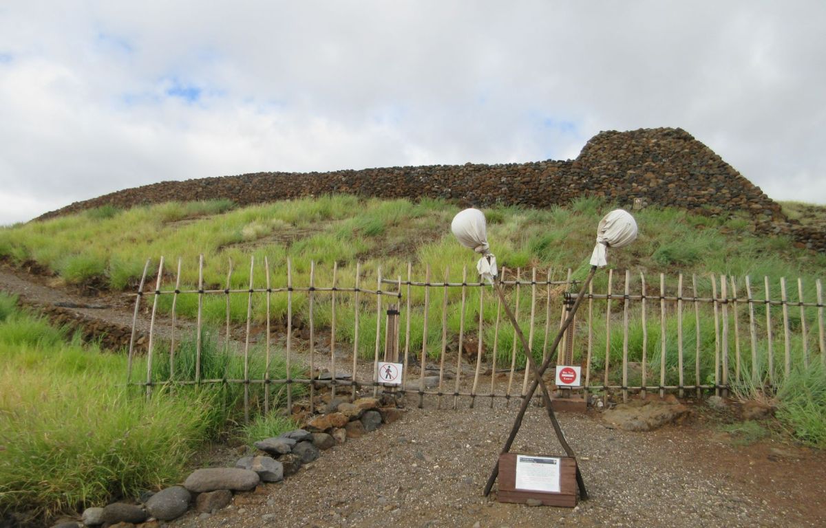
Pu’ukohola Heiau National Historic Site
Kamehameha didn’t turn his back on tradition, using Mo’okini and also constructing another very large heiau at Pu’ukohola that was the site of battles as well as offerings. Though we were able to enter the Mo’okini heiau, Pu’ukohola was closed to visitors. There is a tall rack just down the hill from the entrance that is intended to hold offerings. As at Mo’okini, there were flowers and braids of greenery resting on the offering stand. Below Pu’ukohola is Mailekini heiau, a somewhat older structure that was turned into a fort by Kamehameha, lined with cannons that he purchased from traders when he realized that European armament was the way to stay dominant over the islands.
Pu’ukohola heiau on the hilltop, viewed from Mailekini heiau, near the shore
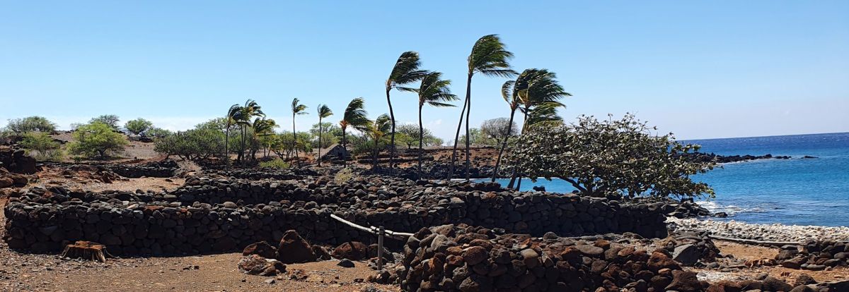
It may look like all of Hawaii is covered in heiau, but there were many villages along the shore. Land was allotted in narrow strips (ahupua’a) from the coast far up onto the sides of the volcanoes to give each family group a bit of each kind of land and the resources of each area, like fishing territory along the coast, farmland, forest for wood and thatch, areas with lava rock for construction, or fine grained stone and obsidian for tools. We visited the Lapakahi State Historic Park to see a village site. This area was occupied until about 1920 when the water table dropped so low they ran out of water.
A village of stone houses, now lacking their thatch roofs, with one fully reconstructed house in the distance. Lapakahi State Historic Park
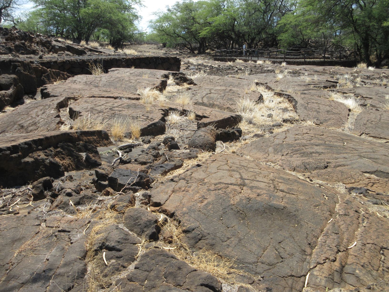
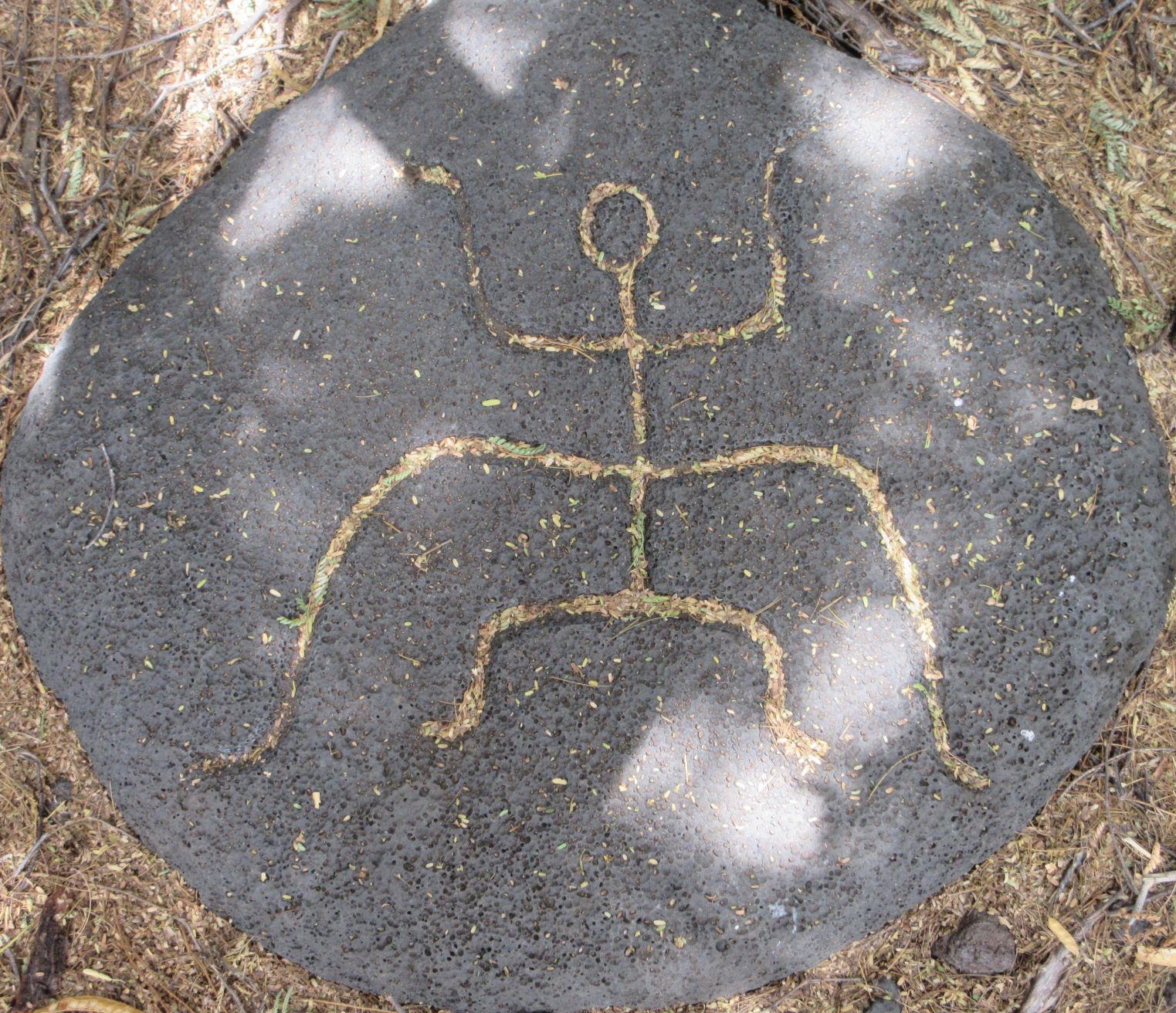
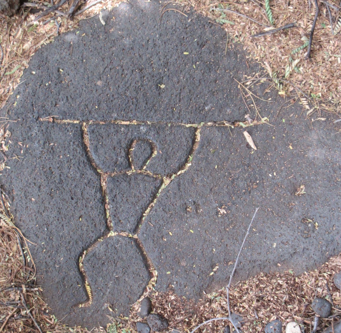
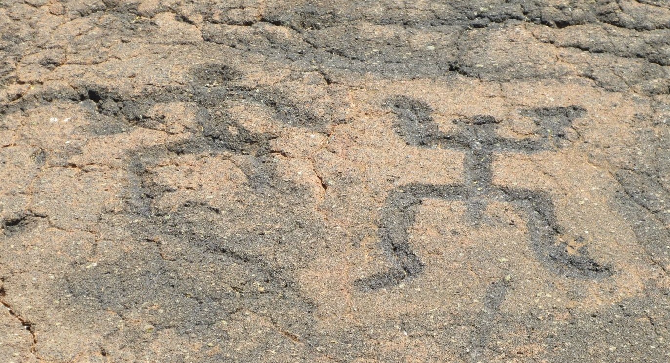
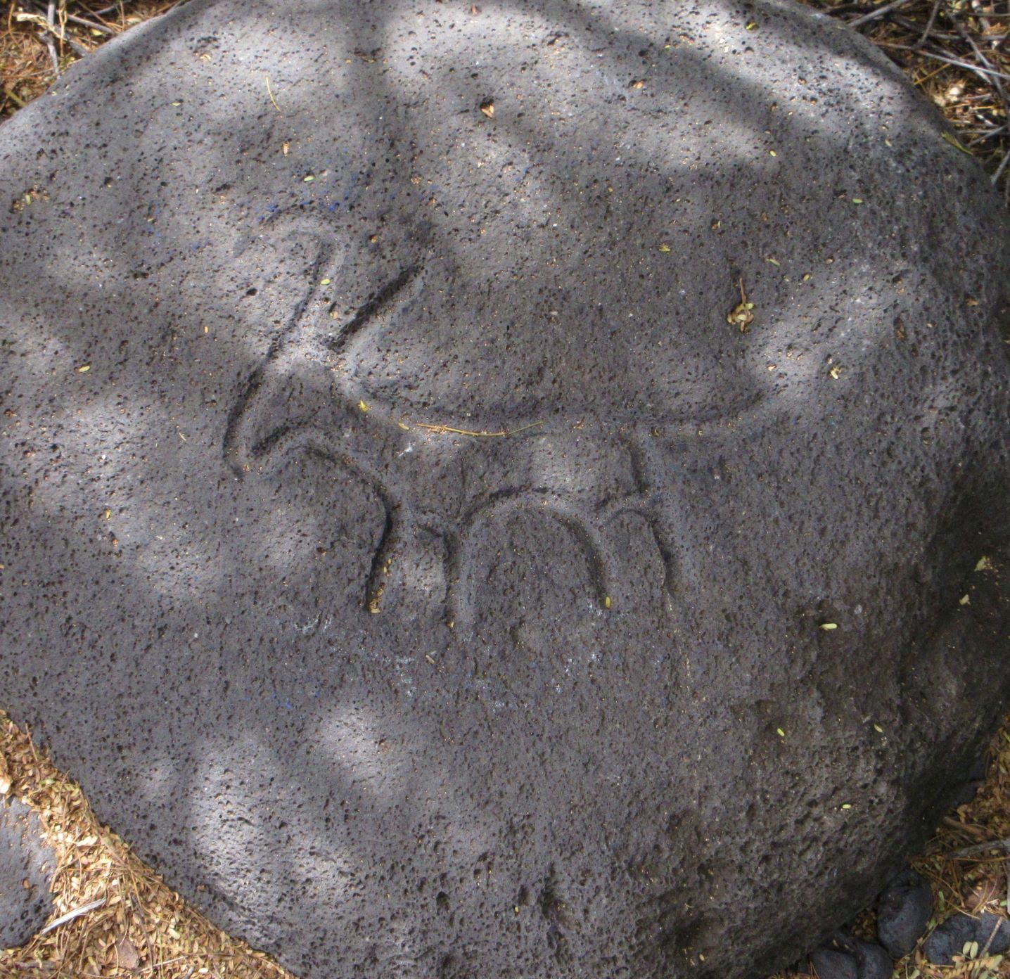
In addition to the fortress-like heiau, and coastal villages, Hawaii has a number of places where people went to create petroglyphs, pecking and scratching shapes onto relatively flat surfaces of lava. We visited the Puako petroglyphs, an extensive area of shapes that are both familiar (men, women) and also abstract.
Puako Petroglyphs
No one is sure why these images were created, and petroglyphs are found in a number of different places around the island of Hawaii and on the other islands. Whatever the purpose, they are very durable, and great food for thought on a walk. It can be hot out on the fields of lava, and there’s lots of advice to take water with you. It’s an interesting walk through the trees to the site, and the variety of shapes is intriguing. It’s impossible to tell how long ago each of these was made.
From long before the days of King Kamehameha right up to the present, Hawaii has a rich history, unique to these islands, that is worth thinking about. People lived in an area so far from where their ancestors started out that they created new stories to describe their origins. They constructed a way of life that served them well for a long time, and many of their descendants are still part of today’s Hawaii.
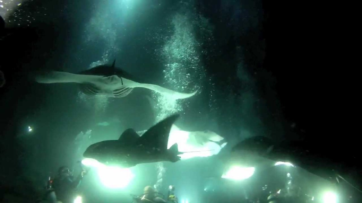
I’ve talked about beaches and snorkeling, the volcano, the botanical garden, and other activities we enjoyed. We owe some of the fun to the suggestions and planning by our visitors. Lyra’s research found Kona Style, a company that offers a sunset boat ride followed by watching manta rays feed in the dark.
The opening photo is sunset at the start of our boat ride. Above is just after sunset and before dark as we were arriving at Manta Bay.
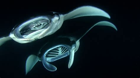
Manta Rays (Internet photo)
We met at the company’s base in Kona, where we were entertained by the young man supervising check-in. He told interesting stories about Kona and the manta rays, explaining that in one particular bay where manta rays are known to feed, tour operators are allowed to shine lights into the water to attract plankton that in turn attract the rays. Manta rays are mature when they are 9-12 feet across, and weigh 800-1500 lbs. (The very largest are over 23 feet across and weigh over 2500 lb.) Overfishing is the greatest threat to the survival of these giant creatures. In recent years, the financial benefit of tourism has been recognized as greater than the benefit of killing mantas
We were a good example of manta ray tourism. Once onboard the boat at around 5:45 pm, we enjoyed the sunset on the ride to Manta Bay (30-40 minutes). Mai-tais and beer were available, and music played. It was a festive atmosphere. We arrived at the mooring just as it became dark. One particular feature of this tour is that Kona Style’s catamaran has an ingenious set of stairs that make it easy to get into the water, valuable for those of us in the creakier age bracket.
Snorkeling in the dark. There are a lot of boats, a lot of people, and a number of weird-looking manta rays. These are internet photos of the exact kind of tour we were on. The experience looks just like this.
There were other boats around and we could hear the shrieks of other visitors as manta rays drifted into their lighted area and swooped upside down, flashing their white bellies as they scooped up plankton. Mantas are filter feeders and have a large central opening where they collect plankton from the water. It gives them a menacing look, but they are not interested in people. We were warned not to let any object dangle from a wrist. Should a strap get hooked on a manta’s mouth, they would pull it (and the attached person!) until the strap broke. Yikes!
After almost an hour in the water floating from the handrail around a block of lights, we’d seen a half dozen mantas, needle fish, and a few gurnard that looked like tiny wind-up toys. We’d also had a look at some of the larger pieces of plankton, tiny wiggly underwater creatures. I was content to go back on the boat. My arms were tired from holding them over my head on the rail and looking down at the sea creatures.
I wore my own wetsuit under the wetsuit jackets handed out on board, I was just starting to get cold when our time was up. Though we hadn’t noticed, it had rained while we were in the water, and most of our gear had gotten wet. I huddled under my damp towel until I was drip-dried enough to change. We cruised home chatting about what we’d seen, sipping tea, hot chocolate, or more beer and mai-tais. It was no longer raining, so the ride was pleasant. We had a great time, and I recommend Kona Style to anyone interested in the experience.
Things to think about when planning tosnorkel with manta rays:
Timing: 5-9 pm from meeting at the tour company office to ending up there. You might want to eat something beforehand or bring snacks.
Cost: About $125 per person
Speaking of food: Water is provided, and tea, hot chocolate (not terribly hot water, though) on the way back. Beer and mai-tais are available to purchase. Do you get seasick? Some of the people who had cocktails on the way out spent the trip back throwing up over the rail.
Youdo not need to know how to snorkel: In fact, you are not given flippers because you must stay still and hold onto the float. Snorkeling around on your own isn’t allowed. You’re given a pool noodle to put under your legs. It works very well, though your arms get tired. (Try holding your arms over your head for 40 minutes straight. Even if you are lying down, it’s a challenge.)
Energetic Music: A party vibe is promoted by the music played during the cruise both directions. If you are not a fan of party music you won’t enjoy it that much. Just close your eyes and think of manta rays.
Who is on the trip: Those of us in the vicinity of age 70 were about double the age of most participants. It’s definitely something for 30-somethings who can afford the booking and enjoy snorkeling. (I definitely enjoy snorkeling, but I was a bit older than the typical passenger.) That being said, the crew was good with everyone.
Speaking of the crew: There was a boat captain and three crew members, two of whom were in the water with us, one at each end of the float. When it seemed like we weren’t seeing many mantas, they pushed the float around to try and get a better position. The people in the water worked Hard, and the captain kept his eye on their movements, the float’s position, the boat’s position in relation to the other five or so boats in the area, and communicated well with his crew in and out of the water. They were all quite skilled, hard working, and good at what they were doing.
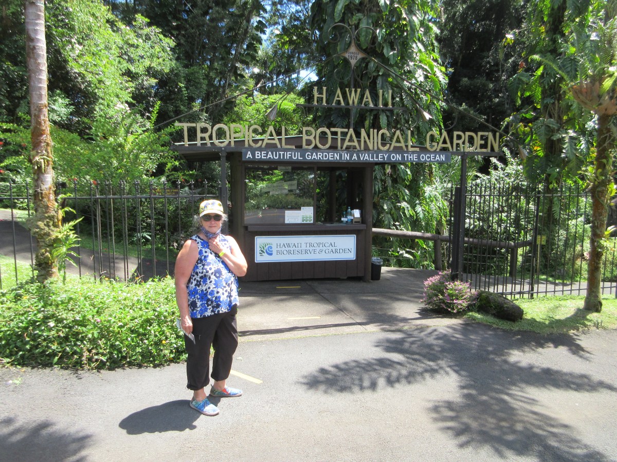
There is a Saturday market in Hilo that we decided to visit. It was a long drive, almost two hours, and we decided to include a stop at the Hawaii Tropical Botanical Garden in the same area.
The Farmer’s Market in runs seven days a week. The booths are more permanently installed than other farmers markets. and more unkempt from the wear and tear of daily use. One section contains fruit and vegetable sellers, while the others have clothing, jewelry, wood objects, and other items. It’s a sizeable market for a small city, but not on the scale of Pike Place in Seattle, for example.
From the Farmers Market, we took a brief drive around the lovely Liliuokalani Gardens. It was a hot day, and we decided against a walk. We also realized that we could spend much more time in Hilo. The Wailoa River State Recreation Area is in the center of town and includes a large fish pond. There are lots of places to walk once you’ve had a stroll around the Liliuokalani Gardens. We contemplated changing our plans to have lunch in a cafe overlooking the shore and staying in the area, but we had planned on a stop at the Botanical Garden, so we tore ourselves away.
Hawaii Tropical Botanical Garden with our visiting friend Peggy
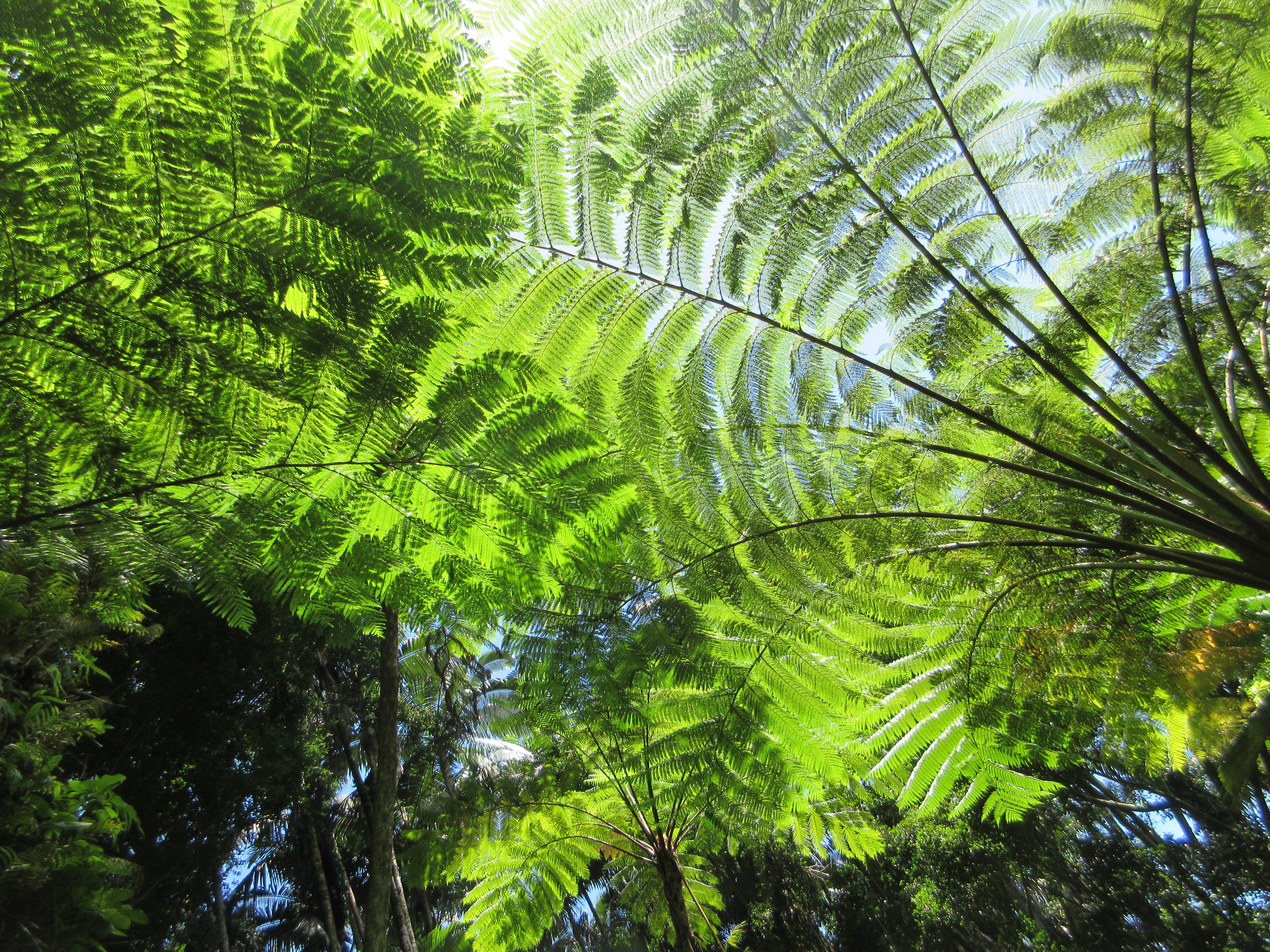
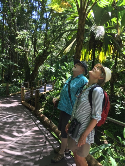
The Hawaii Tropical Botanical Garden is one couple’s vision of how a coastal garden could be created. Between 1977 and 2017, Dan and Pauline Lutkenhouse developed a 17 acre parcel into the garden today. It is a private enterprise, now run by their children, and seems to be thoughtfully run. We were impressed by how well-kept the trails are. A steep boardwalk at the start of the walk is manageable, and themed loops take visitors past groups of orchid plants, anthurium, and out to a waterfall by the coast. I felt a twinge of disappointment to find the large Bird House was empty, but the fact that the non-native birds have been transferred to a sanctuary is probably for the best. Macaws are pretty, but they are native to South America, not Hawaii. They are best left in the wild in the first place.
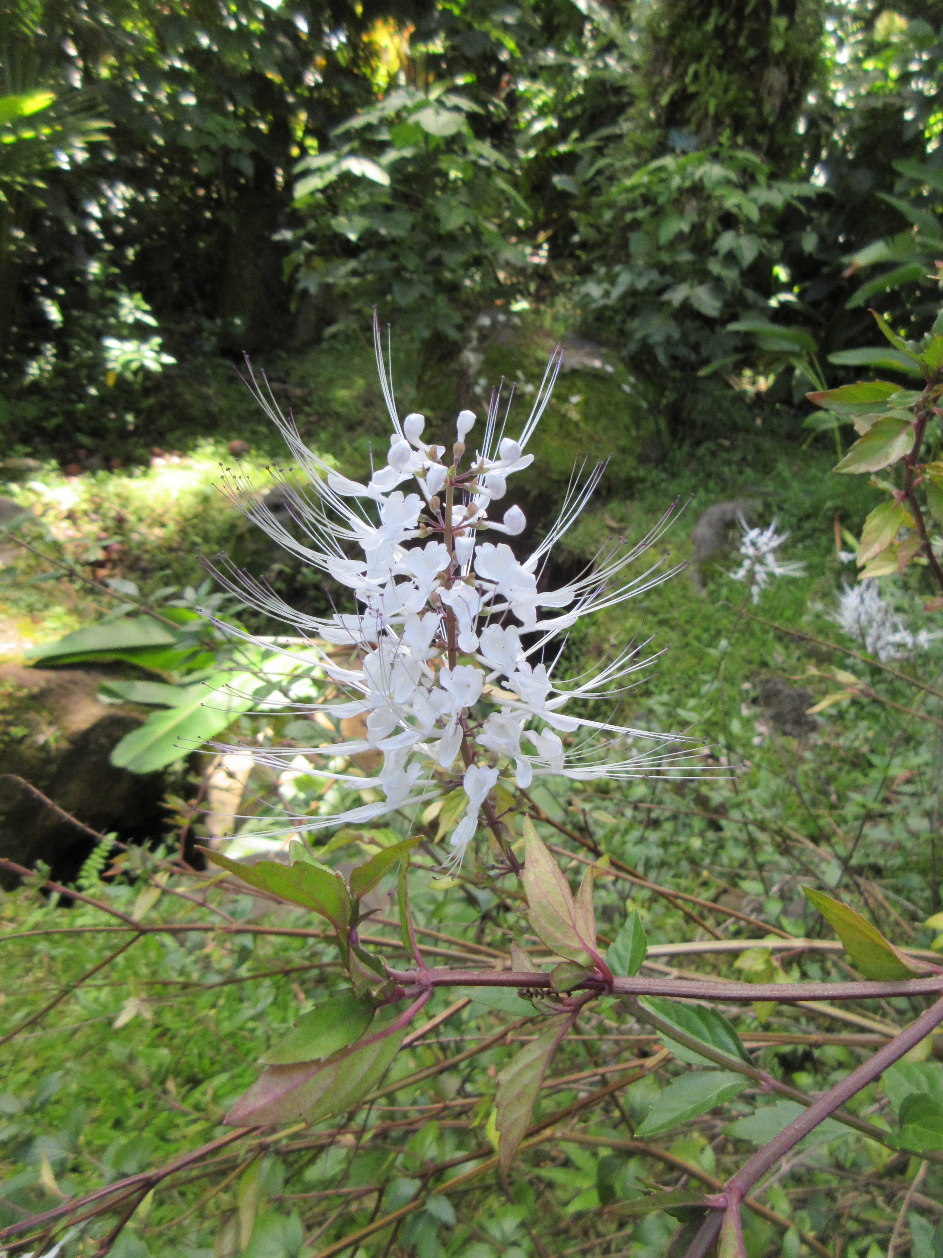
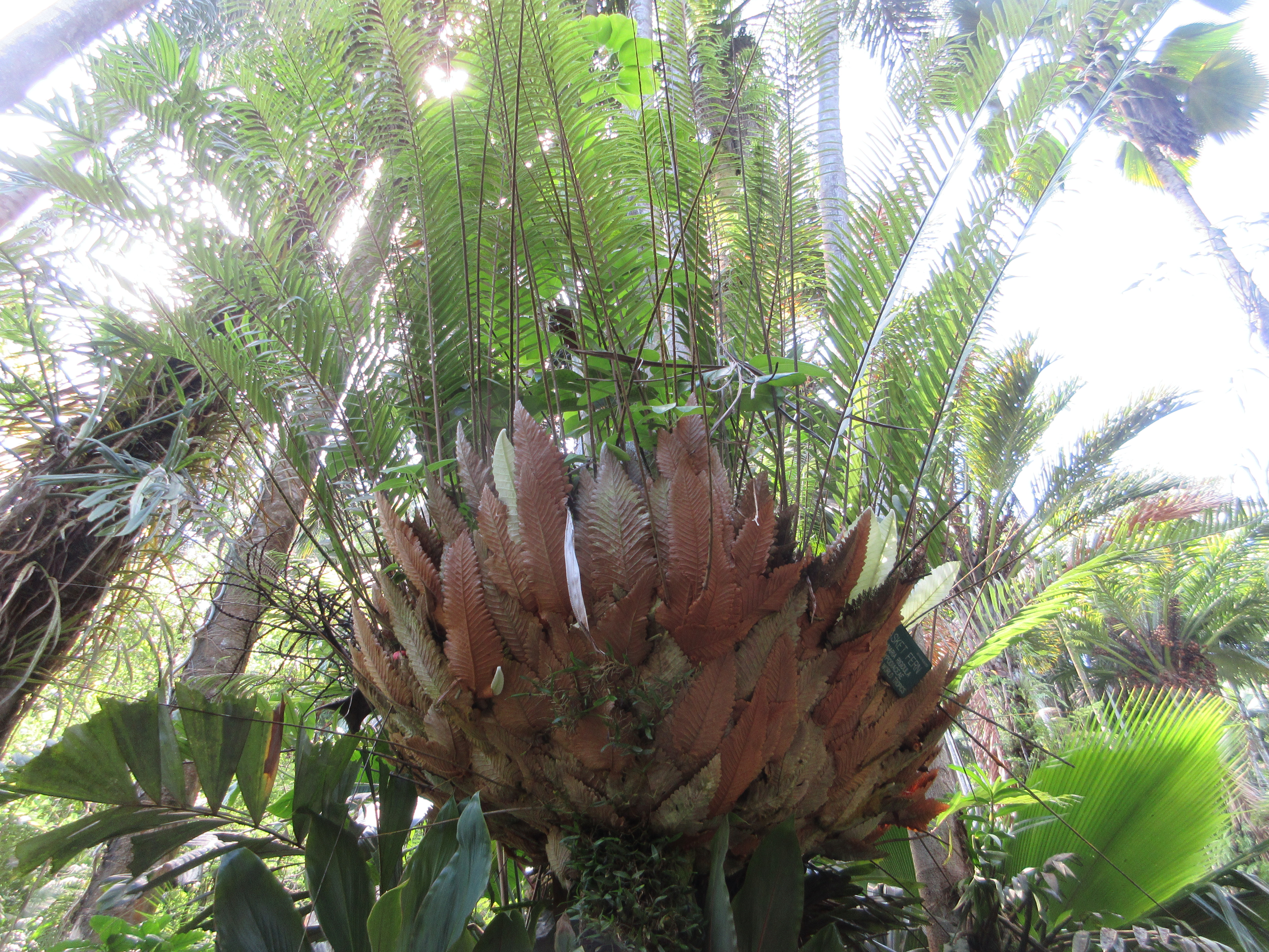
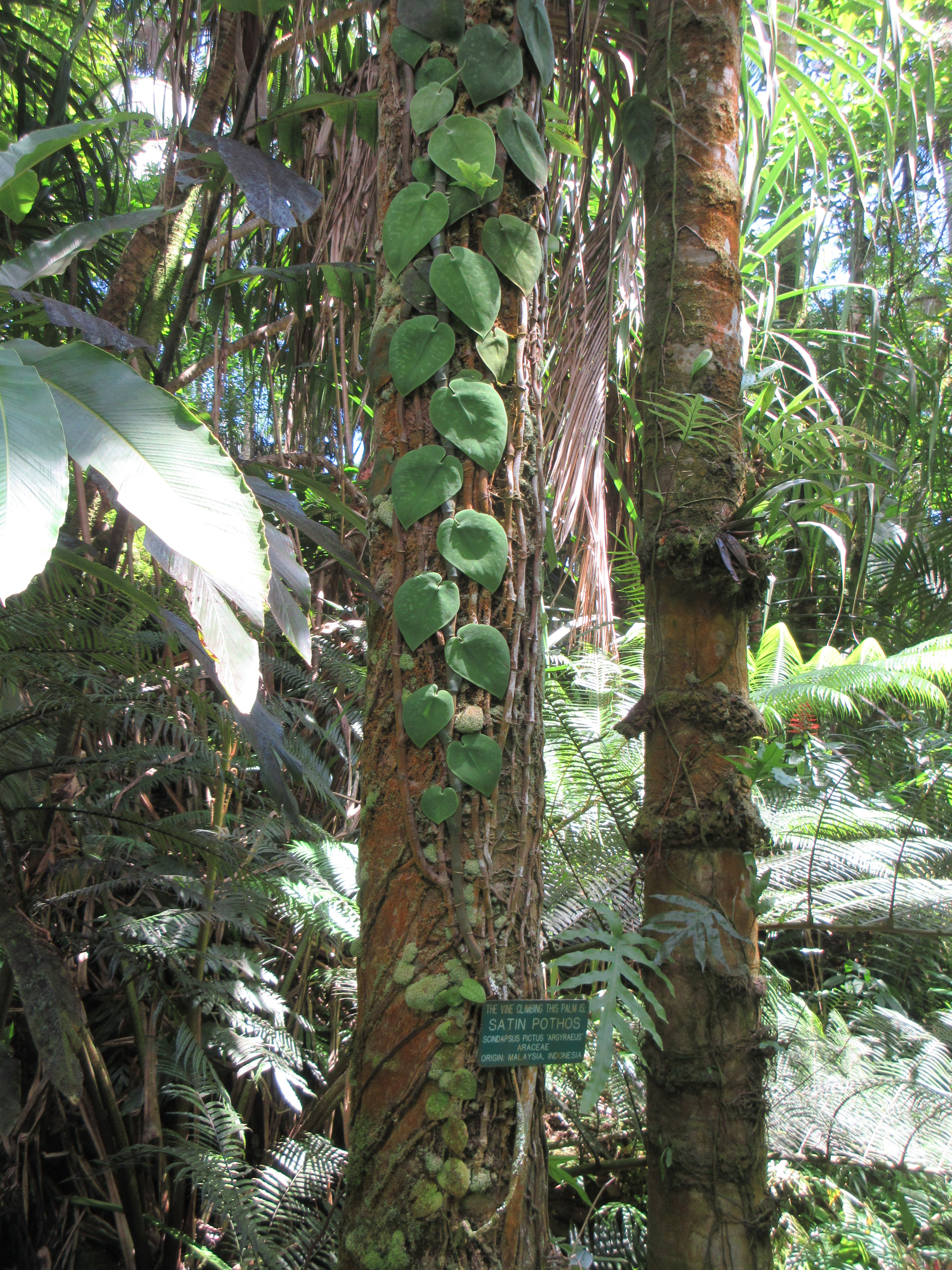
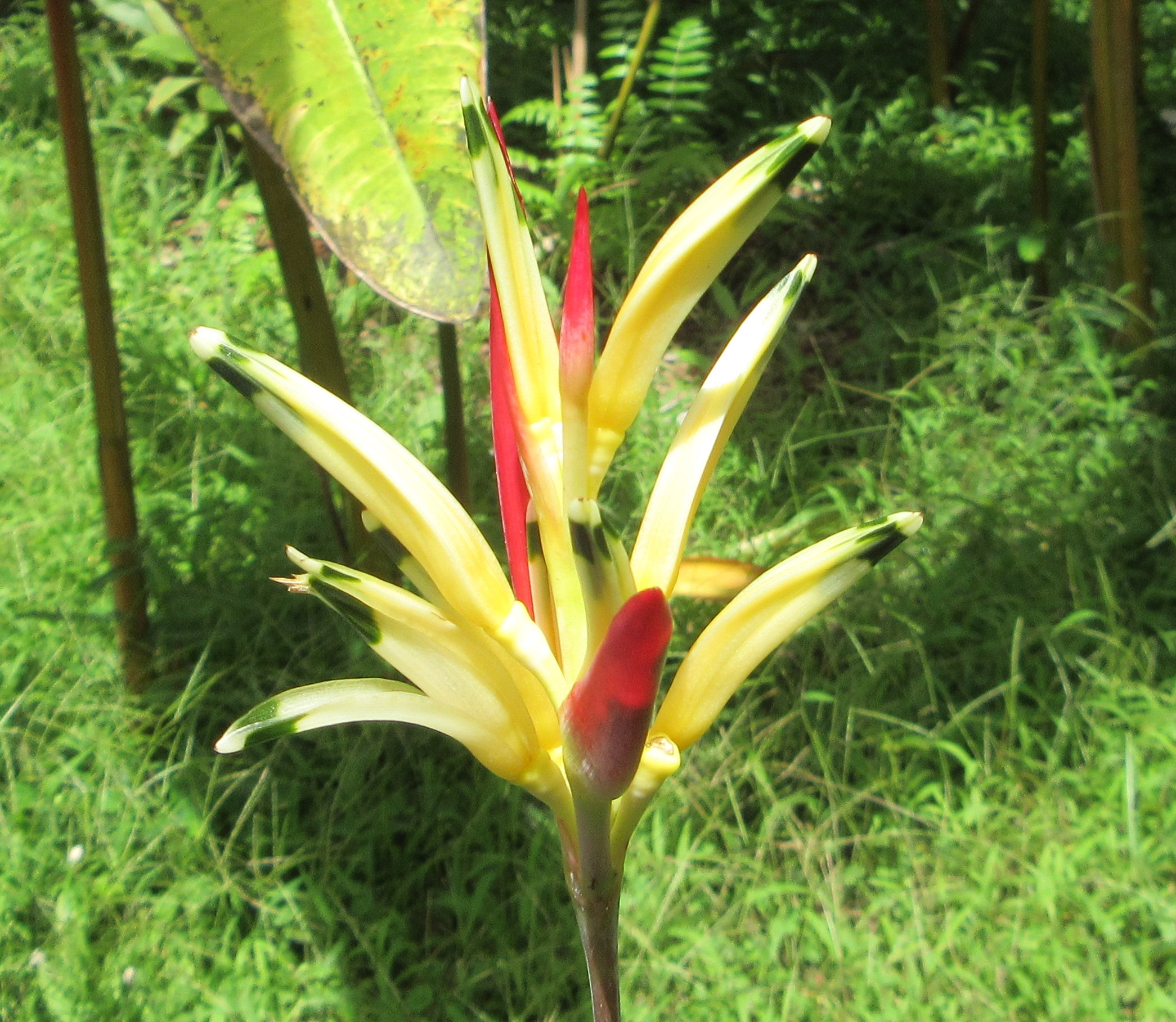
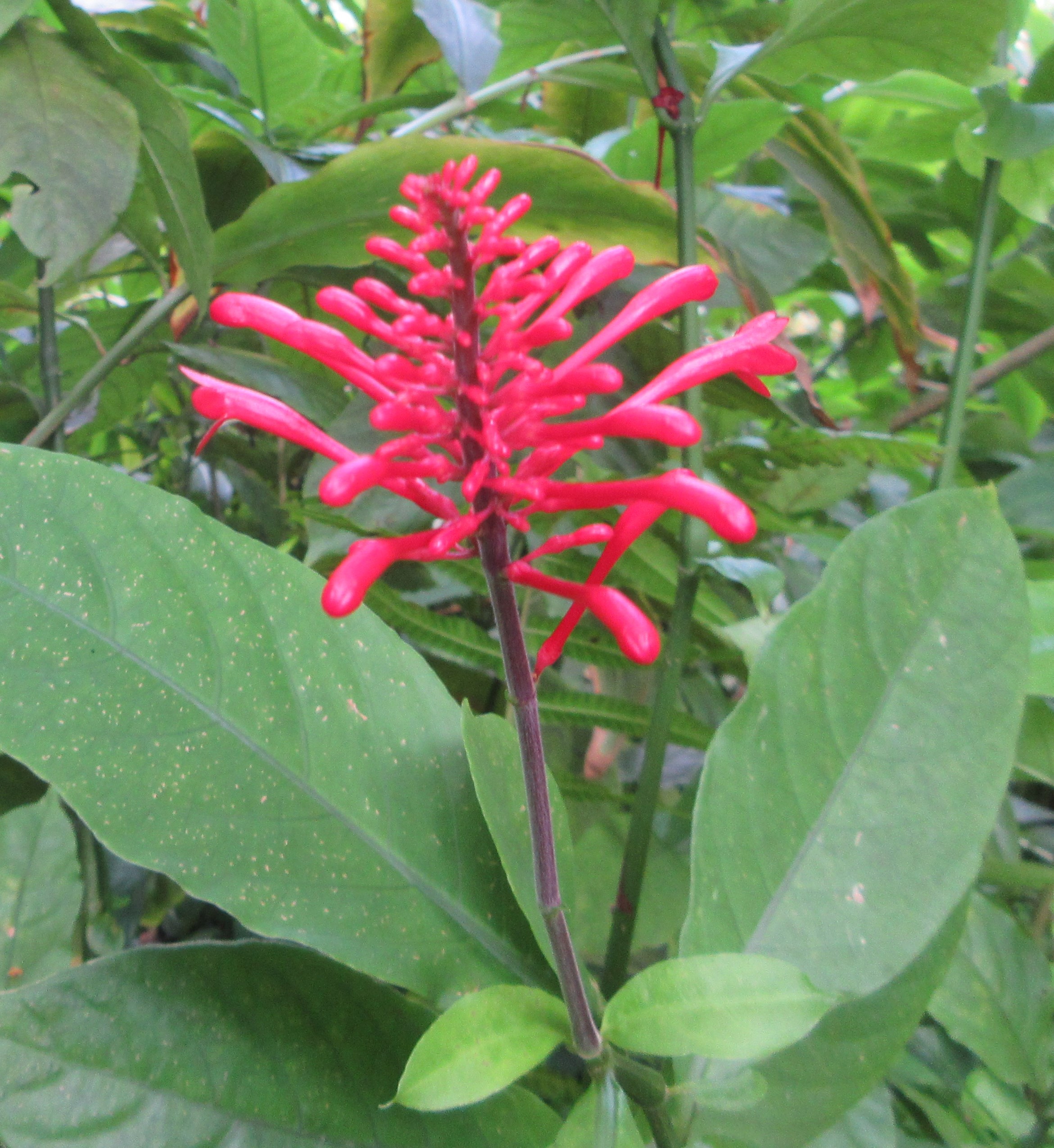
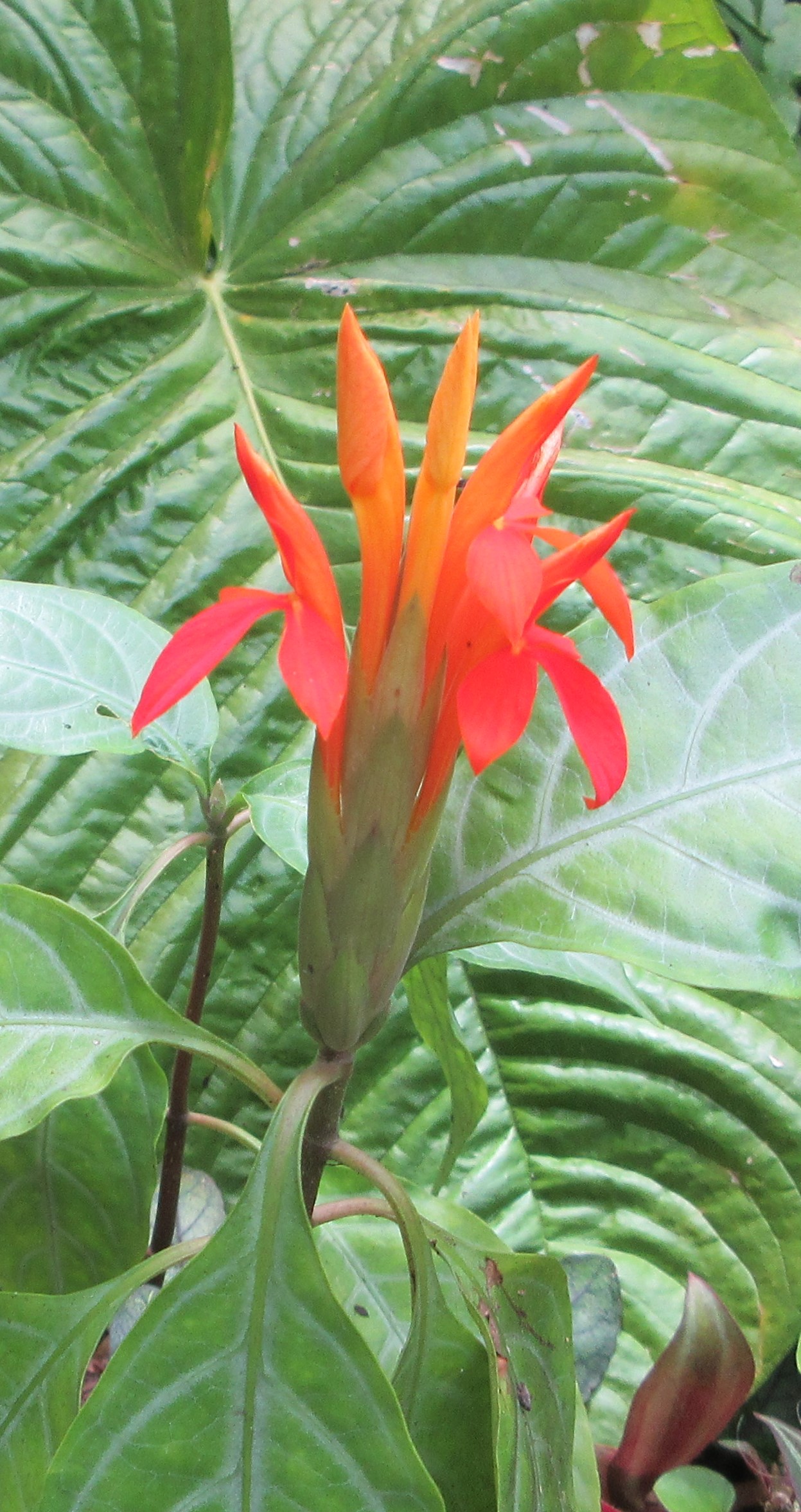
There were flowers and intriguing plants everywhere. We walked the entire trail in a couple of hours and enjoyed it thoroughly. The tall canopy of palms and rain forest plants created dappled shade that kept us cool as we strolled. We carried our own water and snacks (there’s no cafe), and stopped now and then to enjoy the surroundings. We were glad we’d chosen the garden over the city.
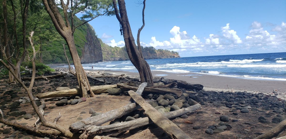
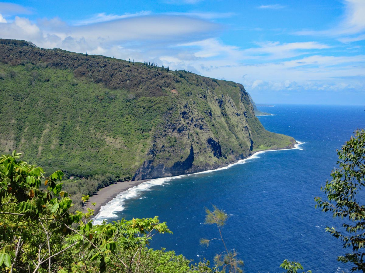
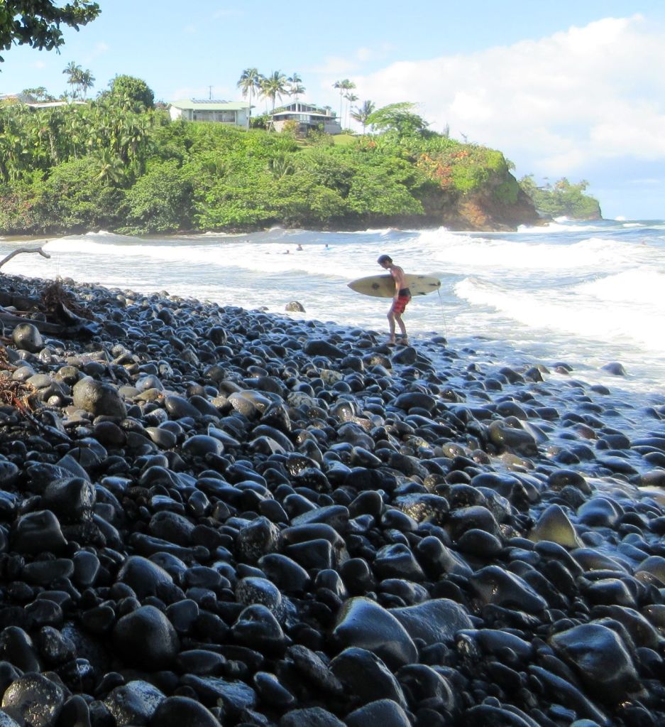
Just east of us lies a turning point in the landscape. Beyond it, the weather is wetter, the hillsides greener, and the coast is shaped differently. We set out to explore as much of the shore as we could, and immediately ran into high, steep cliffs. There are some tiny patches of beach and rocks at the base of some cliffs that can only be reached by boat. We went to Keokea Beach Park where local people built a breakwater pool for swimming and snorkeling. Typical for Hawaii, there isn’t much in the way of beach, but restrooms and picnic tables that make it a good spot to spend a day.
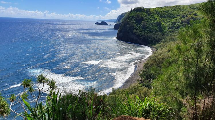
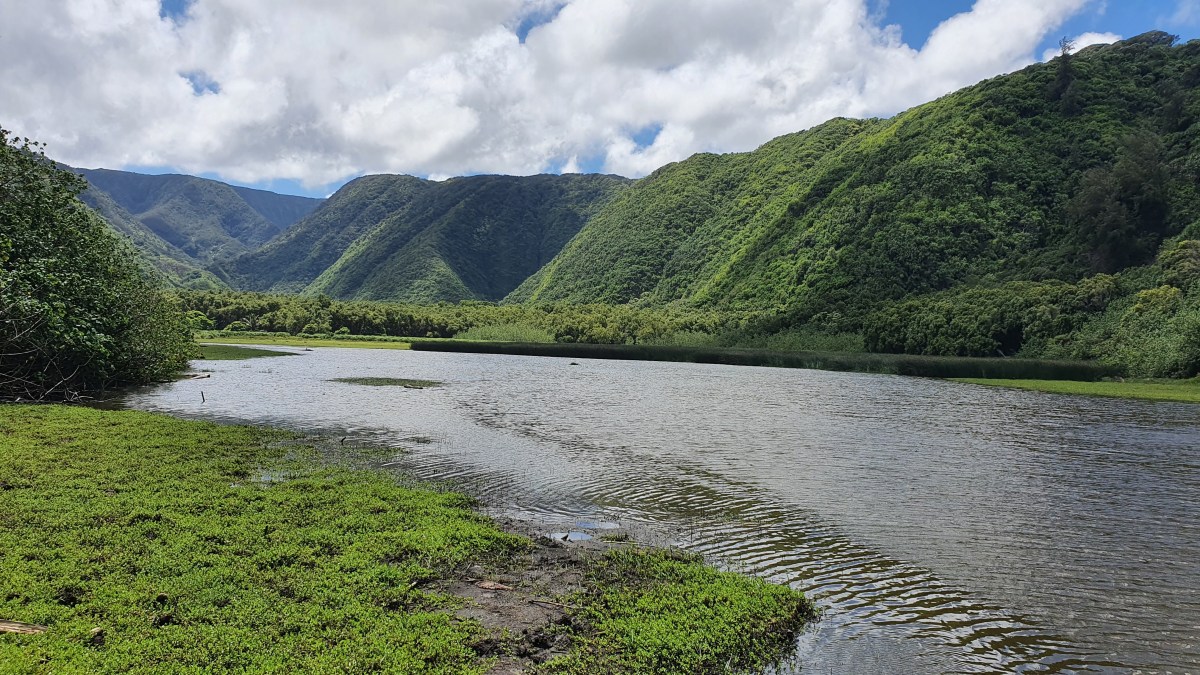
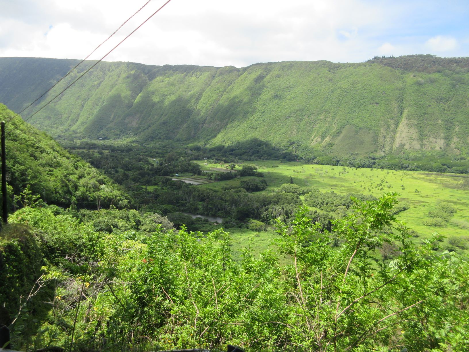
The Pololu and Waipio Valleys angle across the top of the island, each huge and lightly occupied. It is possible to walk down to the beach at the mouth of each valley, though many more people visit the overlook than make the hike.
The main road dead ends at the Pololu overlook, only a few miles from our house. King Kamehameha was born in a family compound just over the hill from our house, and spent his youth along the coast, including the Polulu and Waipio Valleys. We are living in his former stomping grounds.
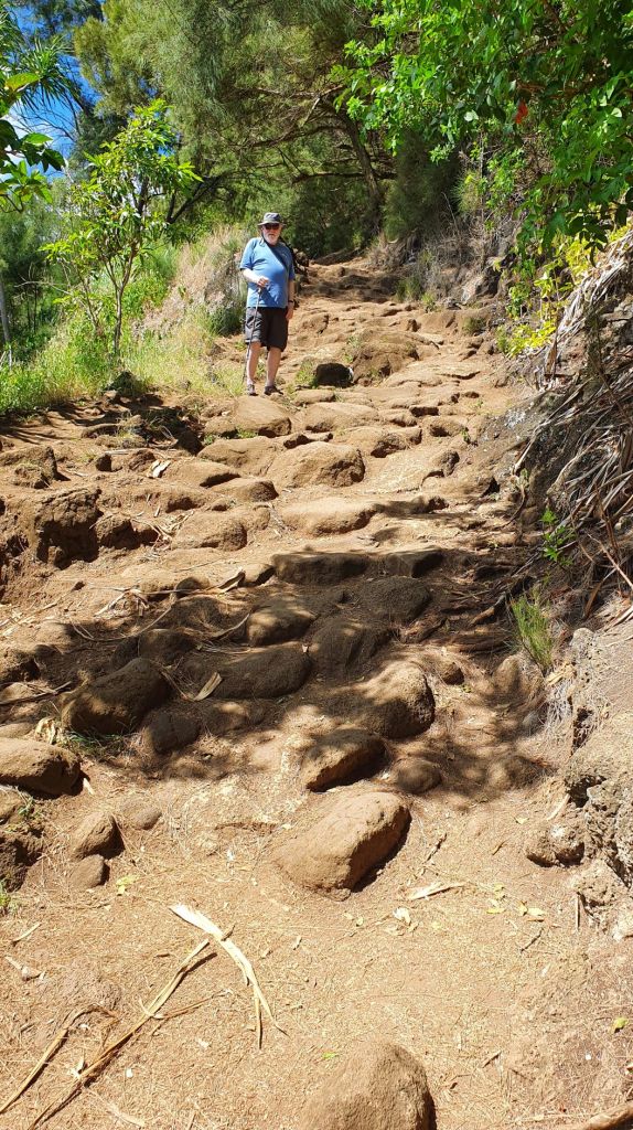
The trail to the beach from the Pololu overlook is steep and rocky. Jonathan decided to make the trip armed with his walking stick, a wise idea as the trail was not only steep but much longer than we thought. Far down the trail we met a woman who had decided not to continue. It was just too much of a hike.
Pololu Valley
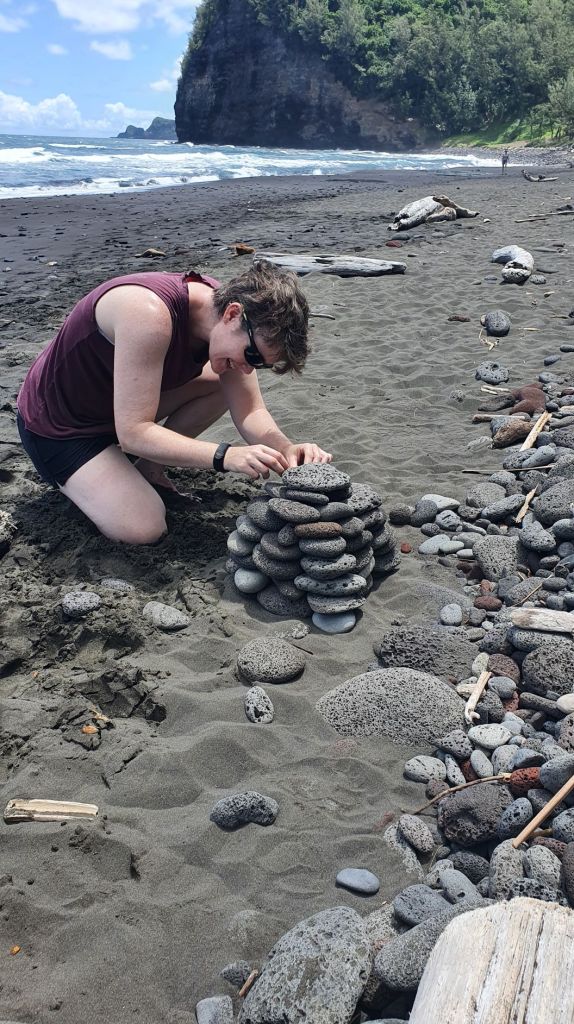
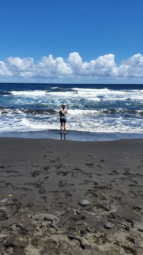
The views were fantastic. Finally at the bottom, we found a sandy beach, driftwood, and rocks. It’s not safe to swim, so we walked along the black sand. A number of other visitors had made the trip, everyone strolling the beach, sipping their water bottles, or sitting on a log.
The walk back up the hill from Pololu Beach got a bit long toward the end. Jonathan took a head start so that he and his stick could take their time, and ended up back at the car first. Lyra walked with me. I began to tire after a while and she insisted on taking my backpack while I sat on a rock. We got all ready to keep going, and found we were about 50 feet from the end of the trail and the parking lot, just around the next curve. I guess it wasn’t so bad after all. Here are a few more photos of the beach and the valley.
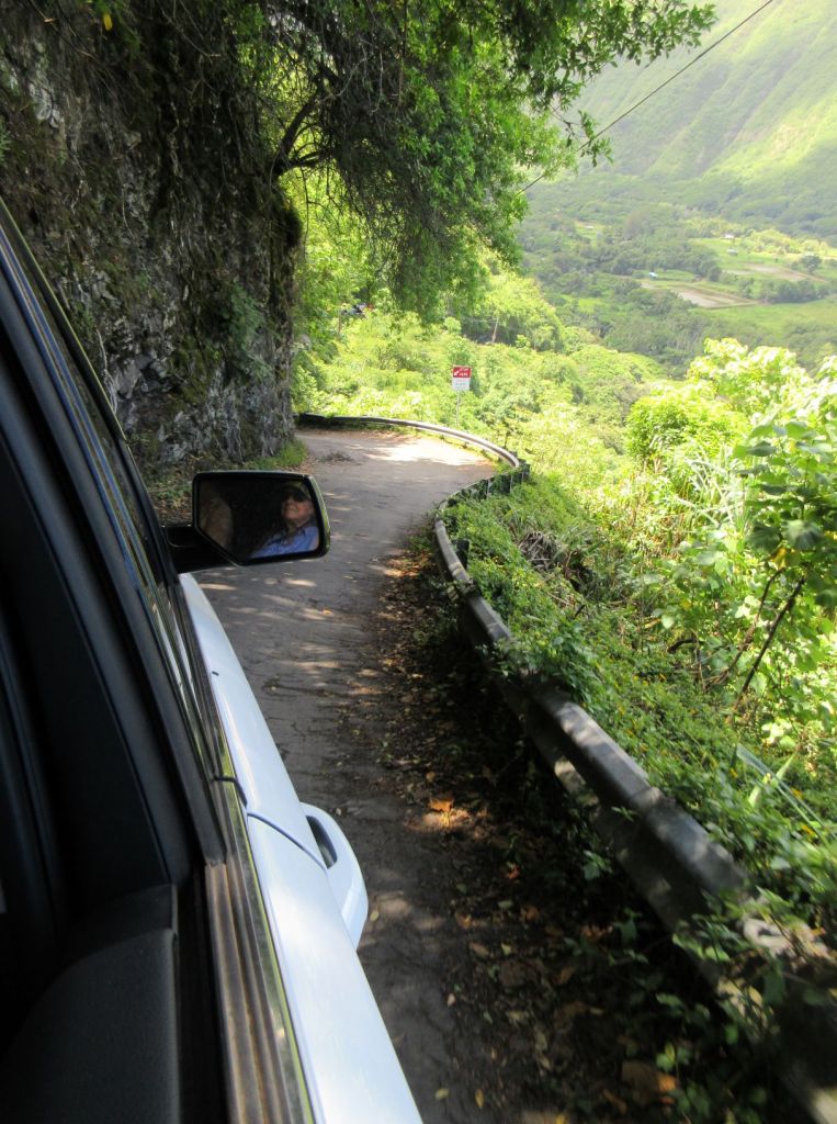
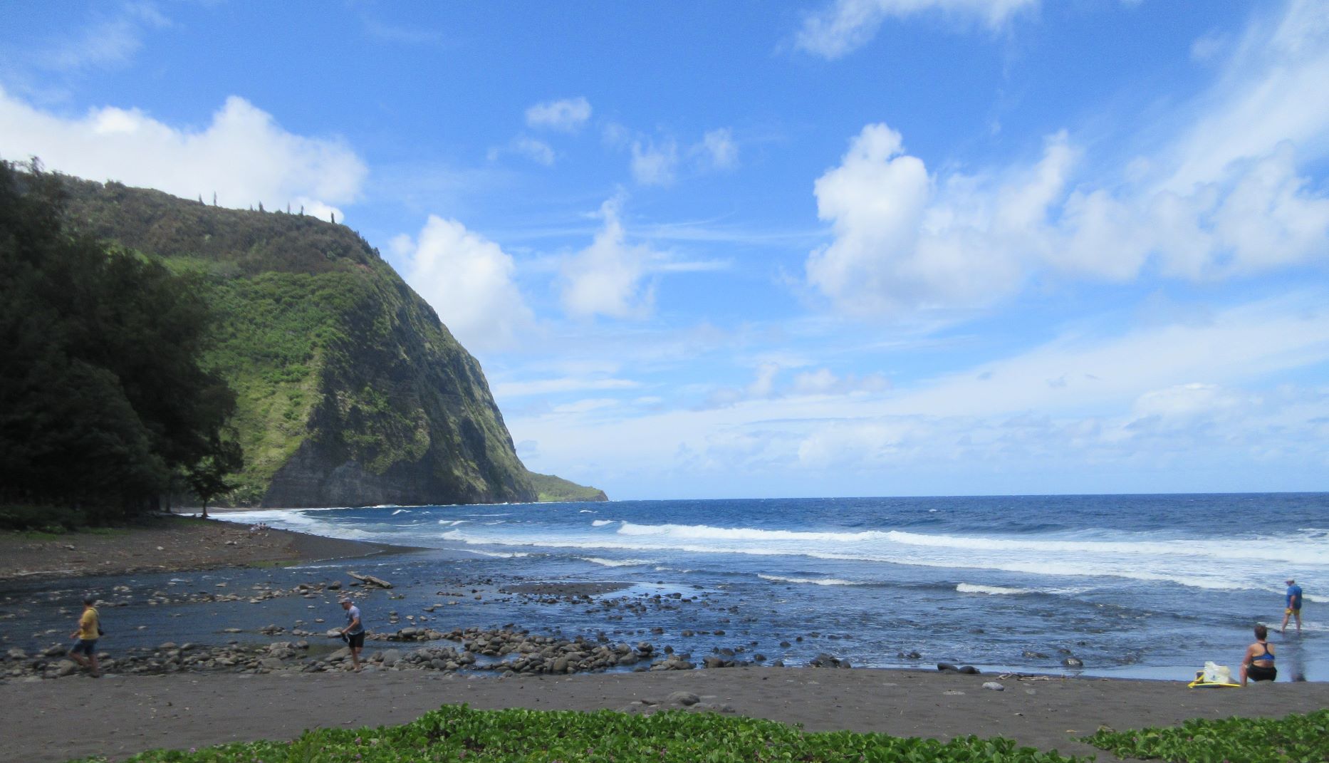
Having successfully visited the Pololu Valley, we debated visiting the Waipio Valley further east. The road from the overlook to the beach is described as perilously steep and narrow, only suitable for 4 WD vehicles. Going with a tour is recommended, unless you are game for walking down. Our young folk decided to get an early start one day and hiked to the bottom.
In a separate (large) car, we drove to the Waipio overlook to get a feel for the area. The road down the hill is very steep indeed, and narrow, with shallow pull-outs that indicate passing can be trouble. However, Jonathan has many years experience on unpaved, 4-WD only backroads of central Arizona, the canyons of NE Arizona, the forest roads of the Pajarito Plateau in New Mexico, and generally wild areas. He thought we’d be fine, so we tipped over the edge and drove down. We were extremely fortunate in not meeting anyone coming toward us on the way down.
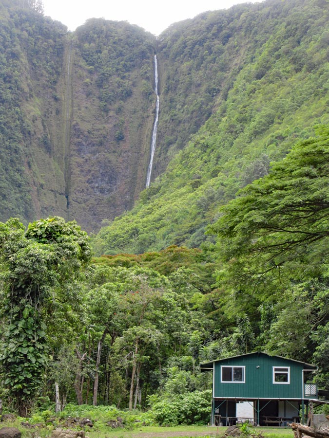
What we didn’t realize is that the road to the beach makes a sharp turn just at the base of the escarpment, so we drove to the very end of the road up into the valley, and looked at the waterfall (trail to the base of the falls currently closed). We turned back and discovered the beach turnoff and drove out to the shore, surprised at the number of vehicles and the size of the parking area. Who should we see on the road but our children just as they were leaving the beach to hike back up the hill. We persuaded them to stay a while longer and ride up with us (lol).
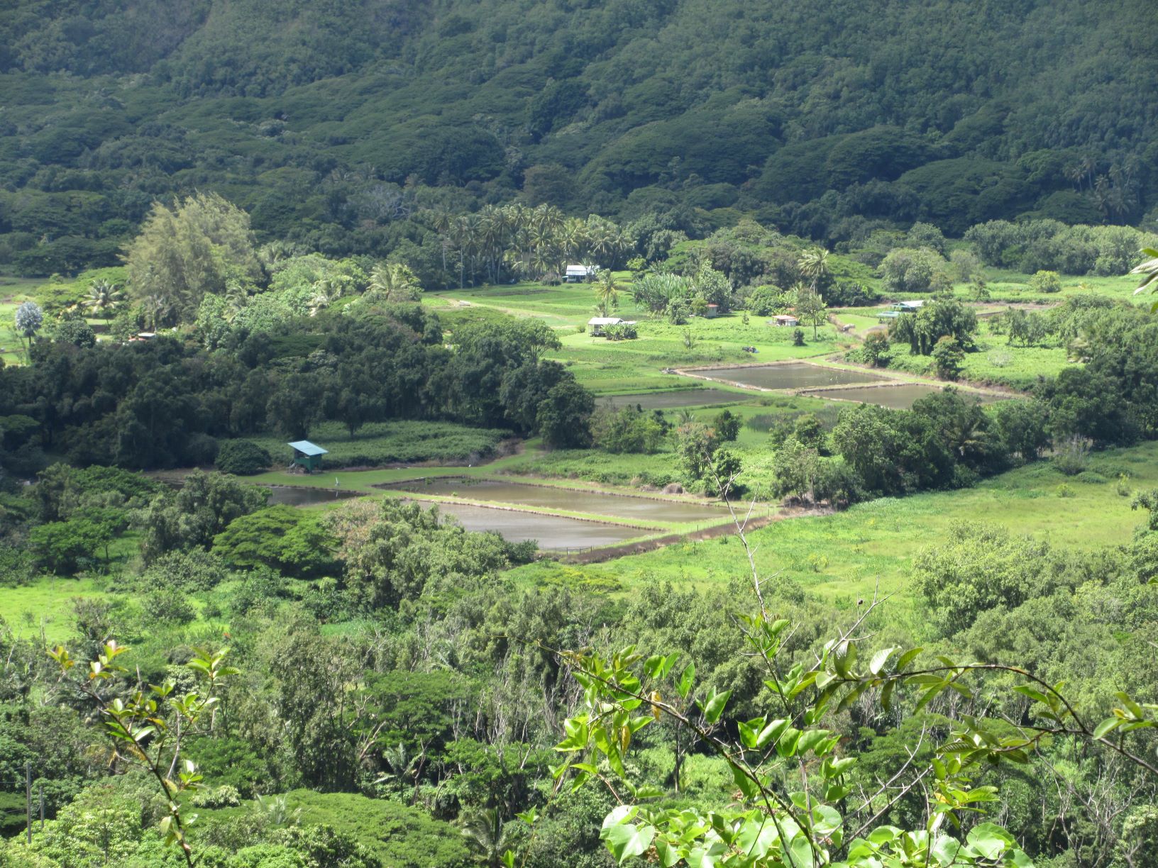
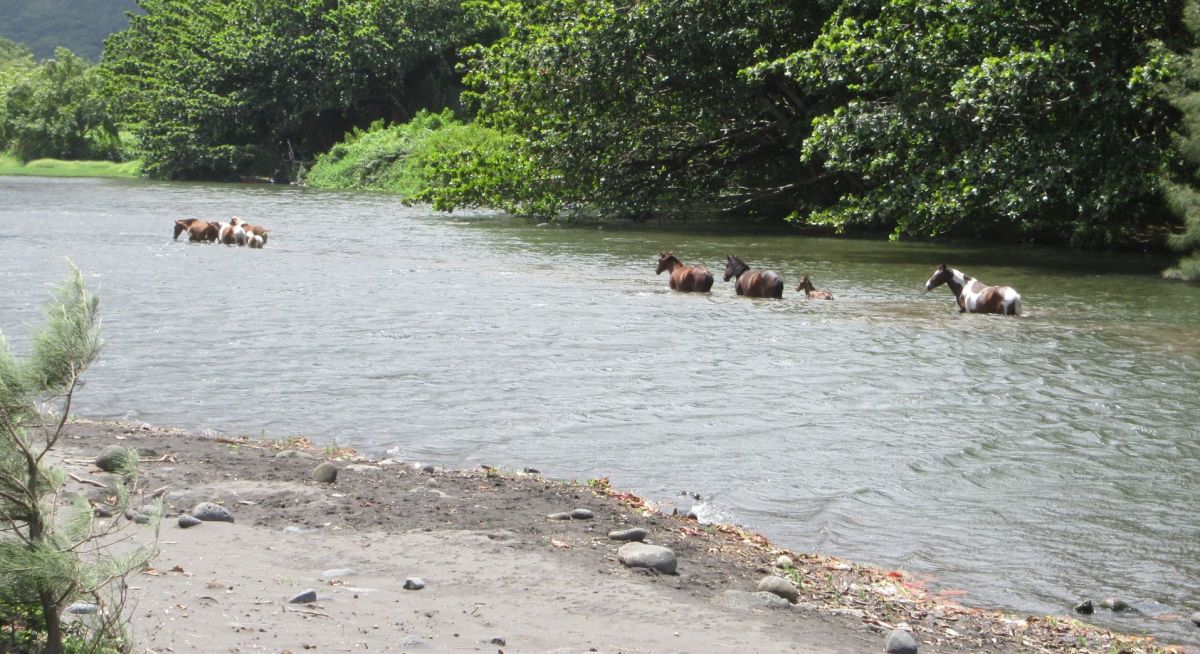
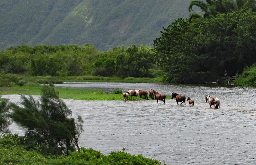
Away from the beach, the Waipio Valley is home to a number of farms growing taro and other crops. The hills are deep green and unmarked by houses, quiet and imposing. Considering the awful drive to get in and out, the valley is quite isolated. Only tourists spoil the tranquility. Our group interrupted the peace and quiet, but it was a lovely visit…..
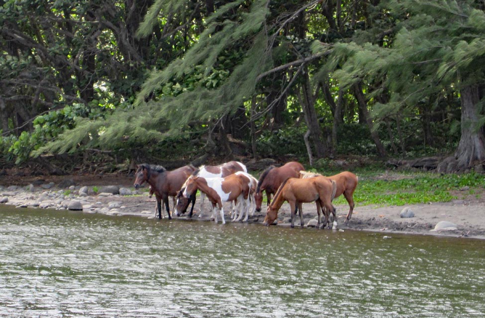
We watched a group of horses at the edge of the stream test the waters and then wade upstream to a small island to graze. When is the last time you saw horses roaming on their own? They wanted nothing to do with the beach or the tourists.
I was a bit surprised to find families that had driven down the incredibly steep and narrow road for a day at the beach. They unloaded lawn chairs, towels, umbrellas, picnic boxes and settled in for a stay. I think most visitors are like us, in the valley for an adventure, not planning to stay very long. The drive back up took a bit longer, and we had to pass a few other vehicles v-e-r-y slowly.
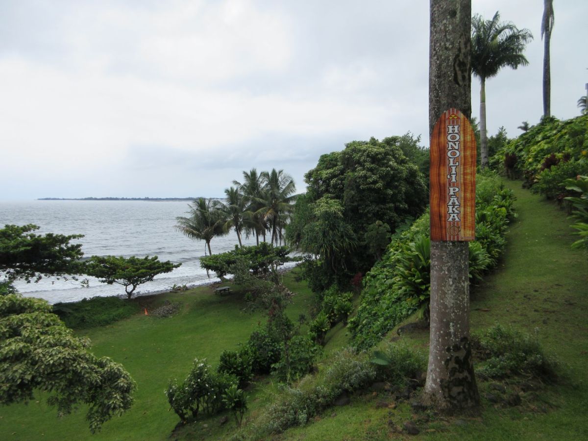
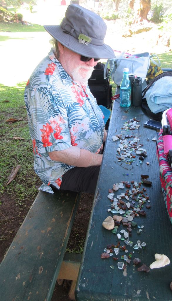
The drive from Hawi to Honokaa, the turn-off for the Waipio Valley takes an hour. There are other shore access points marked along the highway with small blue and white signs, but we don’t want to spend that much time in the car to visit a tiny rocky beach when there are many similar places near us. There was one exception. We drove most of the way to Hilo (90 minutes) to visit Honoli’i Beach Park, the one place in Hawaii that is known to be a source of beach glass. I had to see what I could find.
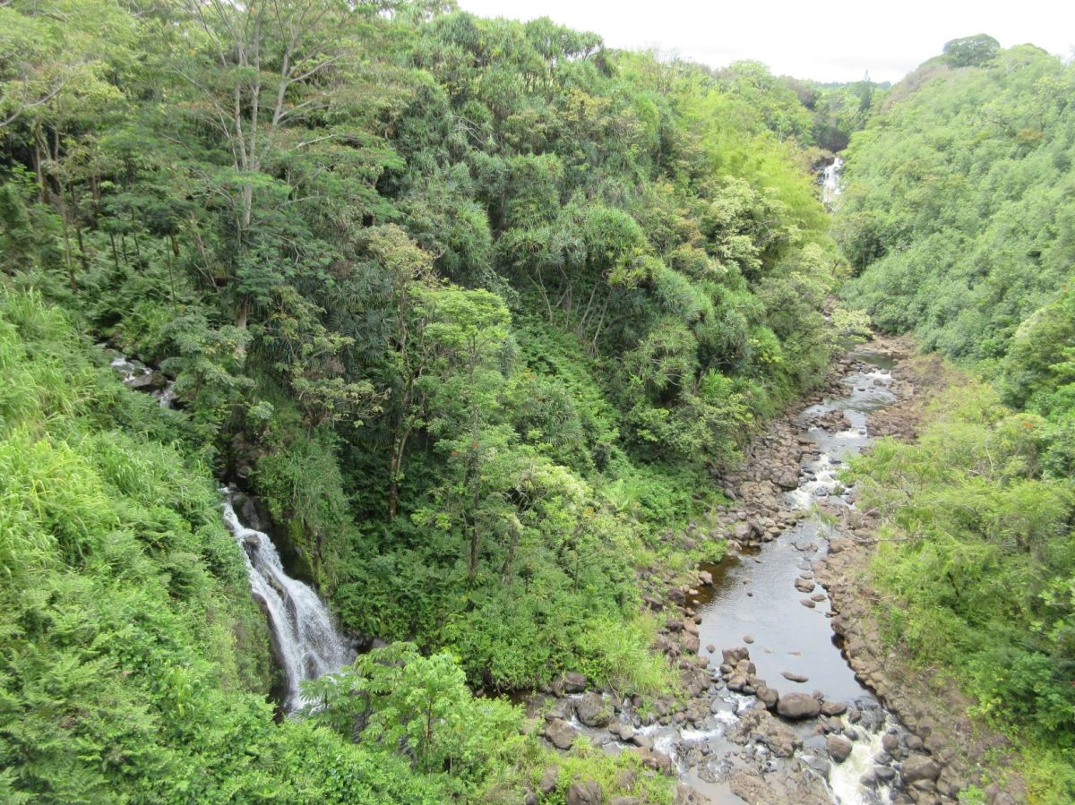
It was a long drive, but we went with all our visitors so everyone could try their hand at collecting beach glass. We took a picnic and found a table in the shade, a good home base. Everyone found glass, in lots of colors, though mostly small pieces.The surf is rough, so swimming isn’t recommended, even though there are lots of surfers. The river that enters the ocean at this site pools behind a sand bar, creating a safe swimming hole. On the drive toward Hilo, we passed over a number of streams with rushing waterfalls heading to the sea.
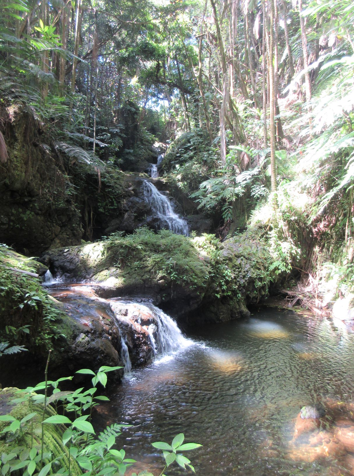
Waterfall in the Umauma Valley
It took about three weeks to get all these visits into our plans, and I am thoroughly pleased with the range of places we’ve been able to visit and the wonders we’ve seen.
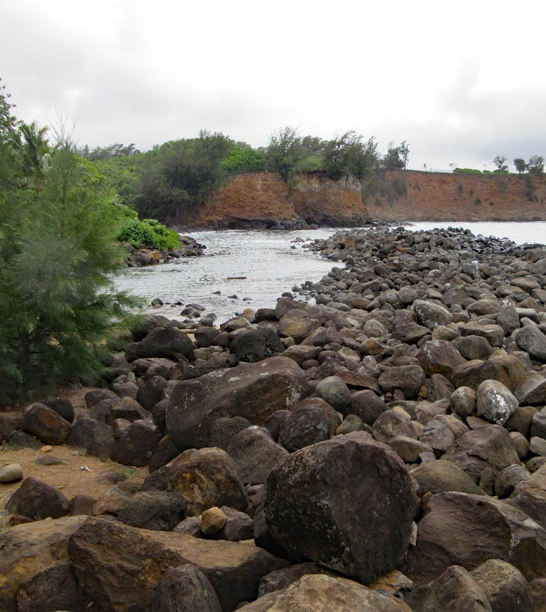
Hawaii has lots of shore but not much beach. If you recall that the island is made of volcanoes, you can understand why sand is uncommon. It has to wash in from somewhere else, or form from the waves grinding up rock–a slow process. Usually a “beach” is rocky shore with a place to swim and snorkel. Some marked spots along the shore have parking areas, some have restrooms and picnic tables, and a few have patches of sand.
We are located at the northern tip of the Big Island in the center of the Kohala region. The west side of the island (leeward) is dry, and the east (windward) side gets most of the rain. In this post, I am going north to south along the west side of the island as I talk about our visits. There are so many places to stop and look at the shore that in almost a month, we haven’t gotten as far south as Kona. All the stops I mention here are in Kohala.
The beach at the end of Old Coast Guard Rd. is the closest to our house.
Old Coast Guard beach is all rocks.
There are similar rocky places along the coast marked “Shore Access.” Some, like Old Coast Guard beach, are merely a place where it is possible to clamber over rocks into the water. At Kapa’a Beach park, the next stop to the south, it’s not too difficult to get over the rocks and into the water, but slippery to get out.
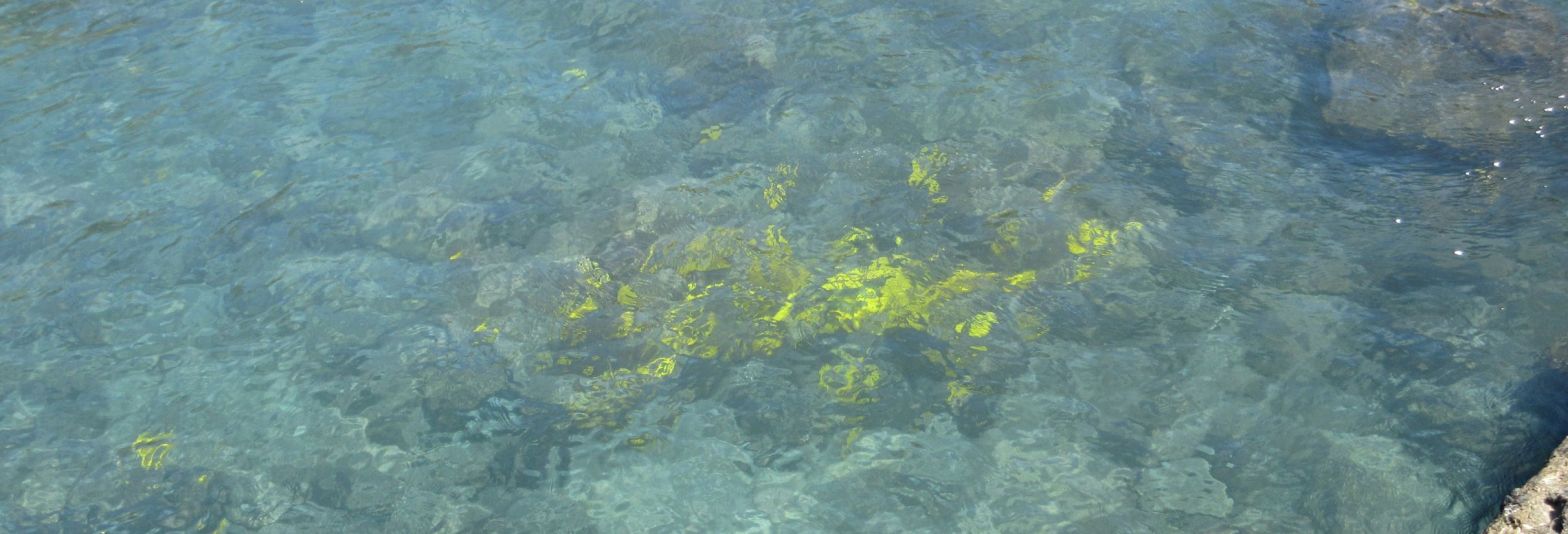
At Mahukona Beach Park, the shore is rocky. This park has a large concrete slab and a ladder into the water; it’s my favorite snorkeling. There are lots of fish of different types and sizes. Amanda and Jim spotted an octopus and watched it change color from the dark of the rocks to the pale tan of the sand.
This is me snorkeling at Mahukona Beach Park
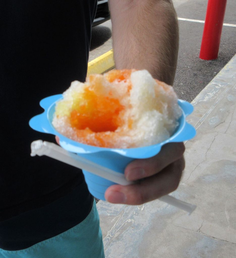
Partially devoured, but still big, shave ice.
There is a gap of several miles to Spencer Beach. We spent a day on the sand at Spencer Beach, snorkeling along the section of reef just offshore. We didn’t get to walking the path through the adjacent Pu’ukohola Heiau National Historic site (traditional Hawaiian monuments from the era of King Kamehameha) until another day. Fortunately, just north of the beach is Kawaihae and the tiny strip mall with Anuenue Shave Ice and Ice Cream. It’s a tiny window with excellent ice cream (chocolate macnut anyone?), and shave ice of myriad flavors and colors. You can get a scoop of vanilla ice cream in the center of your shave ice, and a snowcap of sweetened condensed milk on top. It’s a huge shot of sugar–there are no small sizes.
In the resort area of Waikoloa we tried for a parking spot in the public access area for Mauna Kea beach. Mauna Kea is a sprawling resort, some say the best along this part of the coast. Though the resort is required to provide public access, it is allowed to limit the number of cars that can park, and a guard turns away visitors when no spaces are left. Perhaps we’ll try another day. Hapuna Beach Park is nearby and has a sandy beach along with rocks.
Still in the resort area, we found 49 Black Sand Beach, where the parking was free and the snorkeling was excellent. Amanda found us a sea turtle to watch as it browsed along the bottom, hanging on to coral with one flipper and pushing its head in among the formations to nibble on green things.
49 Black Sand Beach is the southernmost we’ve visited for swimming and snorkeling, on the day Amanda and Jim were leaving. We stopped at Snorkel Bob’s Mauna Lani store to return their rented gear, and got poke bowls for lunch from the Foodland opposite.
School of yellow tang, Kealakokua Bay, Hawaii (Wikimedia photo)
There are even more “beaches” all along the west coast of the Big Island, and we could spend a lot longer than a month visiting them. For now, we’re pretty happy to find a beach with good snorkeling an eight minute drive from our house. The photo at the top of this post shows a large group of yellow tang (fish) just under the surface at Mahukona Beach Park. The internet photo here shows yellow tang fish with an underwater camera.
Volcanoes National Park is on the must-see list of every visitor to the Big Island, though since early 2021, there has been no red lava to be seen, not even a red glow after dark. Still, everyone wants to see a massive volcano. Our visit was a big expedition because we are staying at the opposite end of the island. It would be difficult to find a place farther from the park than Hawi.
Saddle Rd., Hawaii
Near Thurston lava tube
Everyone knew it would be a long ride. We drove the Saddle Road that cuts across the Big Island, where vast tracts of dry ranchland turn into vast areas of green grassland as the climate shifts from the dry leeward side of the island where we are located to the wetter windward side.
At the Visitors Center we confirmed our route along the edge of the crater, starting at the overlook of Kilauea, then on to the new overlook at the Halema’uma’u crater. We saw the white tailed tropicbirds that live inside the Kilauea crater soaring across a background of black lava. It is difficult to comprehend the size of the volcano. Only the now-abandoned museum sitting on the edge of a cliff that was once many yards from the edge shows how unexpected were the effects of the 2018 eruption, despite the fact that the volcano had been active constantly since 1983. The past year is unusual in having NO red lava for visitors to observe.
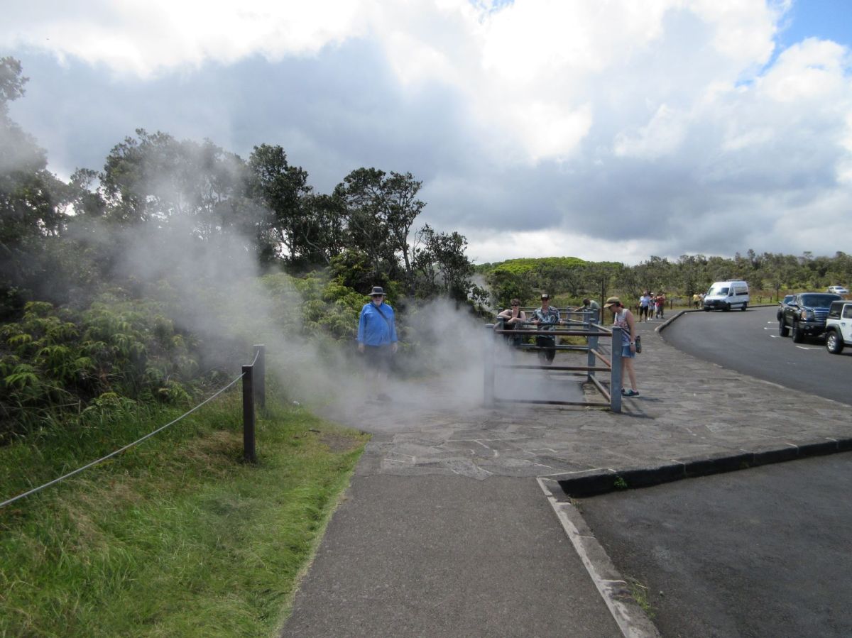
The steam vents were the most entertaining part of the day once I determined that the steam comes from rainwater and not volcanic vents. That is, the steam doesn’t contain sulfuric acid, as volcanic vapors do. When Jonathan decided to stand in the steam I could stay calm.
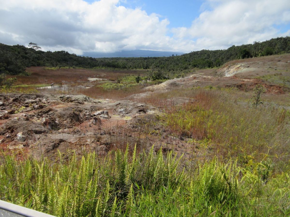
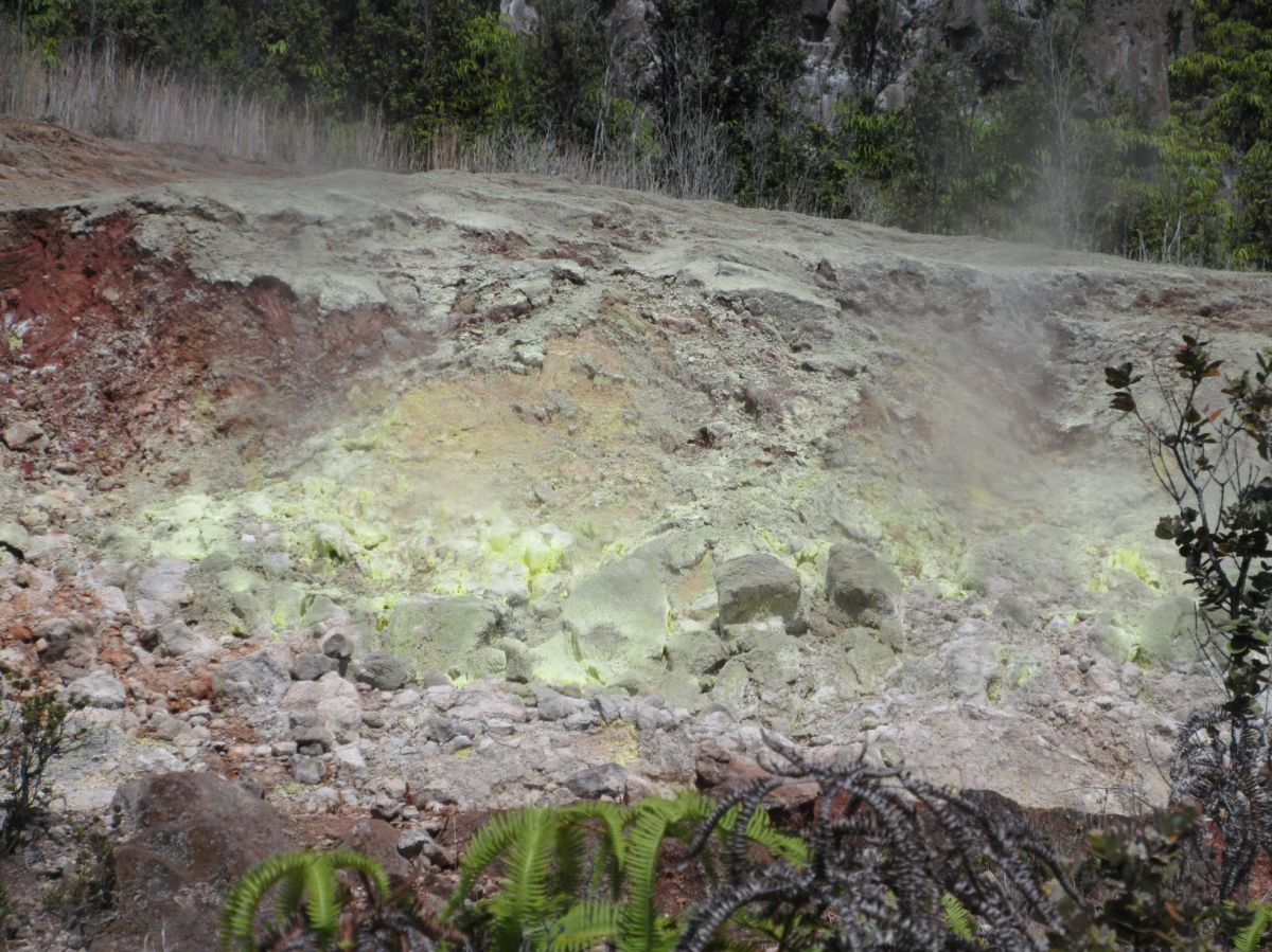
Down the path from the steam vents, sulfur-bearing steam condenses on the hillside, creating sulfur crystals. This is steam to be avoided! A tiny whiff gives you the sulfur/rotten egg smell that we humans recoil from. A larger breath can damage your lungs because of the acid content. The sulfur crystals are bright yellow and on rare occasions have tempted people to step off the path toward them. The results are horrible, as the ground appears solid, but is just a crust over steaming acid. It’s a deceptive landscape.
Kileaua sulfur banks
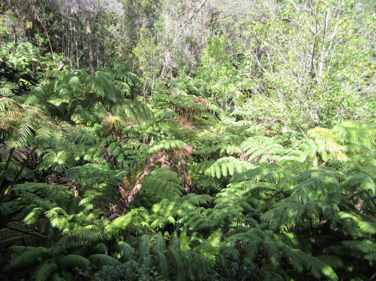
A giant cave, the Thurston lava tube, is another popular stop, and often short of parking spaces. We visited in the mid-afternoon and found parking. The walk down to the mouth of the tube is steep, but manageable. The section of this lava tube that is open for visitors is not long, but turns just enough that you cannot see the exit when you enter, making your first steps a bit eerie. The tube is very dark, illuminated by some lights along the walls during the day. The park is open 24 hours a day, but after 5 pm visitors must bring their own flashlights to see inside the lava tube.
It’s a bit like walking down a dark hallway or subway passage. A veil of roots hangs in the dark overhead. These threadlike strings have made their way through the lava from the surface. Much of the inner surface of the lava tube is covered with small bumps of mineral that has accumulated from water that seeps through the rock. Technically stalactites, hanging from the ceiling, what I saw looked more like goose bumps of whitish rock and less like the long hanging crystalline deposits I imagine from the word “stalactite.”
Once out the far side of the tube and back up the stairs to the parking lot, we had spent all the time we had available. There is lots more to see at Volcanoes National Park. Not far from the lava tube is the start of Devastation Trail, an easy walk through a desolate lava landscape. Just beyond that trailhead is the start of Chain of Craters Road, that heads toward the coast, passing a number of different volcanic formations. Toward the far end of the road is an area of petroglyphs that would be worth a visit. Sampling these stops would take an additional half day, and there are many other trails and hikes around the crater.
Outside the park there is more to see. Another hour of driving gets you to the town of Pahoa, where you can drive through Leilani Estates, a housing development that was partially destroyed by lava from Kileaua in 2018. I have read that the community rapidly tired of “disaster tourism,” visitors who came to gawk, parked haphazardly and climbed on the lava that was clearly labeled off-limits. Still, it’s a dose of reality to see that even today, no one can stop Mother Nature. (I looked at Leilani Estates on Google Earth. You can see the path of the lava right into the neighborhood.)
We had a good visit. I enjoyed the Volcano Art Gallery by the Visitor’s Center, where many local artists are represented. The Visitors Center has useful information, all outdoors at the present. The drive home was a long one, and we were grateful to have a swimming pool to fall into at the end of the day. I’m not entirely sure what attracts us to a big, dark, distant, rocky hole, but we were there. I’d only go again if there was really red lava visible. But then, I’d complain about the traffic.