A car comes in handy once you decide to get out of town, as Charleston is surrounded by water, and though the beaches are beautiful, they are not close by. We’ve tried as many beaches as we could. Every one is an endless strip of white sandy beach unfurling as far as the eye can see in either direction. Much of this is illusion, as the beaches end at inlets that reach deep inland. Visiting two adjacent beaches can involve an hour’s drive or even longer. If we get tired of the view at one end of a beach, we make our way to the other end, a mile or two or three down the road.


Folly Beach
Folly Beach is the closest beach south of Charleston. More than five miles separates Folly Beach County Park on the south from the far end of the road at the north end of the island. Halfway along is Folly Pier, a long fishing pier with a few shops and restaurants.
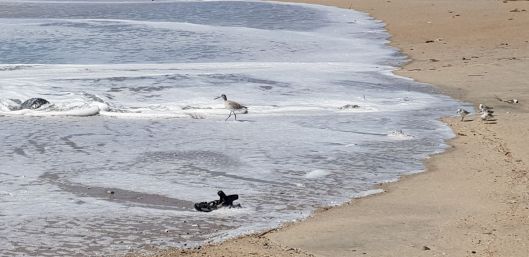
On the beach, we were fascinated by the evidence of nesting sea turtles. Most have hatched and wriggled their way into the water by now, but turtles nest all along the coast here. Nests are marked and monitored by the state and dedicated volunteers. This year some nests were damaged by hurricane Dorian, and the few that haven’t hatched yet may be storm casualties. We spoke to a volunteer who said there was a big uptick in the number of eggs and turtle hatchlings this year, just about 30 years after the protection program started. It takes about 30 years for a sea turtle to mature and begin to lay eggs on the beach where it was born. It looks like the efforts to protect sea turtles are just beginning to pay off. We can use some good news on the nature front.
To the south of Folly Beach is Kiawah Island, best known for its very large resort. Beyond that is Seabrook Island, then Edisto Beach.
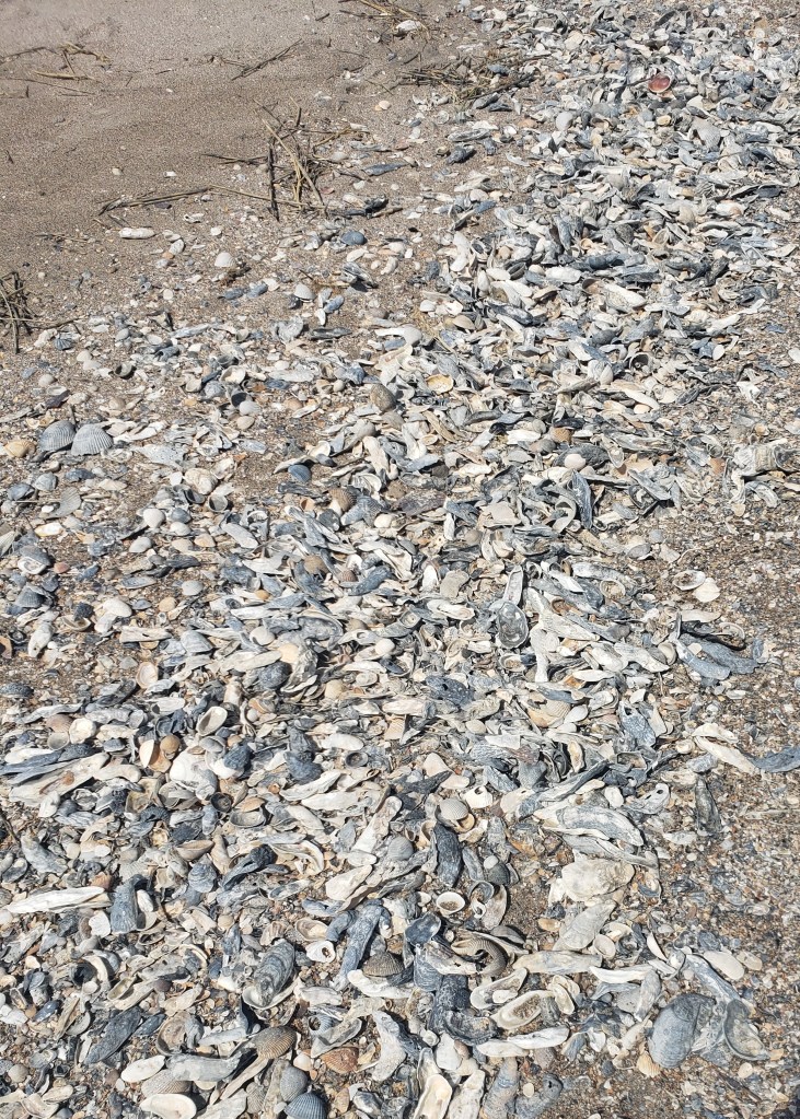
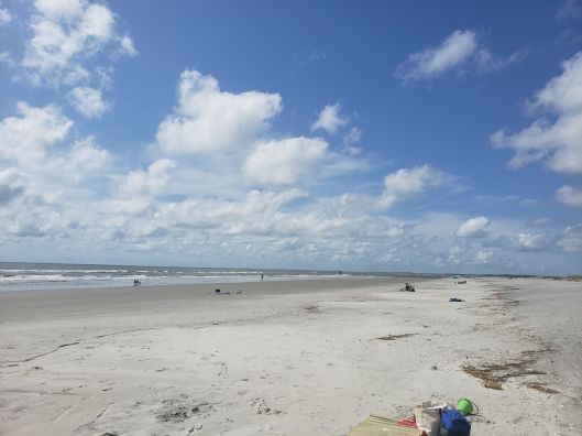
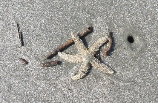
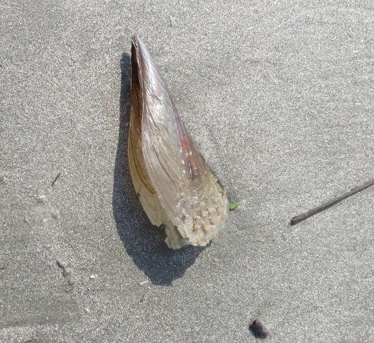
There were a lot of shells on the beach at Edisto, and a lot of people beachcombing. We chatted with people who hunted for whelk shells after Hurricane Dorian passed through, a woman holding what looked like a wok spoon on a stick who was hunting for shark teeth, and people looking for shells, driftwood, or just looking. We were looking for beach glass, but didn’t find any. Jonathan turned up one piece this entire month. We occasionally found broken glass, but that’s a lot less interesting than nicely rounded glass pebbles. This may be a testament to the clean beaches of the region, but it gave us less to hunt for as we strolled. We decided that Edisto would be as far as we’d go from Charleston, as it took almost an hour and a half to get there. The next beaches to the south are beyond Beaufort.
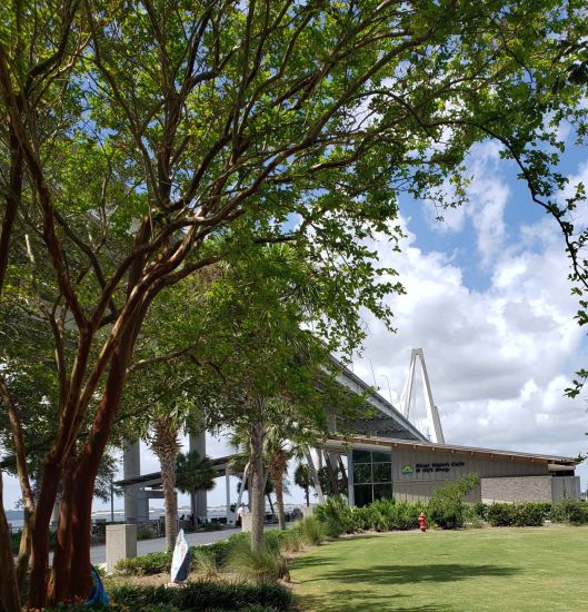
On other days we drove north out of the city. Just over the bridge is the Mt. Pleasant Pier and Memorial Waterfront Park, tucked in under the dramatic harp-like spans of the Ravenel bridge. It’s a gorgeous setting with a view over Charleston. There’s fishing for those interested and a cafe and gift shop for everyone else. Paths wind through the gardens.
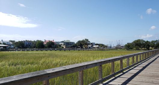
Beyond the park complex is Patriot’s Point, where you can visit a retired aircraft carrier. Nearby is Shem Creek park. We discovered the park accidentally, on our way somewhere else. There is a long boardwalk over fields of spartina grass, with egrets and herons. Boats are moored nearby and navigate the channel out to the ocean.
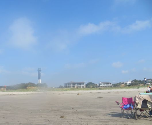
We continued on to Sullivan’s Island, another beach that extends about halfway down the length of the island, Sullivan’s Island in turn becomes Isle of Palms, with it’s own county park.
Sullivan’s Island
One difference we noticed between South Carolina and other places we’ve visited is that there is a lot of private beachfront. I don’t know what the law is, but gated resorts block access to large stretches of beach. You may be able to access these beaches on foot, but the walk would be a mile or more each way. Between mid-May and mid-September, the temperature can be over 80 (F.) and the humidity is often high. A long walk on the beach is not on my to-do list under those circumstances. We stuck to walks that started and ended in the county or local parks and never ran out of beach.
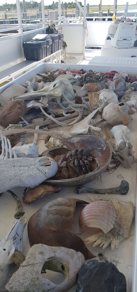
The next stop up the coast was Bull Island, part of the Cape Romain National Wildlife Refuge. It takes a bit more effort to visit because you take a 30 minute ferry ride to get to the island. The boat captains are also naturalists and spend the trip out describing the island habitats and species. They have a collection of materials from the island, alligator skulls, dolphin bones, shells, even pottery from long-abandoned settlements.
Since the site is a federal property, the refuge status is taken seriously and there are no amenities after you pass restrooms not far from the ferry landing. It takes nearly an hour to walk across to the beach. It was a very hot day when we were out there, 90+, and humid, while the shady path to the beach was swarming with mosquitos. By the time you get to the beach, you have only a half hour until it is time to hike back to the ferry landing, or another four hours until the later ferry. If visitors want to walk to Boneyard Beach, it’s five miles each way. On the beach there are no picnic tables, trash cans, shade, and no rest rooms. Though we brought lots of food and water, we didn’t realize there wouldn’t be places to sit and no shade at all. It would have been a better visit on a cloudier or cooler day.
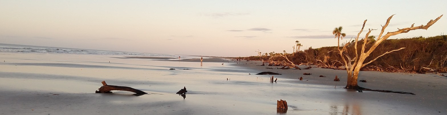
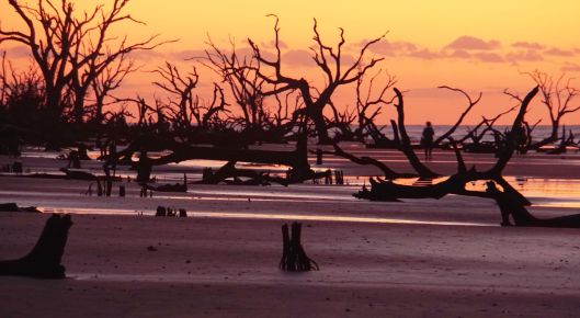
There is another way to visit Bull Island that we didn’t try. Go with a group. Once or twice a month, there are events specifically designed to get people out to the area of drowned trees called Boneyard Beach at sunrise. It’s a photographer’s delight, and a chance to see the beach early in the day. The ferry leaves the landing about and hour and a half before sunrise (five am these days). At the island, a truck with bench seats takes visitors the six miles or so to Boneyard Beach, arriving in time for sunrise. Since no trip is ever perfect, visitors are back on the mainland by 8 am, having little time to enjoy the beach beyond Boneyard once the sun is up, but there’s a lot less walking than the regular visit. The dawn photo here is by a new friend, Linda Miller, photographer and fellow birder. She liked the early visit a lot and got some wonderful photos.
The beaches of South Carolina take some time to get to, and require some preparation if you plan to stay more than an hour. Sunshade or umbrella, chairs, sunscreen, bug spray, swimming gear, picnic, and lots of water. Some beaches have changing rooms and outdoor showers, but others do not. The water is not clear, but it is as warm as the Caribbean. I loved being able to walk right into the ocean and stay in as long as I wanted. Since our visit was after Labor Day and the start of the school year, none of the beaches were crowded, but there were always people out enjoying the sun, sand, and waves.
Visiting the beach in South Carolina:
Take Sunscreen, Water, and Mosquito Repellent. If you forget, you will suffer.
Leave time to get to the beach and back. Roads are single lane, there is little opportunity to pass. Relax, what’s the rush?
Charleston has extremely heavy traffic at rush hour both morning and evening. It helps if you are going against traffic. You may need an extra half hour to get anywhere if you are going the same direction as commuters.


Great photos – looks like a beautiful place. Thank you for sharing.
LikeLike