
As a child, our weather report regularly included the area “from Block Island to Cape Hatteras.” I wasn’t quite sure where it all was, but it sounded interesting. Since arriving in Wilmington, NC, we decided to make a short visit to see Cape Hatteras. When we sat down to plan, we found an enormous chain of narrow islands more than 100 miles long that stretches from the town of Sandbridge and Back Bay Wildlife Refuge that we visited south of Virginia Beach, to Ocracoke Island, offshore east of New Bern, NC. All this is the Outer Banks.
We decided to stay right on the bend in the chain of islands, on Hatteras Island at the Cape Hatteras Motel. We made our reservation, but a week before we were scheduled to arrive we received a call from the manager. Bad weather was due, and they expected flooding and overwash (flooding and sand on the roads). Would we like to change our reservation? We looked at the weather reports and decided to put our visit off for a week, and we were glad we did! The storm was a big Nor’easter. Strong winds pushing water north to south combined with full moon higher than average tides resulted in flooding, tons of sand deposited on roads and parking lots, and high winds that made it dangerous to go outdoors and painful when the wind sandblasts anyone in their path. This was the week that made the news when two houses in the town of Rodanthe collapsed into the ocean. That was just up the road from our motel. Six days later, the sea and wind had subsided and we went for our visit.
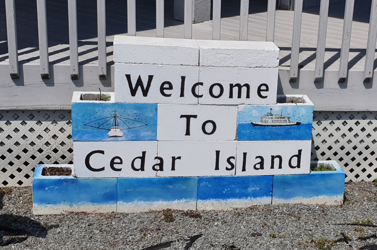
Since we’re in Wilmington, NC, it seemed like a good idea to take the ferry that runs from Cedar Island, NC to Ocracoke Island, drive the length of Ocracoke (about 14 miles) and take the free car ferry to Hatteras. We’d save a couple of hours of driving and see a lot of the area. I reserved a spot on the 10:30 am ferry from Cedar Island, though that meant we had to leave home no later than 7 am to check in by 10 am and not lose our reservation.
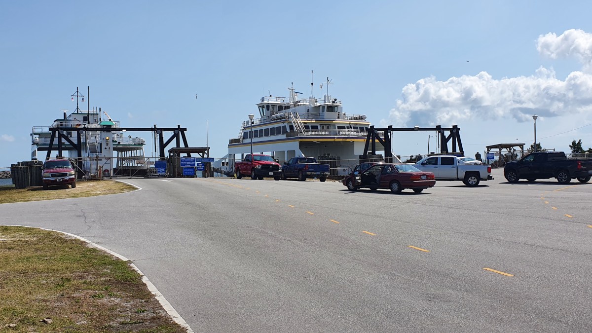
The day came and off we went, arriving at the ferry landing at about 10:02 am, the very last car in line. The lanes weren’t full, so we hadn’t been in danger of losing our place, but people had driven quite a ways to be there. I spoke to a woman who left Chapel Hill with her family at 5:30 am to get to the ferry on time. Once we all checked in, we were told boarding would begin in 10-15 minutes. We waited, and waited. Over an hour later, I saw a couple pin down a man in white shirt and black slacks, possibly a captain, as he walked from one building to another, pointedly NOT approaching passengers. When their conversation was over, I went up and asked the couple what they found out. By now it was 11:30 am with no movement on the ferry.
There was not going to be a 10:30 am ferry. A mechanical problem that we were told earlier was fixed and only needed inspection, was a red herring. Those with reservations would be given priority on the 4:30 pm ferry. However, the ferry takes two hours. The drive down Ocracoke takes about 40 minutes, and the next ferry to Hatteras takes an hour. The earliest we’d arrive at our hotel would be around eight pm. If we drove, we’d be on the road much more of the day than we planned, but leaving Cedar Island by noon, we’d arrive at our hotel by 5:30 pm. We hit the road.


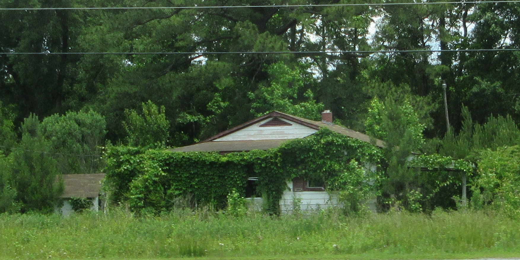

It was a very long drive. We crossed a lot of rural North Carolina, and I was intrigued by the abandoned houses sprouting greenery from windows and doors. There was also evidence of rural poverty when we mistook unpainted houses for abandoned ones.
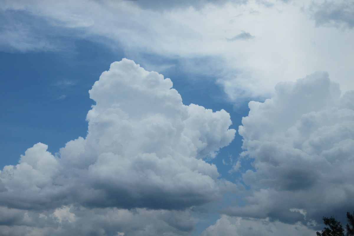
On the last stretch of highway heading east for the shore, the wind suddenly picked up and blew so hard that I looked out the window to see if the sky was green or whether there was a funnel cloud nearby. It was dark and gusty. We outran the storm, though it caught up later. Finally, we crossed the first bridge over the Alligator River and then the Croatan Sound and Roanoke Island and made it onto Bodie Island. We turned south along the long, narrow string of islands toward Hatteras, and arrived at our motel around 5:30 pm. Though we’d spent the day sitting in the car, we were tired. We took a short walk on the beach, and had dinner at the Diamond Shoals Cafe nearby. Back in our motel room, we heard the storm breaking and stepped onto the covered deck to watch. The wind howled, rain poured down, and lightning struck in long horizontal lines over the ocean. We were lucky to have been under cover.

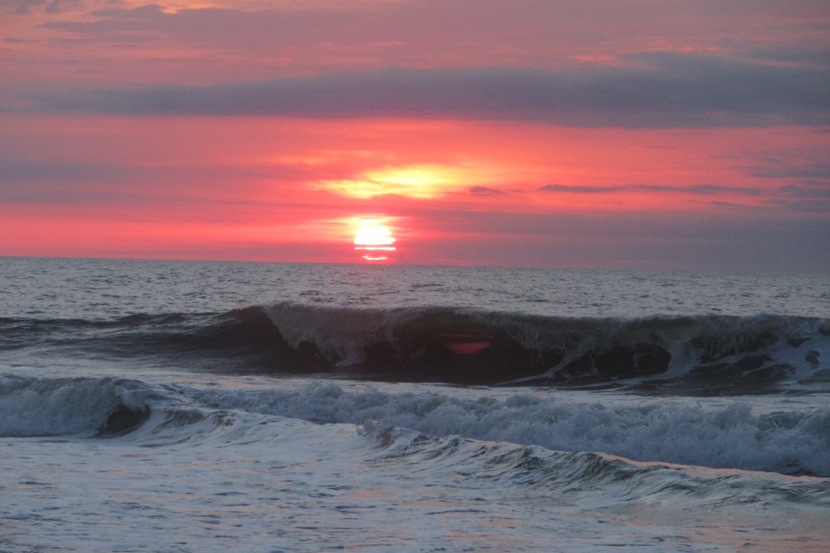
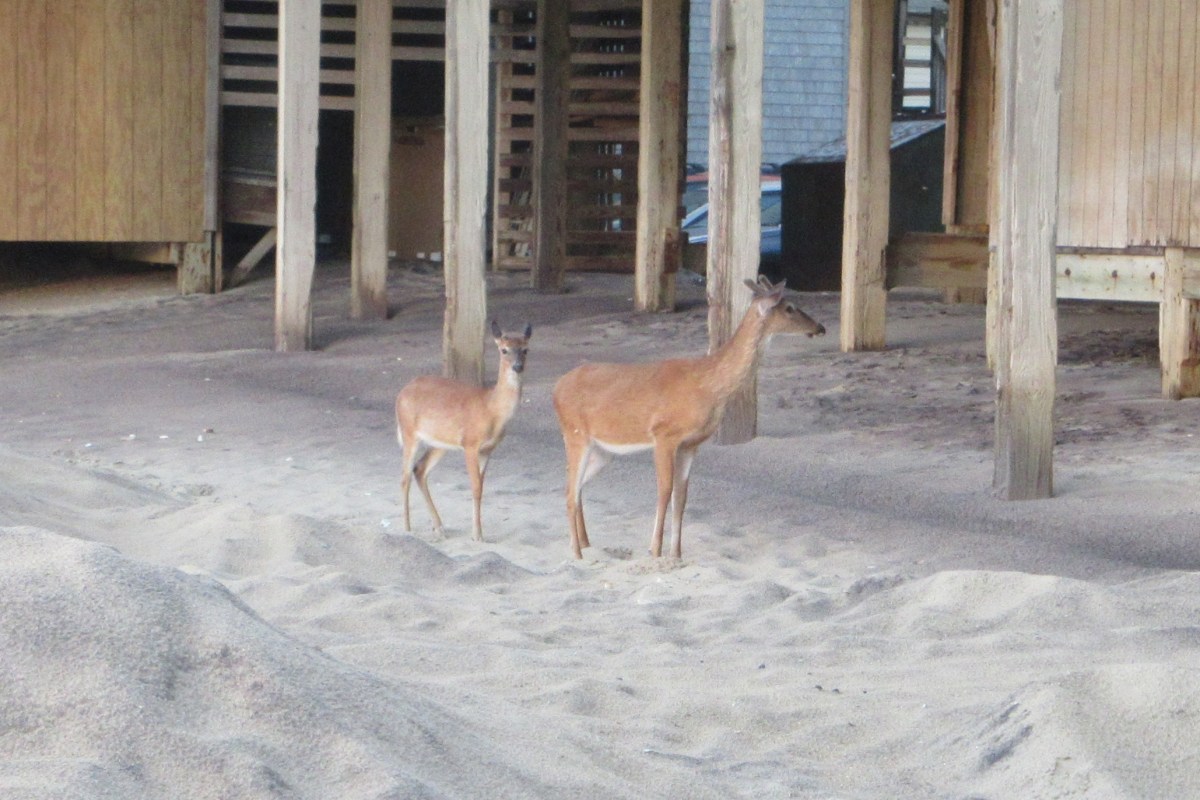
We saw the full moon the next morning when we got up to see the sunrise. 5:45 am is a bit earlier than I am usually awake, but it was worth it to see the sun come up over the waves and climb above the clouds. We spooked a pair of deer on our way back to the motel. I was as surprised to see them on the beach as they were to see us.


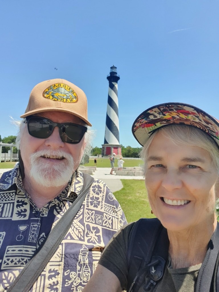
Later, we visited the Cape Hatteras lighthouse, stopping along the way to look at shore birds wading in the shallow pools at the end of Lighthouse Road. We walked on the beach out toward the point where the coast changes direction, different currents mix, and the water is shallow and roiling with sand–to me this is the Cape Hatteras.
From the lighthouse we crossed the road to the Buxton Woods Trail, to see some of the inland part of the island. The path is shaded and winds through the trees. It was far too late for birds, and on a hot day, lovely to be under the trees.
In the early evening we met a friend from years ago who now spends part of each year in Avon, NC, just north of Hatteras. We sat and chatted on his deck overlooking the ocean as the sun began to set, watching the waves and the birds that floated by. This was a perfect day. We moved on to have dinner at Oceana’s Bistro where they’ve invented a sort of extended tortilla cheese flat bread called a “griller.” Jonathan had the one with mushrooms, artichoke, and other things that was delicious.
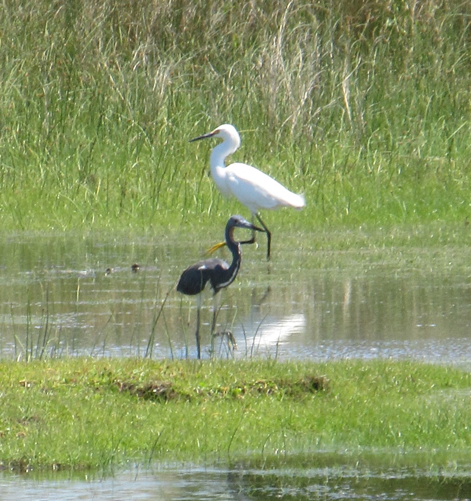
With only one day left, we got busy early, getting up to drive north to the Pea Island National Wildlife Refuge. Unfortunately, during this time of year when birds may be nesting, a lot of the refuge is closed off to visitors and there doesn’t seem to be a place where visitors can find out what is open on any given day. We made the best of it and saw some good shore birds on the sound side of the sand spit, then crossed to the ocean side to look at some others.

After a stop at Scones and Muffins for sustenance, we returned to the motel and then decided to visit the local museums in Frisco, first the Native American Museum, then the Graveyard of the Atlantic Museum. The Native American Museum was a labor of love created by a local man, Carl Bornfriend, who collected Native American objects wherever he found them. Now a non-profit foundation, the collection has grown to include thousands of objects. Displays line the walls and walkways at the museum and are so varied that there is something to see at every turn. Outdoors is a nature trail.

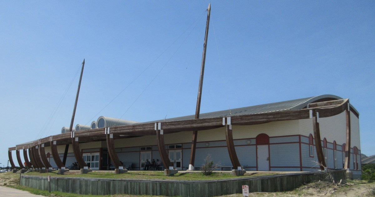
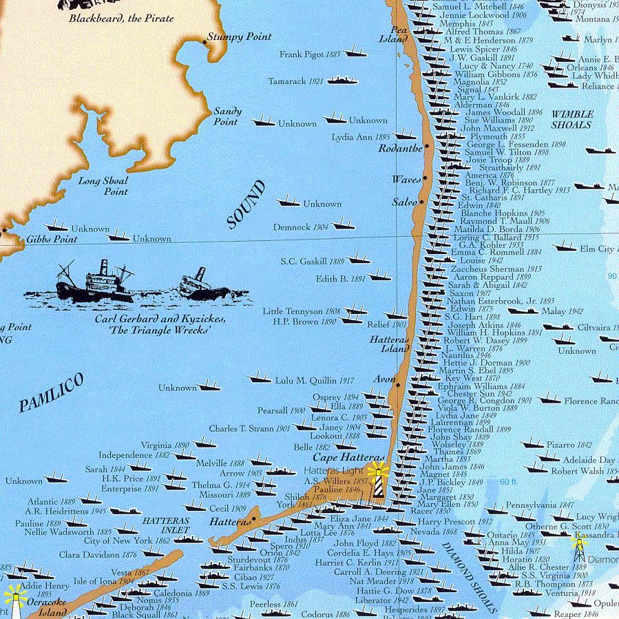
Our second stop was the Graveyard of the Atlantic Museum, also known as the shipwreck museum. The building is reminiscent of the skeleton of a ship, and the exhibits cover anything related to ships. The North Carolina coast deserves the graveyard name, as there are several thousand shipwrecks in the offshore waters. In addition to famous wrecks, the museum includes stories of famous sea rescues, and shows the development of maritime technology, including scuba breathing apparatus, and underwater cameras. An infusion of Covid recovery funding is allowing the museum to expand and update its exhibits.
After a late afternoon beach walk, we had dinner at Cafe Pamlico at the Inn on Pamlico Sound. The food was delicious. There was live music, and I always hesitate to sit in a room with live music in case it is too loud for conversation. When I mentioned this, we were seated far enough from the performance area that we could hear the very enjoyable playing, and still talk to one another.
We planned to take the ferry on our return trip, but when we looked at the three hours of ferry ride and the four hours of driving, it added up to another long day. By driving back the way we came, we’d give up a visit to Ocracoke Island, but get home mid-afternoon. I cancelled our ferry reservation and we packed up. The next morning, when we were already a half hour down the road, I received an email from the NC-DOT ferry people letting me know that not only was the ferry cancelled, there would be no other ferries running between Ocracoke and Cedar Island that day due to mechanical problems and Coast Guard inspections. They were sorry they would not be able to take us anywhere and we’d have to find another way to the mainland.
We might have gotten up, driven to the landing and gotten in line for the shorter (one hour) ferry, arrived on Ocracoke, driven down that island, and then found that there would be no ferry. That would have added about four hours to the four and a half hour drive. I was grateful that we had decided against the ferry.
Cape Hatteras is an adventure. We watched lots of kite surfers along the shore, went bird watching, even watched as a tiny biplane towed a huge advertising sign over Nag’s Head and Manteo as we drove off the island. We surprised deer, and avoided getting stuck in the drifts of fine, pale sand heaped everywhere after last week’s storm. For boating, fishing, surfing, or any other water sport, Hatteras is a wonderful spot. There are miles of beaches, and though there’s hardly any beach glass, there are sea shells and smooth rocks to fit any pocket. Sunrise and sunset are a beachgoers delight. Watch out for storms, high wind, beach erosion, rip currents, and nesting wildlife, and you’ll be just fine.
