

A disused Army base, Ft. Ord National Monument, now is managed by the Bureau of Land Management (BLM) and is open to the public. From Ft. Ord Dunes along Monterey Bay (see banner photo for this post) to hilly inland scrub, it’s a huge park, more than 14,000 acres. We’ve explored the long stretch of beach and driven around an extensive neighborhood of abandoned barracks just a few blocks inland. The collapsing structures are within a fence, and some are boarded up but obviously visited many times over the years since the fort closed in 1994. There is supposed to be redevelopment, especially new housing, but it’s going very slowly, 30 years on with little change.
Most of those 14,000+ acres are inland, and there are miles and miles of trails. It took us a while to become interested in visiting, as most of the area is closed to vehicles, with permanent gates across all the roads into the property. It’s a long hike into the heart of the park, and we don’t take long hikes anymore. There is even a section closed to the public because live ordnance may be present. Earlier this year, the local papers ran stories about metal detectorists getting run off the closed area, as the BLM was concerned someone would blow themselves up.
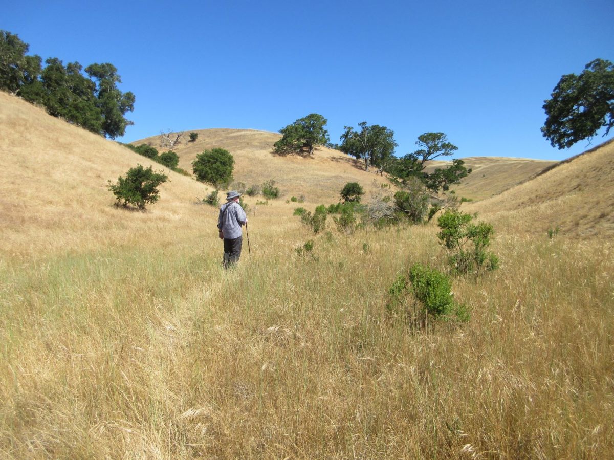
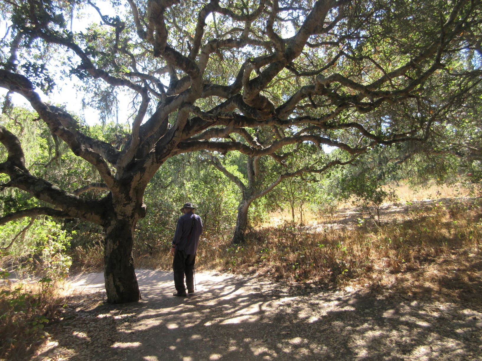
Our first visit beyond the beach started at the Ft. Ord National Monument marker and took us along trails through grassland and patches of oaks. We looked at birds and admired some of the gnarled tree trunks. We agreed that we needed to visit as early in the day as possible, as the grasslands heat up rapidly. The current high heat warning affecting most of the western US hasn’t reached us, but bright sun feels hot enough.
On another exploration, we approached the inland part of the park from its western side, where four lanes of Gen. Jim Moore Blvd. divides the densely urbanized town of Seaside from the completely undeveloped part of Ft. Ord. When we found the parking area/trail head, we realized that the trail headed straight out into grassland with few trees in sight for almost a mile. We decided that perhaps this wasn’t a walk we wanted to take.
Not far away, we walked down a dirt road, the Jerry Smith Access Corridor, and onto trails that go in many directions. It’s almost a half mile along the corridor to the actual trails, which takes up a lot of our walking energy. We met other walkers on the paths, many with their dogs. Though we didn’t see many birds, we enjoyed the walk, and got to pet lots of friendly dogs.
Our best hike so far started at the Creekside Trailhead. There isn’t a creek that we could identify, and all the tiny lakes in Ft. Ord have dried up. This limited our expectations for bird watching, as birds seem to prefer staying near a water source.

The trail headed uphill, and we could see hikers at the peak of a ridge overlooking the parking area. We didn’t think about getting that far up, but the trail climbed up and up as we walked. We arrived at a break in the rock of the ridge, a gateway to the top. Through the “gateway,” we walked out to the end of the ridge, surprised that we’d reached the top. Some compassionate soul installed a park bench there, where we sat to enjoy the view.

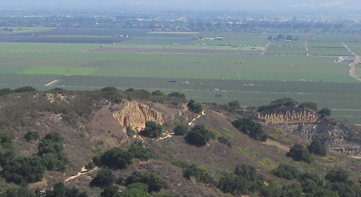
There’s a remarkable change between the grass and chaparral-covered hills of Ft. Ord, and the valley of the Salinas River that is immediately adjacent. From our seat looking out to the north, we could see the layer of marine fog hanging over the ocean on our left, while to our right, hills became mountains off in the distance. Straight ahead of us was the flat, dark green plain of America’s market basket, the Salinas Valley. Every inch of the valley floor is a checkerboard of housing facing off against agriculture. On the one had is the need for reasonably-priced housing in California, and on the other is the nation’s reliance on the Salinas Valley for a huge volume of fruits (strawberries, cherries, peaches, plums, nectarines, apricots, citrus, apples) and vegetables including the famed artichokes of Castroville. The annual Artichoke Festival is coming up on July 24-25.
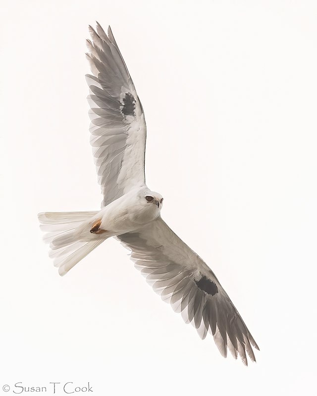
While we were resting on our wonderfully located park bench, we looked down on a white-tailed kite circling in big loops over the terrain, watching for an unwary ground squirrel or rabbit. There is no other hawk sized bird that is so white, and the triangular white tail is easy to recognize. We watched until it flew out of sight over another valley.
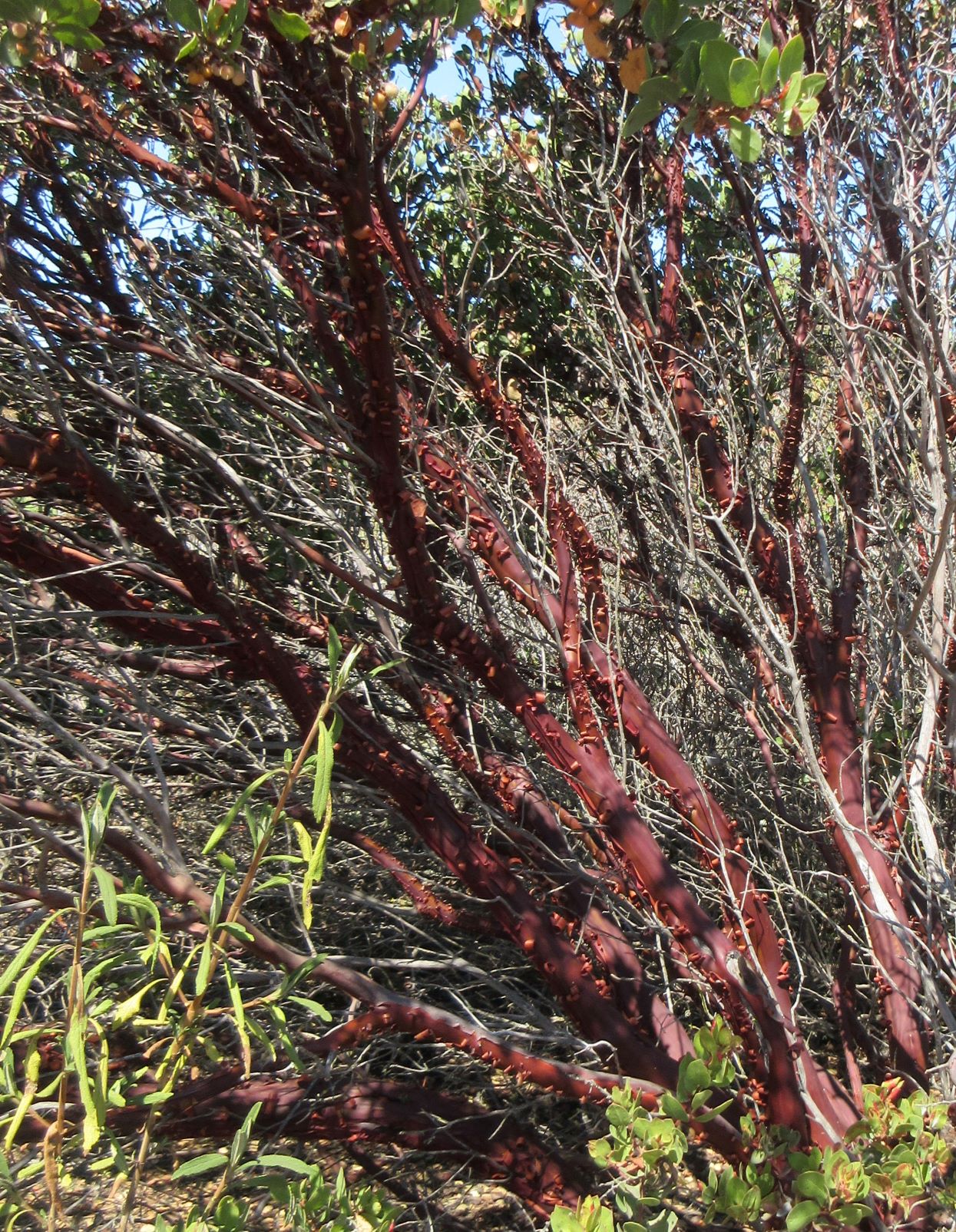
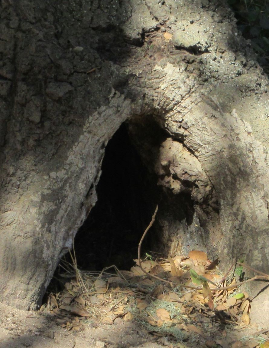
L-R: Madrone; heading down the trail; entrance to the Hall of the Mountain Kings?
As we turned to walk back along the escarpment we noticed the deep red bark of madrone, a tree with distinctive red-orange bark. It appears to grow on the mesa tops here, but we found no more growing once we crossed through the gap in the rocks and went down hill. The trail puts a bit of stress on the knees, but it was a lovely walk, the sun was out, and nothing could be better. We intend to keep visiting Ft. Ord to see more of those miles of trails.
