
If you’re going to explore, you need maps. The map on your phone is indispensable, but it’s not enough. There are places both inland and along the coast of California where cell phone signals disappear, but there’s a solution for that: Paper resources. Two in particular have helped us out, the DeLorme Atlas and Gazetteer for California, and the California Coastal Access Guide.
The DeLorme atlas is a large format book of maps that covers the entire state. When you start down a rural road and then lose your phone signal, you can check and see whether the road eventually connects with something else, or whether you will have to turn around. There’s not quite as much detail as a USGS quad sheet, but it takes up a lot less space. We tend to leave it in the car; it’s there when we need it.

The California Coastal Access Guide is a big help when you’re trying to stop at places all along the coast. It’s great for us because we’d like to walk the entire coast, and figuring out how to get to the beach can become a big headache. California has valuable state laws that protect access to the coast, at least as far as the high water mark. No matter who lives in the adjacent property, landowners cannot prevent people from walking along the shore. Unfortunately, people don’t always behave themselves, and papparazzi can hang out on the high tide mark trying to photograph the rich and famous in their houses nearby. For that reason, some wealthy land owners have tried to close off their beachfront to keep out the public. David Geffen, record producer, is one of the best known. He spent twenty-seven years trying to sue various California agencies so that he could block access to the beach in front of his house in Malibu. He lost.

That doesn’t mean that homeowners with beachfront property have to make access easy. Many “coastal access” points have only minimal markings, and have only one or two parking spaces. The trail to the coast may be narrow and almost invisible if you aren’t looking for it. The Coastal Access Guide lists points of access all along the coast, with some useful directions. A chart is included that tells whether there is a beach, a trail, parking, and whether dogs are allowed. We use it to plan visits when our children bring their dogs.
Even this resource isn’t complete. Developers have to assure coastal access as part of the permit process before housing can be built along the shore. This means there are narrow coastal access paths through some neighborhoods that are not in the Coastal Access book. We do our best to discover them. When we find an area that seems apt for beach combing but doesn’t have an obvious path or parking area, we drive along the road closest to the water looking for the Coastal Access symbol.

In Carmel Highlands, there are two neighborhoods along the water. We wanted to visit Yankee Point, an irregular chunk of land off Spindrift Lane, but found no way to get to the water. We’ve made a couple of passes, but haven’t had any luck getting out to Yankee Point, despite a tempting trail visible in GoogleEarth.
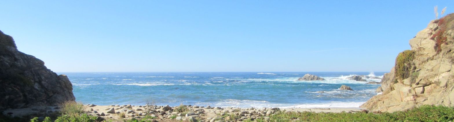
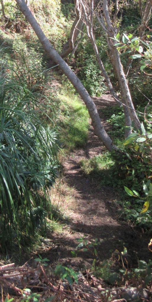
In the next neighborhood to the south, off Yankee Point Drive, there is no access to Yankee Point, despite the name. At the very south end of the street, though, we found a narrow coastal access trail that leads to a tiny beach at the mouth of Malpaso Creek. There are a few places for cars to park on the street, too. We were so pleased at having found a hidden coastal access point that we walked down to have a look. The trail has a beautiful overlook of the inlet, one trail to the beach, and another into the woods upstream for a short distance. Highway One passes overhead on a high concrete bridge, yet under its span is a patch of woodland with good birdwatching, and toward the end of the trail about a quarter mile in, there’s a tiny stand of redwoods.
On the Saturday of MLK holiday weekend, we set out to visit Monastery Beach and arrived to find it packed with cars and people. The crowds were too much for us, and we decided to try Yankee Point Drive. Sure enough, there were three other cars parked, but still room for us. We stopped at the overlook to chat with a young woman sitting in the sun. We said how much we enjoyed this lesser known spot of coast and she told us that this was one place she always came by herself. There were a few other people along the path, and one family on the tiny beach, just the right number.

If you live or visit anywhere north of the Bay Area, there’s the best possible list of access points that includes even the most carefully hidden ones. The Hiker’s Hip Pocket Guides to northern California (Sonoma, Mendocino, Humboldt, and DelNorte counties) include every possible access point. It can be a lot of fun finding your way to these lesser known places. We used the Hiker’s Hip Pocket Guide in Mendocino and saw some lovely tiny beaches with its help. When you move to a new area or plan a longer stay along the coast, these guides are worth having. We find new places to visit almost every time we thumb through their pages.
