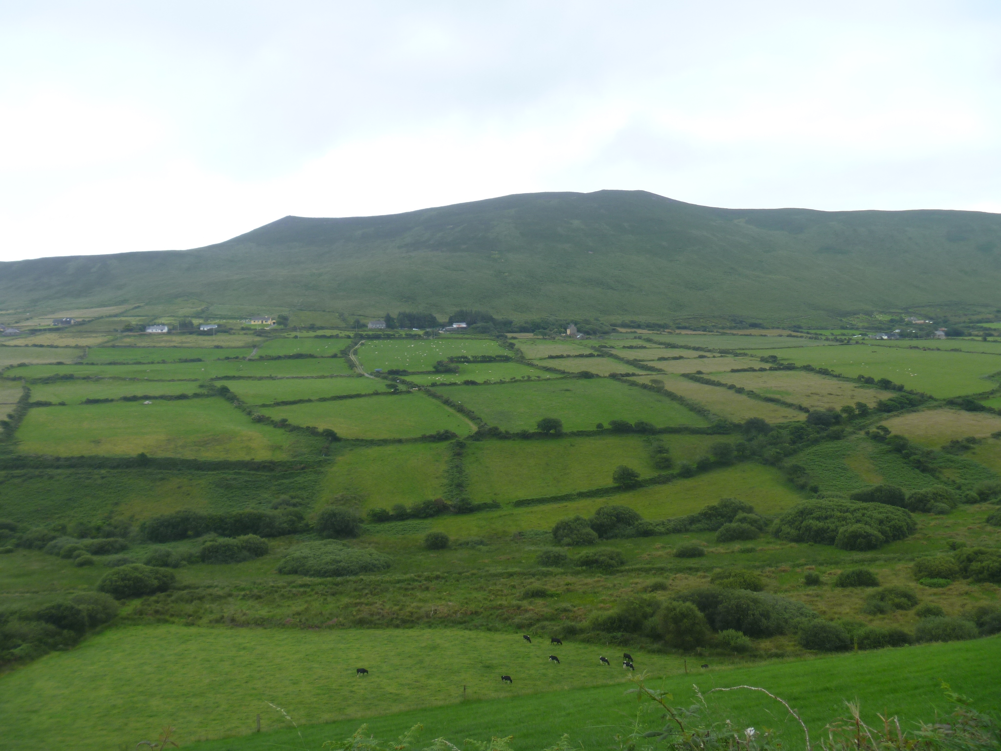
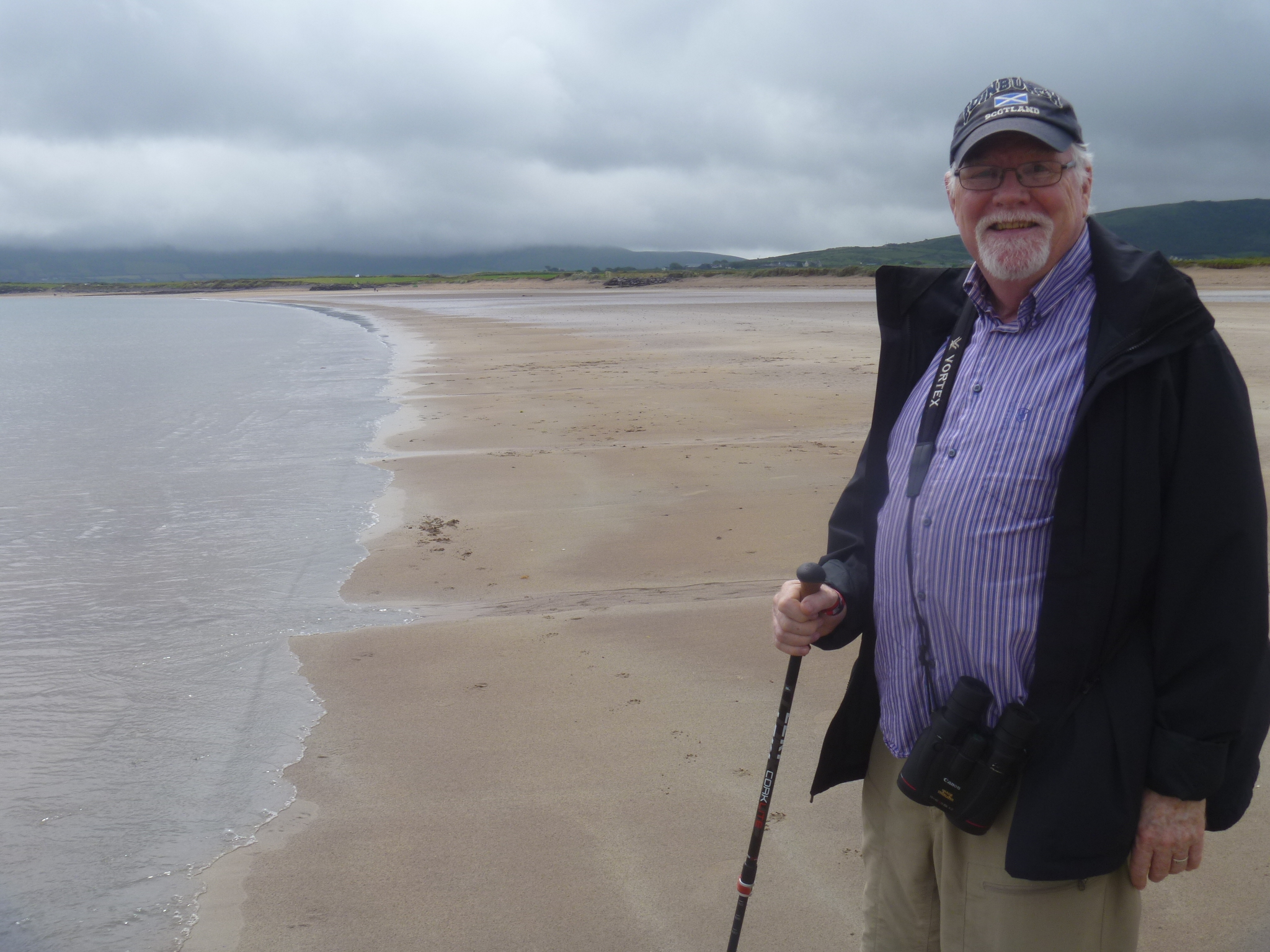
Ireland is very green and lovely, and when the sun is out the views are spectacular. When I asked my daughter, Lillian, how she dealt with the changeable weather when she was here she said she always wore her rain jacket. That’s a must. We tried scheduling activities according to the weather report this first week in Dingle. (That was a silly idea.) The weather never corresponded to the forecast, and the days that were supposed to have pouring rain had sun, and the day that was supposed to be sunny had fog so thick you couldn’t see the water from the cliffs. (We’ll go see the view another time.) Everyone goes about their touring as though the sun is out, and sometimes it comes out, sometimes the fog rises to the top of the hills, and other times it rains. Bring your boots/rain shoes.
 We spent our first week getting to know the Dingle Peninsula, visiting some of the beaches and the many archaeological sites. We also scoped out the local grocery store (Supervalu), weekly market (Saturday mornings), and ice cream store (Murphy’s). We chatted with visitors from the US, the UK and Italy, as well as the delightful host of our house here, Marie.
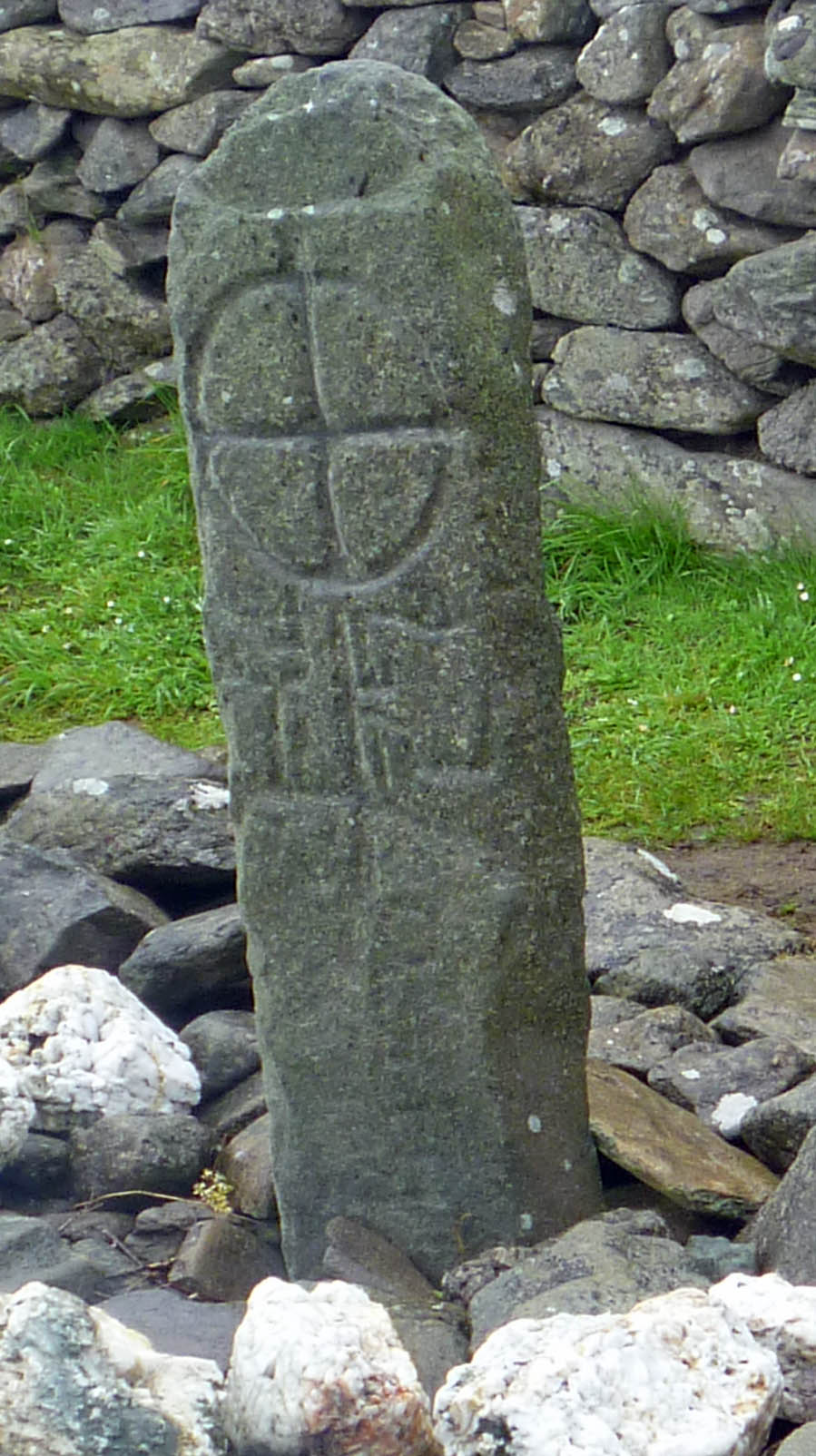
There are lots and lots of historic and archaeological sites on the Dingle peninsula, and most of them are some kind of circular structure, like these two places.


Jonathan is standing on the wall of the stone fort on the left.
Like many places, preservation is a difficult issue. There are about 1200 documented historic features on the Dingle Peninsula alone, and most of them are not restored–how many stone circles are people interested in visiting? There are a number of small chapels called oratories that date from Irish christian worship as early as 600 AD. The most intriguing is the Gallarus Oratory. It is a tiny log cabin-sized box of a building with only a small door and a tiny window. The entire building is made out of flat pieces of stone that overlap so that water flows off the roof and sides. It claims to never have been restored.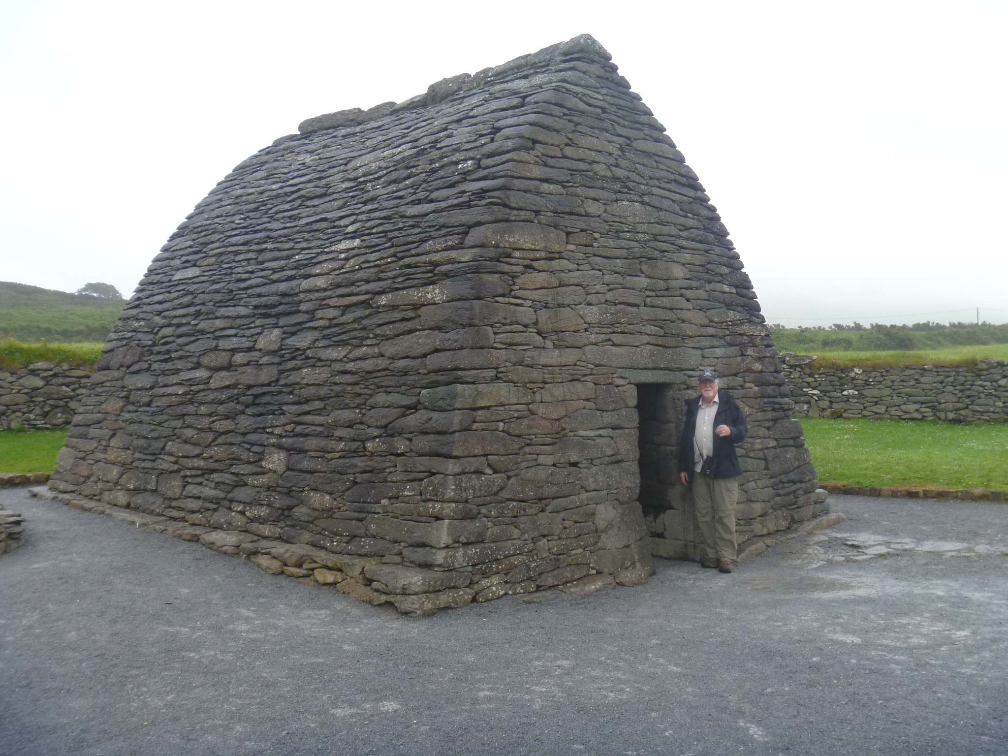
The amazing preservation of Gallarus is counterbalanced by the eventual disappearance of the Dun Beg Promontory Fort. Perched on a cliff overlooking Dingle Bay, erosion is taking its toll and about half of the main wall has fallen in due to erosion of the cliff edge. In the past, entry was through the center doorway. Now that door is too close to the cliff edge and visitors circle around the end that is not falling into the sea.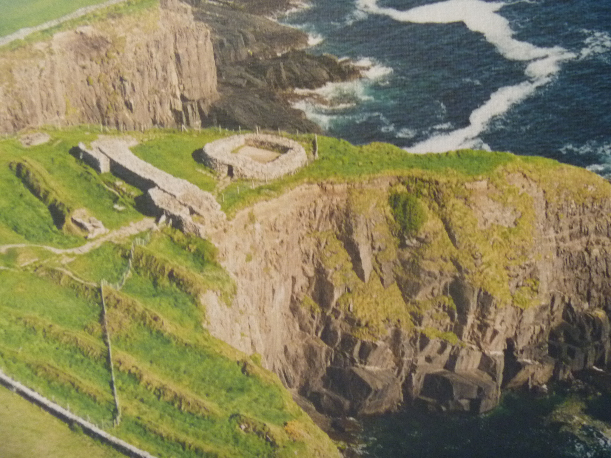 You can see in this photo from the site where the cliff edge gave way (in 2014). How much longer will the remainder of the fort last? There is nothing that can be done to save it in the long run. As if this were not enough archaeology, we happened to see a notice for a talk on the archaeology of the Blasket Islands that are off the end of the Dingle Peninsula. We were part of a full house in a local hotel meeting room and saw maps of the islands that go back to the 1400s. Like many places around here, very little archaeology has been carried out. Despite this, the case of the Blasket Islands is interesting because people lived on Great Blasket until 1953 when they agreed to be moved to the mainland to obtain services like school, church and stores.

This view of the domed stone hut on Great Blasket Island is similar to one I saw years ago on a calendar. I’ve had the Dingle Peninsula in the back of my mind ever since. It is great to finally be here.
